47. Bishop Estate & Darling House
Regicides’ Rain
Bishop Estate East, Woodbridge Land Trust
September 21, 2014
This property is also a Woodbridge Land Trust property. This page was originally written for the WLT section of CTMQ.
 The more I hike around Connecticut, the more I realize how much interconnection there is with our trails. For years when I’d hike the blue-blazes of the CFPA trails, I’d totally ignore the side trails that went off to who-knows-where.
But now, as I explore more and more land trusts and other such entities, I realize those side trails often really do go somewhere interesting. While it’s impossible to develop one, massive compendium of every cleared and blazed and mapped trail in Connecticut, it would be pretty cool to do something like that.
For instance, this tract of land off of route 69, only a few minutes from the Wilbur Cross and its Heroes’ Tunnel, connects southeast to West Rock State Park via the Regicides Trail (my Regicides hike here) and therefore all of New Haven. You could spend an entire day, visiting museums, hiking, going up towers and over tunnels and all sorts of cool stuff.
All from a Woodbridge Land Trust property you’ve never heard of – one which has a trailhead at a museum you’ve never heard of. And heck, the best brewery in the state is only 2 minutes south of said museum! (That would be New England Brewing Company if you live under a rock. Or don’t drink beer. Or care.)
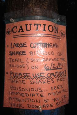
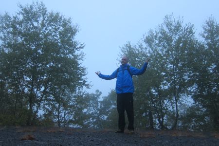
Yeah, I love this stuff. Quick interjection – Pre-dawn hiking in the rain is great and all, but man, it’s so much better when you pass one of these things just before the trailhead:

The best place to park for this property (and the eastern section across route 69) is in the Thomas Darling House – the museum for the Amity/Woodbridge Historical Society. (CTMQ Visit here.) It was sort of weird for me to park next to two other cars on a rainy pre-dawn Sunday. Would I see other humans on my hike?
Spoiler Alert: No. Don’t be ridiculous.
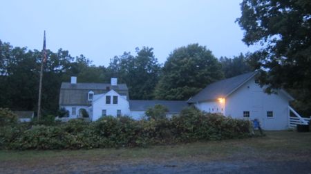
The Darling House Museum
If you read my Woodbridge Land Trust pages, you’ll probably see this a lot: Their trail maps are excellent. Really and truly, some of the best. I’d appreciate contour lines, but understand why they leave them out. (They do denote elevations here and there to help sort of make up for the absence.)
 After parking and a short slog through an unmowed field, I entered my first WLT property. The trailhead sign lays out the distances to some of the cool stuff these trails link to like West Rock and Judges Cave.
Sure it was dark and raining, but I was happy. The trails here are very well cleared and marked. The woods below the West Rock ridge are incredibly open. Sure, they were farmed a hundred or so years ago, but there is literally no understory. This is a problem that plagues our forests and can be attributed to one dear creature…
Make that, one deer creature. If you ever want to see deer – lots and lots of deer – go hiking in the rain at dawn in Connecticut. I saw at least a dozen in the two hours I was in the woods. Heck, I saw as many deer as squirrels. And that’s insane.
My original goal for this hike was to get up to the ridge and “Lookout Point” for the sunrise.
And, for the record, I did exactly that. The only problem was heavy rain and low clouds. No biggie.
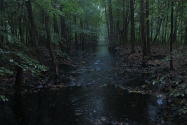
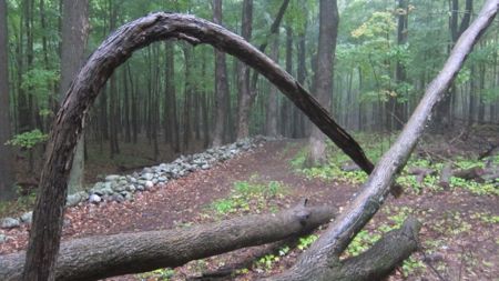
This property has a network of flat blue trails below the ridge that highlight a bunch of old stone walls. There is a really great bridge here as well that cross the West River. But the “real” trail is the red trail that makes its way up to the West Rock Ridge.
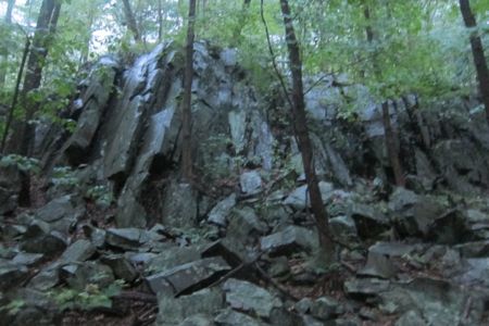
The red trail is never too steep, but it does climb 430 feet fairly quickly. While climbing, the trail passes beneath some rather impressive cliffs and rock jumbles. What struck me was how much effort was put into this trail. So true trail-building skills were employed here, by someone who knew what they were doing.
All for a little unnamed red trail in a Woodbridge Land Trust property. I reached the Regicides Trail at the top just as the rain let up. It allowed me to take this beautiful picture of overlooking Woodbridge to the west:
Ahem.
It happens. Before scuttling back down the trail, I took a moment to reflect on my hike of the Regicides Trail several years ago. It’s a pretty cool hike, and one that isn’t brought up much in CFPA circles. But its mix of history and scenery is tough to beat here in Central Connecticut.
Once off the ridgeline, I hiked one of the blue trails due south. Again, I was struck by the sheer openness of these woods – at the end of summer, no less! There is a beauty to it, sure, but it’s also sort of weird.
These flat sections make for some very fast hiking, which is exactly what I did. As I made my way back over the bridge and to my car, I was already thinking about what the eastern “Bishop Estate” trails would bring me – and if the rain would stop falling at any point.
SCRCOG Trails on CTMQ
Woodbridge Land Trust Trails on CTMQ
SCROG Trails
Woodbridge Land Trust


Leave a Comment