Section 2: It’s All New!
Tunxis Mainline Trail: Section 2
Plymouth/Burlington, 8 miles
April 20 & 27, 2008 & January 18, 2015
 [2015 Update: Hear Ye! Hear Ye! The CFPA has closed the gap along the Tunxis in Burlington! I have no idea how long this gap existed, but it had probably been well over a decade at least. Such things are very exciting to people like me – seriously! Now, hikers can hike the Mainline Tunxis from Marsh Pond in Plymouth straight through to the Massachusetts line in Hartland. And I’ve done exactly that! (Over the course of five years, but I’ve done it.)
The crappy part, for me and only me, is that I have to re-do a bunch of my Tunxis pages. The Yellow-Dot is now the Mainline and the Mainline is now the Yellow Dot. This affects about 15 CTMQ pages believe it or not. But the CFPA and the Tunxis are both worth my efforts. And since my original Yellow Dot – now Mainline – hike was north to south, I will basically flip each paragraph in my original to try to make it make better sense. Yeah, good luck to me with that.]
Let’s get going…
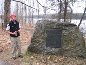
Don’t front on Rob too badly – it was rather early. That rock is in Plymouth, therefore, Plymouth Rock
Have you heard of Plymouth, CT? It’s not one of our most talked about towns. The Burlington section of the Tunxis mainline does begin in Plymouth and spends its first mile or so there, before entering Burlington proper for the rest of the 7 miles of this section. Burlington also contains a substantial amount of regional Tunxis trail mileage.
You can find all those hikes here.
The southernmost section of the Tunxis Mainline ends in the middle of the woods near the top of Compounce Mountain in Bristol, about 7 miles south of where we were starting. One could walk through the center of Bristol to connect the trails, which would certainly make the Tunxis very unique. Take in Hoppers Birge on the way? It would be kind of neat, actually.
 Now that the rest of the Tunxis is continuous, why not? It’s time we create a true urban CFPA trail section. (I just emailed my idea to the executive director down there. We’ll see what they think.)
[2015: I did the first mile or so with Rob in April 2008. Here’s how that went down]:
[Blah, blah, blah...] We drove over to the south end of Marsh Pond and parked right next to the trailhead. (The CFPA Walk Book doesn’t say you can park here, but there are no posted signs and space for at least two cars.)
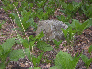
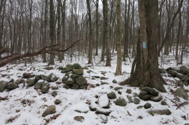
The first mile or so is a gentle, flat hike through hemlock and pine along the western edge of the reservoir/pond. After a sharp right turn at the terminus of the White Dot Tunxis, the trail climbed ever so slightly along an old woods road. Here’s something exciting – when the trail turns left (north), right off the trail to the left (west) in the skunk cabbage patch, there is an old stone marker with a “B” on it. This is a 200 year old (I’m guessing) boundary marker where Bristol, Burlington, and Plymouth converge. Are you sitting down? Here it is:
This is the stuff you read CTMQ for, folks.
It was right at this point that Rob and I noticed the smell of a campfire or wood burning stove. Neither of us said anything about it nor found it the least bit odd. We hiked onward.
As we crested a small rise, we saw some smoke and then a charred and smoldering tree stump. “Hmm, that’s not good,” I said. “Careless campers,” mused Rob. So we walked off the trail and checked it out – not too bad, just some a couple tree stumps and – hey, look over there, more stuff smoldering.
We decided it wasn’t “on fire” really so we hiked about twenty more feet, past the Yellow Dot Tunxis’s southern end. More smoldering sections and larger patches of black. “Let’s call someone.” So we did.
[2015: Sounds exciting, doesn’t it? Well, you can continue that tale and our hike through the raging forest fire over here, along what is now the Yellow Dot Trail! As for us right now, we must head north on the former Yellow Dot/now Mainline Trail…]
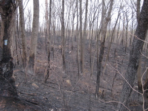
The trail heads north to Tory Den and noticed that the entire forest for as far as I could see was burned up.
Eh, what are you gonna do? Let’s go check out Tory Den then. Tory Den is awesome. It’s the first “cave” or “den” I’ve experienced in the state wherein an adult human can actually hang out comfortably. It is certainly not the first one that was used back in the colonial days as a place to hide. You have your Will Warren’s Den in Farmington where some hoodlum hid out from the townsfolk and who could forget Judges Cave in New Haven where anti-Loyalists hid from the Redcoats – on and on it goes.
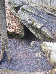
Tory Den is no different except the person hiding out here was a dang Tory! A Limey! Turns out, this part of Connecticut was a big Tory holdout area and one particularly infamous Tory, Stephen Graves of Harwinton, used to hide here all the time when the Patriots came for him. He was eventually caught as was his brother-in-law but the cave served as a great hiding spot for many other Tories over those years. Read much more about CTMQ’s visit to Tory Den here.
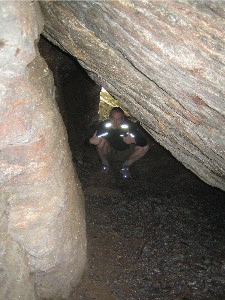
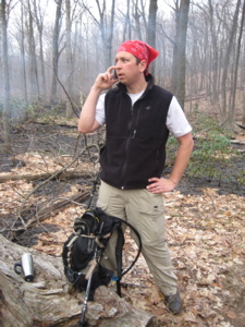
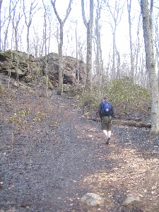
Me in Tory Den and you see how cool Rob looks here, calling the fire department? A true hero!
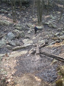
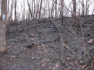
The cliffs above the den are rather impressive (and imposing) in their own right. We poked around the Den area – stirring up the ash and dust with every step. This entire area was burned off – leading me to think the fire may very well have started in the Den itself, which is probably popular with local kids.
[2015: At that point, we doubled back and went east on what is now the Yellow Dot Trail. So for this page, we now must go to a different day, one week later, when I hiked the rest of the (now) Mainline Trail as it existed then… from north to south. Now I shall try to switch that around, but it will read funky for a while.]
The area around Tory Den looked exactly the same as it did a week prior; blackened trees, black crumbly leaf litter, black mountain laurel skeletons, charred rocks. If this were done by lightning, then I wouldn’t care. But of course it was either a careless smoker (it happened on Opening Day for fishing in CT), or stupid kids with a campfire – and that makes me mad.
{2015: This re-doing it backwards is a bit difficult, by the way.]
Leaving Tory Den heading north, a drizzle began to come down and I finally left the fire-scarred area via a short downhill and some more cool little rock canyon features.
As I trudged north, I encountered a plethora of fiddlehead ferns just beginning to unfurl. There were hundreds of them, in varying stages of development. So I did what anyone would do – made a note to come back here quickly after I was done to snip off enough for dinner.
Which is exactly what I did. Delicious. These things are sold at some supermarkets and just called fiddleheads. But of course, eating them a few hours after picking is always better… just sauteed in a little butter with maybe some garlic powder – mm, mm. There are a million other recipes for them here in New England, but simple is almost always better in my opinion.
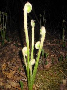
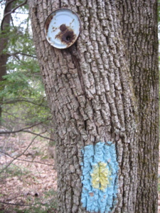
A perfect fiddlehead and an old, old metal trail marker.
The trail winds its way northeast very near some giant houses as it nears the end of Johnnycake Mountain Road. I headed up Johnnycake and then onto Old Field Road and back into the woods. It soon reaches its intersection with the White Dot Trail and…
[2015: Now we’re whisked forward seven years!]
… And here I am at that same intersection again, at dawn on a cold January morning in 2015!
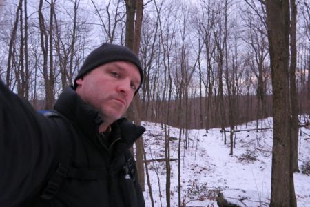
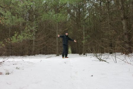
I look so tough
For me, the only annoying part of winter hiking is the lateness of the sunrise. I wake up around 5 every day and I like to get going. With the sunrise not until 7:15, I found myself putzing around a bit at The Whole Donut in Canton at 5:30, and then I got gas at the super cheap CITGO in Burlington, and then I listened to the radio for a bit before I got going.
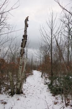
But it was still long before sunrise, and the overcast sky didn’t help matters much. But my plan was to hike south to where the new trail begins at the White Dot intersection north of Tory Den and then return north to the beginning of the previously hiked Nepaug section off of Hotchkiss Road.
I parked on Route 4 at Joni’s Antiques. I wouldn’t suggest parking here, but at 5:45 on a Sunday, I felt okay about it. (There’s tons of parking here and at the shopping center next door if you wish.) I found the trailhead on the other side of route 4 and got going.
In the dark.
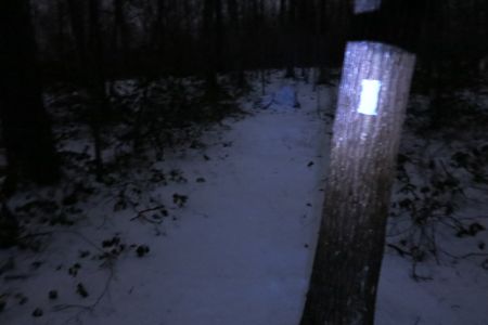
I include that picture to show you that hiking in the dark isn’t all that crazy with today’s headlamps. Especially on well-marked and cleared trails. One minute into it, you almost forget that you’re doing something most people would blanche at doing.
Jive turkeys
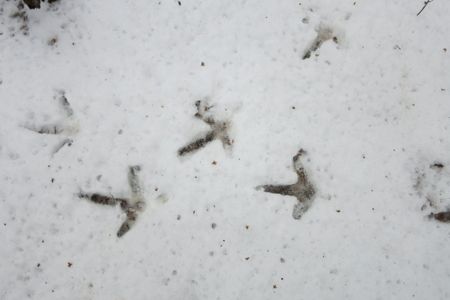
Aside from rousing a large flock of roosting turkeys, I encountered no issues on my hike down to the start of my hike. As if that sentence makes any sense.
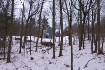
 Dawn had dawned when I got to the White Dot intersection, which was nice. (In other words, I timed my hike perfectly.) I turned tail and headed back north. Burlington has gone through some serious growth recently, and there are new roads with new giant houses near the newly blazed trail.
It really seems like every new house in Burlington is 6,000+ square feet.
But aside from one barking dog, I didn’t ever feel too intrusive. Though one house would be smart to put in some screen trees or something, but maybe they like looking at doofy hikers trudging through the ice and snow at dawn. I know I sure would.
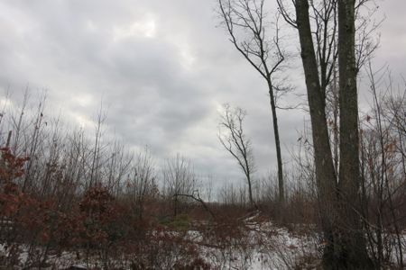
There is one stark area the trail traverses near some of these houses, south of Rock Road. I don’t know if the lack of trees is related to the similar area a couple miles east where a “down draft” low-level near-tornado knocked over a bunch of trees along the eastern end of the White Dot. Oddly, I find these anomalous areas kind of cool to walk through. And I find a beauty in these types of depressing pictures. The looming storm helps too:
Of course, the cleared area very well may have been another planned cul-du-sac, which is actually more likely than any natural event.
Across Rock Road, the last stretch of trail before Route 4 is fairly uninteresting. Well, there is a traverse of a stone wall:
And a very small climb to the top of the hill that Route 4 cuts through just west of Burlington’s business center. I mention this because I wanted to include the following picture. And this is totally silly, but when I was hiking this stretch, and began coming down the hill to Route 4, I had Appalachian Trail flashbacks.
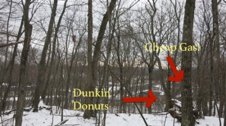
There aren’t too many CFPA trails that crest a hill above a business center and then descend down to it like this new section of the Tunxis does. If you’ve ever done, say, at least a week or two on the AT, this is often a very exciting thing.
It may mean a mail drop for thru-hikers, but it always means ice cream and candy bars and perhaps laundry and a shower. So there I was, up on this unnamed hill in Burlington looking down at the Dunkin Donuts and CITGO and CVS and Irish Pub flashing back to my thru-hike and how this sort of situation was always so exciting for me.
Sigh.
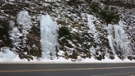
Okay, so once down to Route 4 I was able to look at the ice wall. It’s cool:
From there, the trail dips right back into the woods, continuing north down an old woods road amongst some hemlock and pine. Perhaps I was too keen on following the bobcat tracks, but I missed the sharp right turn halfway down the hill. Don’t you do that.
 Which reminds me… I got a comment on a Tunxis page a couple months ago from an Ann Jurkiewicz alerting me to this new section of trail. She wrote:
Thanks! i have lived in Burlington for 20 years and was pres of the land trust for 10. It’s great that people like you enjoy and appreciate the fabulous trail system that was created by the .Connecticut Forest and Park Association… Also, there is a new trail the CFPA has blazed to connect the entire mainline tunxis with the New Hartford section. Go to Hotchkiss Rd near Foote rd intersection find the trail head go north to New Hartford or South, the new part, through beautiful class 3 water company lands . Watch the blazes, it’s a new trail with some turns.
 Did you catch that? “It’s a new trail with some turns.” Dangit, Ann, I wish I read that with more intent before I went out.
I also had to look up what “Class 3 water company land” means. For your own edification and mine, it is all land owned by a water company which is unimproved land off public drinking supply watersheds and beyond one hundred and fifty feet from a distribution reservoir or first order stream tributary to a distribution reservoir.
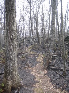
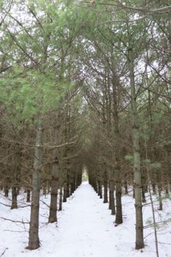
And lo, it IS beautiful. After the sharp turn, the trail dips down to a seasonal stream and then enters a surreal, spooky, creepy, incredible place. It’s a white pine plantation that is still well-maintained.
I am always sort of freaked out by unnatural natural areas like this. Hundreds of rows of stick straight trees, spaced perfectly apart as far as the eye can see. Man, if I grew up around here I would have owned this area. So fun and so interesting.
Here’s what a plantation like this looks like from above:
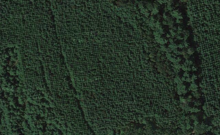
How cool is that?
So cool that I set up my little tripod and took a picture of myself at the section of trail where it goes right down a neatly trimmed row. You have to check this place out… it’s (black) magical.
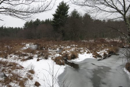
 It’s also fairly short, as before I knew it, I was out on Covey Road and doing the short walk down the road to its intersection with Hotchkiss Road. There is a lively little marsh off the road:
And after a short walk through the woods, I met up with the now poorly defined beginning of the Nepaug Region of the Tunxis. (This is where that section used to begin and take hikers up to the Massachusetts border.)
I poked around the area a bit and although I still had my 20 minute walk back to my car, it was an odd ending for me. I mean, I “finished” the Tunxis in Hartland well over a year ago, but here I was “finishing” it again. On a cold and dreary January morning in the middle of nondescript woods in Burlington.
To cap it off, an ice storm had begun. But that’s the thing – that’s hiking. Different trails in different conditions at different times of the year.
And always good. I love the Tunxis.


Leave a Comment