Bulls Bridge
I’ve Got Bridge You Can See. No Bull.
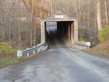
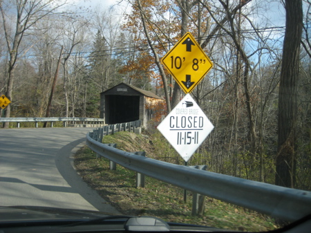
Bulls Bridge, Kent
November 12, 2011
 You know how covered bridges are pretty and quaint and always seem to be located in some picturesque setting deep in some hollow above some bubbling brook? Well, Bull’s Bridge in Kent has one of those things – the Housatonic that gurgles beneath it is a nice river.
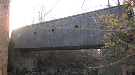
But let’s not kid ourselves – this is kind of an ugly bridge. Sorry Kentsters, but it is. But it has something cool going for it that the other two covered bridge in Connecticut don’t – it’s a mere hop, skip and jump from the Appalachian Trail. (Okay, it’s true that the West Cornwall Bridge about 15 miles north of here is pretty close too, but not quite as close.)
And you know I love me my AT. In fact, I was here alone because I was doing an overnight on the AT and was parking for the night a very short distance away from the bridge. (I walked in to a shelter at dusk, then hiked out and back to the NY state line, back to my car, then took these pictures and got some breakfast before continuing north on the AT in another out and back hike – again ending right near this ugly bridge.)

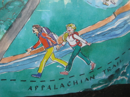
Lord knows how many days I’ve spent on the AT. Never saw a woman this well put-together.
The Bridge spans the Housatonic River as I mentioned. It’s 110 feet long and was built in 1842. Now I’ll turn to my friends at PAST for some more info:
Bull’s Bridge takes its name from Isaac and Jacob Bull, who started an ironworks here in 1760 and also built the first of at least five wooden bridges that have crossed this rocky, wooded gorge. The present span is believed to date from 1842. An example of the lattice truss patented by Ithiel Town in 1820, the bridge carries what was once a major highway from Hartford to Newburgh, New York, on the Hudson River.
The bridge has undergone many changes since its construction. The queen-post trusses that surround the Town lattices are probably not original to the bridge. Bull’s Bridge was raised higher above the river as part of the development of a nearby hydroelectric station in 1901-1903. The State Highway Department replaced much of the lower chords and all of the treenails in 1949. Finally, in 1969 large plate girders were installed beneath the bridge to carry the weight of the traffic, with the exterior sheathing extended to conceal them from view. Despite these alterations, the character of the original bridge is still plainly evident, a reminder of the age when Americans relied on wood as their chief building material. The bridge was listed on the National Register of Historic Places in 1972.
There is a very nice park like setting around the one-lane bridge, with ample parking on the east side and then a bunch of trails through the woods and along the river on the west side. You can even hook up with the AT via these trails if you wish. There is a canal here too, as well as a power generation station, so it’s a bit of a mixed up scene for some reason.
Not to mention the white water Housatonic is plagued with issues like damming and releases. I found the whole issue pretty interesting to read about. The river during my visit was “normal” and I had fun poking around the pothole formations in the rocks.

Lastly, I found this old description of the area from the “History of Kent, Connecticut.” by Francis Atwater in 1897. It’s more beautiful than this bridge.
The chief attraction at Bulls Bridge is the falls. They begin a few rods above the bridge, tumbling many feet down a ledge that extends from bank to bank. Boiling and dangerous are the torrents and swifter in their course than is the arrow’s flight. From the first falls the river gradually descends for many rods over a slanting surface of rock, at places jutting upwards sufficiently to cause other and lesser falls. The shores in the vicinity of the falls are wooded, picturesque and winding, appropriately bounding the dashing waters. The place is named after Jacob Bull, who over a hundred and twenty-five years ago was given permission to erect a grist mill and iron works at this point. Mr. Bull came from Dover, N.Y.
The next paragraph describes the area the Appalachian Trail traverses past the bridge, heading north. Now it’s called the Schaghticoke Mountain and it is now an official tribal land. In fact, after a detour to the (near) summit of Schaghticoke Mountain and back over into New York, the trail clips the reservation’s corner and it is there where the AT crosses an Indian reservation – the only time on the entire length of the AT. THESE are the facts you come here for.
Between Scatacook mountain and the river there is but a narrow strip of valley land. The mountain rises precipitously to a great height and must be at least two miles long. It is densely wooded and in summer time it presents a grand bank of luxuriant foliage, which can be best seen by the traveler on the east side of the river. The road beneath the mountain, with the winding stream on the right hand is full of attractions. It is not unfitting that in so romantic a region, at the south end of Scatacook mountain, the few last families of the Indians who were once the sole masters of the country should have their dwelling place.

My page on the Bulls Bridge Cascades
Back to Bridges, Canals & Dams, Roads & Tunnels


Ah yes, Bulls Bridge in Kent … just as unattractive as I remember it from my own visit there this past January though I’ve got to admit that the partially frozen Houstaonic underneath the bridge did make for some very nice pictures! (http://www.mouseski.com/2011/02/cold-visit-to-kent.html)
Comment #1 on 12.07.11 at 10:55 pm