The Longmeadow Baby Jog
I Like How They Have a Border Fence
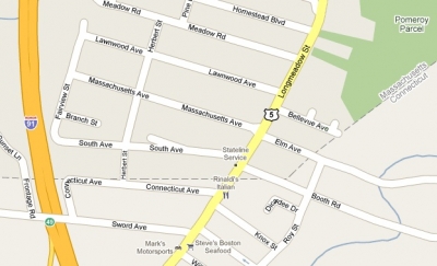
Enfield, CT/Longmeadow, MA border
11/30/2009
I made up the name of this border anomaly, but I figure I have the right to do so, since no one has bothered to do it before. And keeping with the tradition of the Southwick Jog, a much more infamous border dispute with Massachusetts and one of this blog’s most visited pages, I’ve decided to use the Massachusetts town’s name that unjustly extends into the fine town of Enfield, CT.

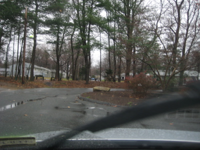
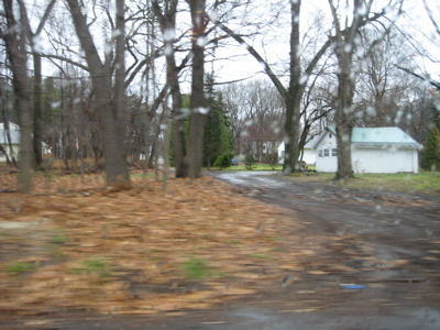
There it is. The Baby Jog.
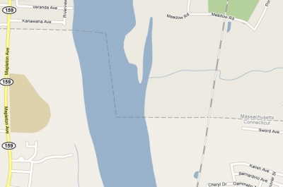
As you might imagine, this smaller intrusion does not evoke the same passion that the Southwick Jog does, what with their Facebook campaign and bumper stickers to “Take Back the Notch!” But it is historically related to the Southwick Jog, and its existence is as crazy and convoluted as its better known counterpart 15 miles to the west. (A good portion of the intrusion from the north is in the middle of the Connecticut River and its eastern swampy land, so it doesn’t have the cache of the Congamond Lakes in Suffield – errr – Southwick.)
I owe everything factual about how this blip came to be to the same great resource I used on the Southwick page, The Southwick Jog, by The Reverend Edward R. Dodge. I realize these types of border disputes were quite commonplace back in colonial times, but hey, I only care about Connecticut’s nascent battles.
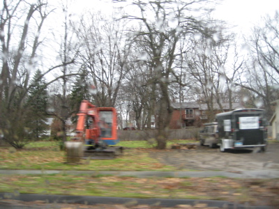
The eastern portion of the jog. Imagine all those lives turned upside down by this affront.
Someday I’ll explore how we used to claim the whole of Rhode Island, most of Long Island, eastern New York over to the Hudson River and even a part of southern New Jersey that Connecticut bought from the Lenape Indians – that one ended in murder by arson. Ugh, if they only knew what South Jersey would become, 400 years later… Such a shameful waste of good Puritan men.
This page came about as a result of several people emailing me over the last year or so, usually after reading the Southwick Jog piece. I guess they never felt like clicking the link over there to read the whole (admittedly long) story of our northern border, so I’m happy to do it for them and condense it.
The western stretch. Yeah, okay… No one cares about this part.
I first reached out to my Enfield friend Dave who writes an always interesting (mostly) food blog, Dave’s Cupboard. He summed up the whole thing very succinctly: ” The dip in the state line is the result of a lawsuit filed by Enfield and Suffield in the 1700′s and settled in 1749. A surveyor’s error had put Enfield in Massachusetts, where it had been incorporated in 1683. Eventually, the town wanted to cede from Mass and join CT. The line jogs down in the center of the CT river because when the lawsuit was settled, Agawam MA kept their border, so Enfield’s border was drawn kinda diagonally from the jog to today’s Longmeadow/Enfield/Somers border point.”
That’s should be enough for anyone… But I decided to check out the border myself and really delve into the history.
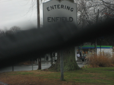
So I drove up to Enfield one miserably rainy and cold day to check out the scene (and score some cheap Mass gas)! The weather kept me in the car for the most part (I was wearing my fancy work clothes), so my pictures all pretty much stink; though honestly, I’m not sure if a sunny day would have helped much. It’s not the prettiest border in the world.
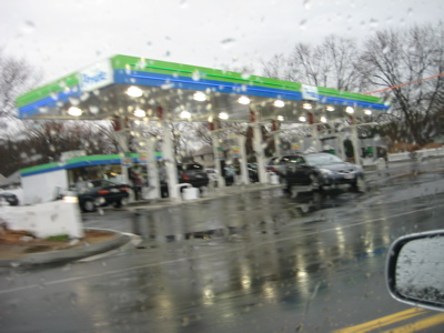
6 feet into Massachusetts equals 16 cents cheaper gas
Okay, let’s get to learnin’:
I have edited this treatise extensively (believe it or not), hopefully in a way that retains the guts of the story and doesn’t repeat too much from the Southwick Jog report.
The Springfield-Hartford area was settled in the mid 1630′s by William Pyncheon and Thomas Hooker, respectively. William Pyncheon had been connected with affairs in the Massachusetts colony from its very inception. He was the founder of the settlement called “Roxbury” and
when his people took the “Western Fever”, he led them to that place by the Connecticut River which came to be called “Springfield”; the year was 1636. Thomas Hooker was an English clergyman, and upon his arrival in the new world, settled in Cambridge with his congregation. Neither he nor his congregation were happy there and three years after settlement
they, too, took the “Western Fever” and removed themselves to the area that is now known as “Hartford”; the year was 1636. Springfield covered abroad area. The boundaries were indefinite and as additional settlers moved in, the area spread out to include what are now the towns of
Westfield, Southwick, West Springfield, Chicopee, Wilbraham, Ludlow and Longmeadow and Enfield and Somers in Connecticut. Hartford, too, spread up and down the Connecticut without much regard for boundaries. Suffield, Connecticut’s lands were later within Springfield’s
jurisdiction. In 1647, the Massachusetts General Court ordered that Woronoco, (Westfield), should be part of Springfield. At this early period, Suffield was included as a part of Woronoco.
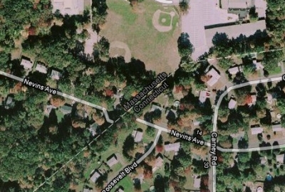
Please note Nevins Avenue. Rumor has it the CT Nevins’s hate the MA Nevins’s
CTMQ Notes: Suffield is the town west of Enfield on the other side of the river and is part of the whole Southwick Jog debacle. I’ll not mention them again except when absolutely necessary to the story. The next part of the story is covered over in the Southwick Jog piece and
basically outlines the beginnings of the border dispute, the overthrow of Oliver Cromwell in England, the restoration of Charles II, and the adoption of the revolutionary Connecticut Charter in 1662…
[The Connecticut Charter] was a remarkable document, which not only gave the people of Connecticut, at long last, some legal basis for their colony, but also a high degree of freedom and independence. In granting the territory, it specified what the boundaries should be.
The eastern limit was to be the Narragansette River, the southern boundary, the sea, and on the north, its limit was to be the southern line of Massachusetts with the whole colony extending westward to the Pacific Ocean. Though Connecticut had her charter which clearly defined
her northern border, and though she was suspicious that the 1642 line [the one erroneously drawn way too far south by MA-employed drunken surveyors] violated her charter, she did little more than make periodic protests to her neighbor to the north.
Nevins Avenue from the bad guys’ side, looking at the cool Connecticut side.
There was good reason, of course, for her reluctance to right this wrong which she felt had been committed against her. At the moment she was embroiled in other border disputes: one with Rhode Island over her eastern boundary and a second with New York over Long Island and the
western Territory. Also, it must be remembered that the Indian menace was still a live issue in all of the colonies at this period, diverting considerable time, energy, and interest to the winning of that struggle. The land continued to fill up and the pressure of town against town was
increasingly felt; the border problems with Massachusetts could no longer be ignored. The problem seemed to concentrate itself particularly around the area which is now Suffield and Enfield, Connecticut. Enfield, Connecticut, was originally a part of Springfield and was settled as early as 1647 by residents of that town. In 1657, thirty families from Salem came and made their home there. The population increased and gradually there began a migration from Enfield out into the surrounding territory, particularly eastward. Somers, Connecticut, was one result of this migration. Massachusetts, Plymouth, Connecticut, and New Haven united in 1643 for friendship, defense, and advice. This was known as the New England Confederation. Each colony was expected to contribute money for the common defense, and was entitled to send two commissioners to the annual meeting of the Confederation.
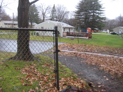
This is the ugly end of the CT Nevins Avenue, with border fence in foreground.
…
There existed all the ingredients for a full scale border dispute. There was the 1642 boundary line which Connecticut did not approve; there were two interpretations as to what the territorial limits should be; and now there were two new towns lying in what appeared to be questionable
territory. In 1686, complaints were heard from Suffield and Enfield to the effect that their territory was being molested by the towns of Windsor and Simsbury. Windsor and Simsbury answered this criticism with the report to their government that the towns of Suffield and Enfield were the aggressors. It is difficult to say who was sinner and who was sinned against. It is very probable that both were guilty when it came to invading the border of the other. In these early years, individuals more often than not decided local boundaries with the sole view of their own personal convenience and profit.
At any rate, Connecticut moved slowly and carefully in the face of this new controversy. Before making any decision, she felt the wise move would be to draw her own border to determine where the line really lay. Calling upon Massachusetts to join her in this survey, she received a flat refusal. The Bay Colony saw no need to do the work which had already been done. The 1642 survey clearly revealed where the line was and the towns of Suffield and Enfield were unmistakably within that border and had every legitimate right to complain when Connecticut encroached upon their territory. Connecticut, therefore, struck out alone, engaging
John Butler and William Whitney to run the line. In preparation for their assignment, they studied the Massachusetts Charter, found the point three miles south of the most southerly branch of the Charles River, noted the latitude and then, unlike the “mathematicians” before them, set off overland, surveying the line in the orthodox fashion. With their work completed, they filed their report dated August, 1695, which to no one’s surprise, revealed the 1642 line in error; it was laid too far south.
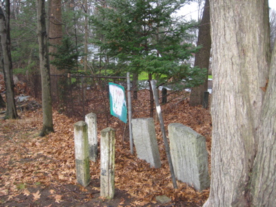
The Nevins Avenue border fence and what I can only assume are the graves marking those who have died over this border war.
[Connecticut offered a compromise, Massachusetts offered their own, but...]
Neither colony was willing to accept the other’s proposal. If Massachusetts agreed to Connecticut’s plan, she would lose some of her territory as well as weaken her defense of the 1642 border. On the other hand, if Connecticut agreed to the Massachusetts proposal, it would mean a deeper penetration into Connecticut territory, particularly at Woodstock, Massachusetts. And so the problem stood, no nearer final solution, but indeed, more complex with each colony clinging tenaciously to its own personally surveyed border line. In 1702, James Taylor of Massachusetts and Messrs. Pitkin and Whiting of Connecticut, ran a third line according to the Massachusetts Charter, with the result that it coincided almost perfectly with the line Connecticut had run in 1695.
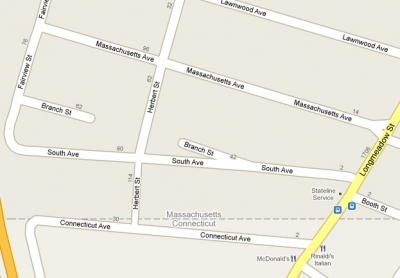
Take note of the above section of the Baby Jog. Herbert Street looks so simple and drivable… And note the territorial street names, named after the warring states… and “South Ave” which of course should be “North Ave” in Connecticut…
[Even though Taylor was in the employ of Massachusetts, they refused to accept the most recent survey. The states continued to bicker for a few more years...]
In 1713, a compromise was finally agreed between the disputing colonies, calling, first of all, for a new line to be drawn (this would be the 4th such survey). This was done, and it fell north of the original line laid out seventy-one years before. Obviously, this presented an immediate problem. The new line lay north of the Massachusetts settlements of Suffield, Enfield, and Woodstock… (But CT ceded the towns to Massachusetts to get this matter behind her. However, the townspeople weren’t happy about the decision…) A possible reason may have been taxes. Massachusetts taxes were high while Connecticut’s assessment was comparatively low. Also, Connecticut’s very liberal Charter may have been an irresistible inducement. Then, too, by 1717, Enfield and Suffield had populations which were pretty much equally divided when it came to state loyalty; there were as many Connecticut people settled in these two communities as Massachusetts citizens.
This is Herbert Street. A potholed dirt road symbolizing the 300 year border war.
…
Whatever may have been the reason for Suffield’s and Enfield’s request – taxes, freedom, or retaliation for the unethical treatment of 1713 – Connecticut did not succumb to the temptation to include these towns under her Charter. Very emphatically she denied the request,
underscoring her decision with the fact that the compromise of 1713 could not be violated under any circumstances. Connecticut probably remembered, too, the long years of struggle which had gone before this compromise, and was not willing to risk reopening that old wound. For several years there were peace and good relations on both sides of the border. Suffield and Enfield had accepted Connecticut’s decision, but had never entirely given up the hope of becoming part of that state.
The driveway is in MA, but the house was in CT. There were two cars in the driveway, one with a CT plate and one with a MA plate. That backhoe is used to bury those who give their lives to the Baby Jog struggle.
[Woodstock first asked to become part of Connecticut, which then prompted Enfield and Suffield to follow suit...]
Connecticut voted May, 1749, to receive Suffield, Enfield, and Woodstock under her control and further made it known that the1713 compromise was not binding as it had not been approved by the Crown. Massachusetts answered this declaration with a somewhat sarcastic note, informing Connecticut that while she (Connecticut), may not have sent the results of the1713 compromise to England for approval, Massachusetts had done just that, as was her custom with all important matters. Therefore, it would seem that if anything had been illegal as to the proceedings, such
error would have been called to the attention of the colonies before this date. So insistent was Massachusetts that the three towns were still under her jurisdiction that she continued to levy taxes, send announcements of feast days, and election sermons right up to the period of the Revolution. When these failed to be acknowledged, there followed petitions, letters, threats, and even some minor violence. Over one hundred years had passed since the first line was run, and still the colonies were no nearer to a solution that they had been in 1642.
Phew, back to friendly territory, albeit a mile further south than it should be.
But now there were other events which were increasingly absorbing the colonies’ interests and attention: the French and Indian War, (1754-1763); the Stamp Act, (1765); the Boston Massacre, (1770); the Boston Tea Party, (1773); and the Intolerable Acts, (1774). In May, 1774, a very unusual event occurred. Just when everyone assumed that the border troubles had been forgotten, a petition was received by the General Assembly of Connecticut from a small group of the inhabitants who resided in the southern portion of Southwick, Massachusetts. The petitioners gave no reason for their sudden desire for Connecticut control, other than to say that their land lay below the accepted state line, and, therefore, ought to belong to Connecticut.
…
[On and on it goes... While the Southwick Jog article sort of drops the whole Enfield piece of the puzzle, at some point in the future around 1801, Connecticut basically said enough is enough and here's our northern border and you can eat it, Massachusetts. The last bit of the article that mentions Enfield is this...]

It should say “Notches.”
Massachusetts countered this with a fact which apparently Connecticut had conveniently forgotten. Connecticut had assumed jurisdiction over Suffield, Enfield, and Woodstock in 1749 in direct violation of the 1713 compromise. However, Massachusetts made it clear that she would be willing to accept this loss but would remain firm in her refusal to relinquish any portion of Southwick.
Which then leads us back to two things: 1) The continuation of the Southwick/Suffield-Granby border dispute, which is still actually being contested to this very day (something about which state gets to collect boat mooring fees in Congamond Lake), and 2) Dave’s original, simple one
paragraph note to me about what I’ve deemed the “Longmeadow Baby Jog,” which bears repeating: ” The dip in the state line is the result of a lawsuit filed by Enfield and Suffield in the 1700′s and settled in 1749. A surveyor’s error had put Enfield in Massachusetts, where it had been incorporated in 1683. Eventually, the town wanted to cede from Mass and join CT. The line jogs down in the center of the CT river because when the lawsuit was settled, Agawam MA kept their border, so Enfield’s border was drawn kinda diagonally from the jog to today’s Longmeadow/Enfield/Somers border point.”
Geeze, I could have saved your some time by ending this post 2000 words ago, huh?
If you look closely, you can see the Baby Notch too. It’s time we draw attention to this issue!


Taking back the Notches would be a good start, but to make Connecticut whole we will also need to seize Block Island.
Comment #1 on 12.10.09 at 4:59 amAgreed. But we should start with Fishers Island since they are Connecticut in everything (zip code, Area code, school system) but taxes and name. Then Plum Island. Once we’ve completed the takeover, we’ll move on to Block (named for, of course, Adriean Block, the Dutchman who “founded” what was to become Hartford.)
Comment #2 on 12.10.09 at 6:05 amTake back the Baby Notch! — but don’t take Plum Island until they shut down the anthrax lab.
Comment #3 on 12.11.09 at 1:55 pmI like the notch as is. There are enough rectangles and squares (as well as other pejoratives)in the Midwest. No more property acquisition for Connecticut until it (re)creates just one single habitable city. It’s unconscionable for a state with that much money to have such miserable urban dwelling spaces. Just my opinion, and y’know, well, maybe a small island would be okay.
Good read, Steve.
Comment #4 on 12.12.09 at 4:06 pmGet over it, CT people. The notch is ours. I can’t believe that after 300+ years, there are still people that are mad about this.
Comment #5 on 09.30.10 at 3:13 amThe town on the Massachusetts side of the border is Longmeadow, MA — not East Longmeadow, MA. East Longmeadow is a different town a few miles to the east, whose southern border doesn’t encroach on Connecticut at all (why would they want to, that’s where they keep their maximum security state prisons, smushed right up against the border!).
Prior to 1894, both Longmeadow and East Longmeadow were both part of one big town, but that town was called Longmeadow (well, originally long meddowe) so at no time was this border jog between Enfield and East Longmeadow — it’s always been Longmeadow, so you should probably call it the “Longmeadow Baby Jog” instead (although that sounds to me like some kind of charity race).
Comment #6 on 10.31.10 at 3:03 amThanks Josh. I’ve updated the page.
Comment #7 on 04.05.11 at 1:28 pmYou Connecticut losers should quit yer whinin’ and admit defeat.
Comment #8 on 05.11.13 at 5:53 amYou’ll never get the Southwick or the Longmeadow jogs (nor any major league sports teams for that matter