Section 4: SHHhhhhhhenipsit
Shenipsit Trail: Section 4,
Vernon, Tolland, Ellington ~ 6 miles
May 13, 2010
 Ahhh, such a clever title. For this is the secret section of what has become quite the oddball trail. I’ve come to learn why the Shenipsit isn’t included in the conversation with CFPA’s “big” trails (Metacomet, Mattabesett, Quinnipiac) – too much development, too many unknowns along the way due to “progress.”
And yet, the trail survives… Some would say it thrives. It does connect a bunch of very nice parks and takes in some interesting history along the way. It passes near some really cool features and meanders along some stunningly beautiful creeks. But one thing that plagues the Shenipsit is that it’s not a continuous footpath; there is a 5 miles (or so) break between the commuter lot in Vernon and its unceremonious re-start up in Tolland.
Until now. Sort of. I think.
While researching stuff for the my Valley Falls Park hike, I came across a tiny snippet mentioning that one Mr. George Arthur, CFPA volunteer and Shenipsit maintainer, has indeed connected the trail and it is now whole. The CFPA website makes no mention of this additional section and I don’t know why.
 I saw exactly zero people on the section (it was a rainy afternoon after work, granted), but it is blazed very well. But it’s still confusing and not exactly a destination hike, as it winds through an industrial park and stays mainly on roads. And yet, I’m very glad I found out about it and many thanks go to Mr. Arthur and I hope his efforts are properly recognized.
(For some reason, an old blue oval Shenipsit Trail sign still stands along route 30, about a half mile southwest of where the trail actually crosses. I’m guessing it’s an artifact of where the trail used to cross, but ugly new houses now stand in the way.)
 I emailed Mr. Arthur and he replied with a wonderfully detailed description of his new section… Which I somehow no longer have. But I DO have my memories and my pictures, so let’s get to it.
I planned to more or less jog the section out and back, as most of it is along roads and that often affords a quick hike. I changed into my hiking gear at the communter lot right off of exit 67 in Vernon where the last section ends. Now, the secret section doesn’t actually begin here and there are no blazes, so I guess I lied about the Shenipsit being totally connected.
 But, you can easily “hike” this first bit if you enjoy walking along the busy Route 31 north underneath I-84, I don’t really recommend it though, as it’s not fun and it’s not even part of the “official” new “secret” section. If you choose to do this (say, you’re doing the entire Shenipsit in one day or something), I recommend cutting the 31/30 intersection via South Grove Street.
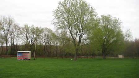
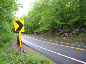
Once on Route 30 heading northeast, pass the strip mall (if you’re hungry, you’ve now passed a McDonald’s, a Burger King, a Subway…) and turn right (south) down the Tolland County Agricultural Center driveway. Here you’ll find the first blue blazes of the section and the comforting feeling we all get with them.
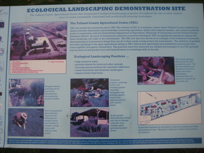
I’d recommend straying off the trail here on the TAC grounds a bit. There are a bunch of informative signs along the way. Heck, I checked them all out and it was raining on me. Since the TAC is a UConn-run organization, the signs are a bit more academic than these things usually are, and I actually learned a few things about a “Eco-Landscaping” and UConn’s turf management program. They are trying to develop grasses that don’t need nearly as much water to stay green as typical turf grasses.

The TAC has seasonal events throughout the year, but the massive metal structure, which I can only assume is a giant spit for roasting humans, provides an eerie backdrop to the whole eco-conscious farm vibe they give off here.
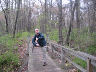
 The trail leaves the lots and skirts the property line near some trees and then returns to the dirt road as it enters the woods. Ahhh, woods. There are a few more interpretive signs back here, and a nice little bridge, but then the trail goes around a swampy section and heads straight east to an industrial park.
One thing about central Connecticut hiking: It’s always an adventure.
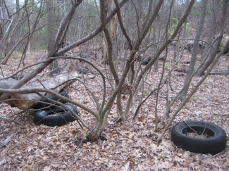
Before the next (long) road walk, the trail passes near a former dumping ground of whatever businesses loom above on the hill. There are tons (literally) of old tires here which soft of take away from the abundance of fiddlehead ferns and skunk cabbage. Oh well. Once on the industrial park road (which really isn’t very “industrial parky”), head left (north) back out to Route 30.
 Along the way, I passed Husky Wear, the company that is officially licensed to make all your UConn garb. How exciting!
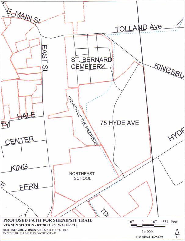
Now, the trail follows Route 30 northeast and then turns left (northwest) onto Kingsbury Avenue. I found this blurb from a website on Tolland Trails:
Future plans are to extend across Rte 30 into the Northeast School property along the easterly boundary, then continue along the easterly boundary of the Church of the Nazarene, then through the St. Bernards Church cemetery, then across Rt. 74 into Connecticut Water Company land along the abandoned trolley track by Shenipsit Lake and joining the northern section of the trail at Grahaber Rd. in Tolland.
Here’s what that looks like on a terrible map. If you look very closely, you can see the blue dots. Unfortunately, that off-road section was not granted – at least not yet – so instead the blazes follow Kingsbury Road. Which is not the best road to walk down.
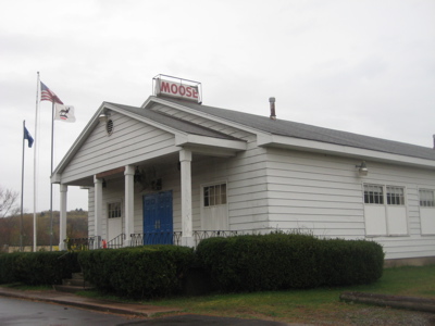
 Although, there are a couple interesting things to see along the way… the Italian-American Friendship Club! I have no idea what that is, but I’m sure they’re friendly. Across the street from them is a Moose Lodge!
Yes, these things still exist. I know nothing of the Moose. Apparently this Lodge, the Rockville Lodge #1574, has seen better days. Their website laments, “I would like to take this time to say we have to stop with all of the rumors.” That’s never a good sign. Their building is up for sale and apparently their membership is lacking. But, they still do good work in the community and all those positive things that fraternal organizations do.
Wouldn’t you want to join these guys? And if you’re a woman, there is also the Women of the Moose here! A lovely bunch.
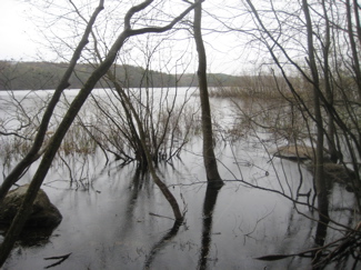
Continue up the road, past the St. Bernard’s Cemetery (humans are buried there, not giant dogs) and turn right (east) onto Route 74. The road walk finally ends as the trail heads north towards Shenipsit Lake along an old trolley line. There is no evidence of the old trolley anymore, but it’s a lovely straight walk along the lake. (It started really pouring on me at this point, so I don’t really have many pictures along the lake).
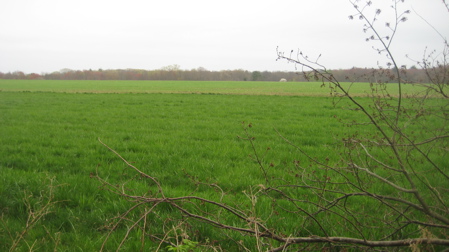
 It really is pretty neat, with fields and pasture on one side and the lake on the other. This continues for about ¾ of a mile and I suggest you enjoy it while you can. Because once the trail reaches the north end of the eastern arm of Shenipsit Lake, it passes by some old farm equipment and then it’s back to road-walking.
Northward up Shenipsit Lake Road… But once the road makes a 90 degree right-hand turn, it turns to hardpack dirt and really feels like a big trail rather than a road. I actually enjoyed this walk, as it was an unexpected backwoods experience. There are some really nice houses here along this dirt road… something I found odd. I guess that’s how they roll in… I think I was in Ellington at this point.
Once at the intersection with Grahaber Road, veer left (west) and walk down that road for about a third of a mile. Ugh. I was so tired of all this road hiking – but again, I’m ecstatic this secret section even exists. So I’m waffling on this whole section.
 After the stint on Grahaber, the trail rejoins the official current Shenipsit according to the Walk Book. Right at Telephone pole # 3632. That’s right, the book states the exact pole… A detail probably only I appreciate.
I’m going to keep going here, and you’re going to thank me later for doing so. You see, there’s nowhere to park at all here on Grahaber Road to spot a car to finish off the full Northern section of the Shenipsit. This last mile is included as the first mile of the last (northern) section in the Walk Book. The suggested parking area up Grahaber Road on Bonair Hill Drive is almost as far away as the next better/safer/smarter parking area off of Route 140 (Crystal Lake Road) on Hopkins Road. And, to further convince you, this last mile is the best mile of my section, so it’s always good to end a little hike in a good spot.
Trust me.
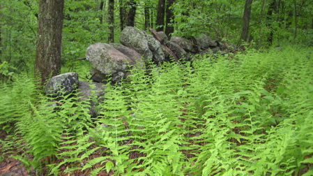
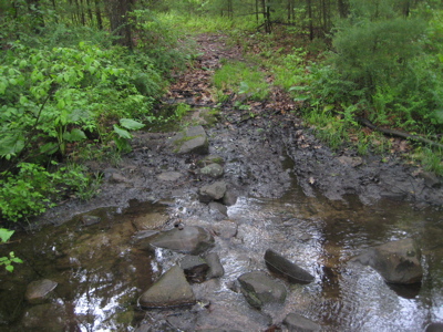
Once back into the woods, the trail offers a preview of things to come. Of course, I hiked this in May, so the flora won’t be as robust during other times. I passed a few stone walls and some ferns (“fernage?”), then crossed a muddy creek…
Walked across a power line cut… Through the secret blackberry-enrobed entrance…
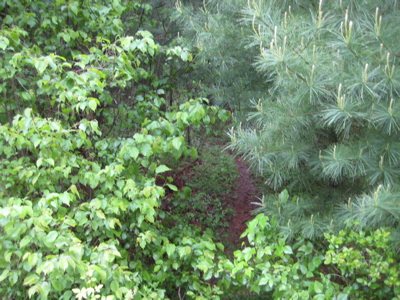
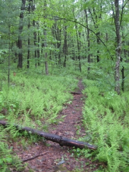
… and then began the wonderful walk through Fern Gully. Devoted readers know that I love fern covered forests. They’re just so… so… so green and lush. Add in what was now a quiet drizzle and some pines and to me, this was perfection. Frustratingly, the trail crosses a dirt road with nothing on it except…
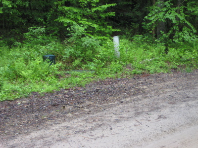
… Argh. Electricity stuff. There are houses on this road to the west and currently one big house to the east at the end. I’m sure there will be houses all along this road in a few years which will suck for the trail. Sure, they may get easements through this stretch, or even go all the way around, but the short section of the Shenipsit – say that three times fast: “Short Shenipsit section, Short Shenipsit section, Short Shenipsit section – is very primeval in a way, and with ugly vinyl siding houses with 3 car garages on the way, I can’t imagine it’ll retain the same overall beauty and feeling.
So for now, just enjoy a few pictures of the stretch – which is really unique to the whole of the Shenipsit.
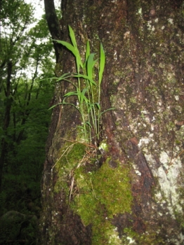
Grass as an epiphyte?!
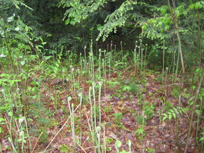
Fiddleheads!
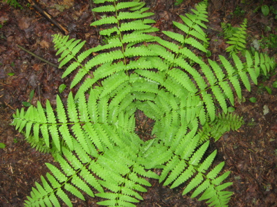
High school biology book cover!
The section ends with a short – and dicey – road walk along Route 140. The road is a beautiful drive, all the way west out to I-91. I’d never driven it before, but it winds through pastures and old(ish) growth forest, up and down some hills. The problem with walking along it, though, is that it’s just plain dangerous – so be careful.
Hopkins Road provides ample roadside parking and serves as a perfect starting point to finish up the Shenipsit, north up and over Soapstone Mountain; a trek I have the good fortune of undertaking with Dennis Himes.

Finish!
Some short video of George Arthur at Shenipsit Lake


I grew up less than a mile from parts of this trail and had no idea until I read your post that it was even there. I’d been to the TAC and on the trails, but thought they were just part of their land. Right now, I sorta feel like I did when I learned there was no Santa Claus.
Comment #1 on 06.12.10 at 11:07 amKerri – don’t fret. That land IS the TAC’s land. Assuming this section of the Shenipsit is officially CFPA trail, the CFPA has merely “borrowed” the land and the trail.
Like all the MDC land where blue trails travel is still MDC land.
Comment #2 on 06.14.10 at 6:46 amI discovered the blue blazed trail near the TAC land this past Sunday. I didn’t take the first blue blaze trail,which you described above,but continued straight. I came across old roads which crisscrossed each other. Not sure whether farmers used these roads to transport corn etc. Off of one of these roads was a red blazed trail which led to a river (Gage). Who owns the land to the south of the blue blazed trail between the TAC building and South Grove Street? I use to live on South Grove Street and remember that field planted with cow corn which became a open field. We use to play back there, great fun.
Comment #3 on 09.28.10 at 5:12 pmThe eerie metal structure is used for the chicken bbq at the 4-H fair. It was originally used for a ham and bean diner, which was a fundraiser the TAC Board of Trustees. Its really not that eerie, but nice try.
Comment #4 on 10.10.10 at 9:11 amLive chicken bbq. Still eerie.
Comment #5 on 11.16.10 at 2:20 pmThanks for all your work on documenting the Shenipsit trail. I used your pictures and text to find parts of the trail I thought did not exist. By the way – I believe there is a new short part of the trail by RT 85 just after crossing the I 385 overpass that is not mentioned in your dialog.
Comment #6 on 01.16.12 at 1:09 amYou don’t need to walk on RT44/6 from the open field on RT85 all the way to the abandoned Drive In movie theater. Thanks again.