Section 1: An Inauspicious Beginning
Metacomet Trail: Section 1
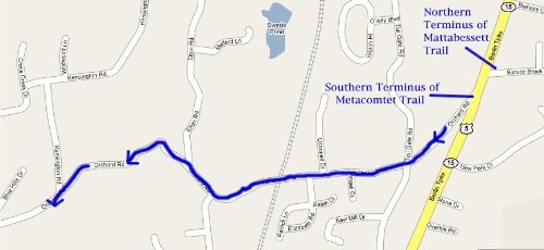
Berlin Turnpike-Orchard Road Turnoff, 1.8 miles
April 29, 2007
 Hoang and I were both exceedingly excited to begin the first section of our trek. This despite the fact that it’s less than 2 miles long, is entirely along a dangerously twisty road with no shoulder, and is very poorly marked. But wait – let’s begin at the beginning: The Southern Terminus of the Metacomet Trail. All trails have a nice sign at each end; perhaps giving some milages-to-go and some of the unique history surrounding the trail’s origins. It should be riiiiiiiiiiiiight here. Or over there. Wait… Is that it over there? Hm.
That’s strange. But let’s back up even further – back east a mile across the southern tip of Berlin to the western edge of Middletown and nearly to Hoang’s and my place of employment. Here, check this out. The following three pictures were taken from the top of the hill on the backroad I take to work every morning.
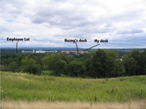
From the top of the hill, here is our place of employment with approximate distance we must walk each morning. Sure is fun in February!
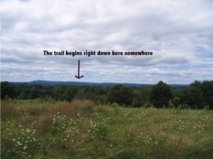
Turning around 180 degrees from that same spot, one can approximate where the Metacomet Trail begins a short way away.
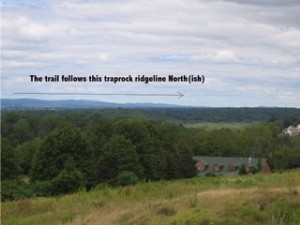
Then, turning stlightly northwest, one can follow the ridgeline (and cell/TV/radio towers) the trail follows north.
Pretty cool, huh? What’s cooler is that when we drive home north each day up Route 9, we can generally follow the ridge the Metacomet Trail takes to the west of us. And after we pick up Damian in New Britain, we parallel it even closer through Farmington and then up by the reservoirs near our home in West Hartford. So you see, I’m pretty intimate with this trail. You could say that I’m weirdly proud of it, which is why I’m so excited to check out that sign at the Southern end. So we poked around a bit more which gave me time to reminisce. My memory took me back to 1996 to the beginning of my Appalachian Trail thru-hike and my experience at Amicalola Falls State Park in Georgia. After seeing the extensive visitor’s center, weighing my pack, signing in, and then hiking straight up Springer Mountain 8 miles, I finally came upon the southern beginning/end of the AT. It was rough, primitive, and beautiful.

Moonrise from Springer Mountain, the Southern end of the Appalachian Trail
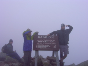
One of the lovely signs every hiker likes to see at a trail terminus (Hoang and I at Mount Katahdin – the Northern end of the Appalachian Trail).
I remained hopeful as trucks rumbled past at 65 mph along the Berlin Turnpike. According to my map, the trail starts right about here:
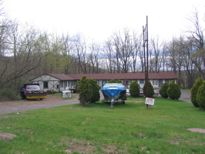
Hmmm, should I go ask the proprietor where the trail starts?
Nah, he looked a bit upset with us photographing his classy motel. I can’t imagine why. Looking across the highway, I noticed the timeless and classic combination of strippers and Go-Karts. I don’t know about you, but whenever I get done Go-Karting, I immediately like to see strippers… and vice-versa.
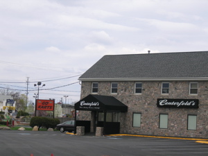
“Free Skee-Ball tickets and lap dance for the winner!”
Getting nowhere, Hoang and I decided to refuel at the gas station conveniently located right across from where the beautiful Metacomet Trail begins (or so I thought). With 1.8 miles of road walking ahead of us, we needed all the essential salts, lipids, and sugars we could get. And since it appeared we were going to be walking an extra mile or so in search of the trail’s beginning, we were sure to stock up there.
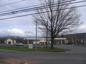
A Dunkin Donuts AND a Mini-Mart!
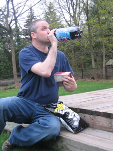
Glug glug glug
Ok, let’s think this through. The trail is 70 years old and I’ve seen a million signs for it crossing the roads I drive all the time – Hey! Is that a bag of Corn Nuts? Mmmm, their saltiness goes nicely with the sweetness of the Diet Pepsi.

Delicious!
Now that we were both rarin’ to go, we buzzed around like bees looking for the interpretive center at the beginning of the trail. Or the descriptive signage. Or the little sign pointing the way. Or maybe a blue blaze? A bread crumb?
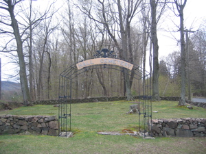
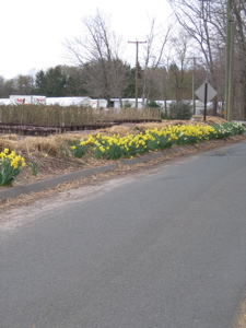
There is this weird empty cemetary right next to the official Southern Terminus of the Metacomet Trail.
Nope to all of the above. The trail just sort of begins where you want it to begin. The map I have (published by the crew responsible for the trail) shows it starting right in front of the truck repair place on the Turnpike (next to the motel above). However, 100 feet South there is a telephone pole that I have officially dubbed the southern terminus of the Metacomet Trail (The first blue blaze is painted on it.)
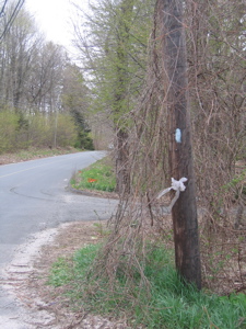
The Southernmost* blaze on the Metacomet Trail
(*Not actually geographically correct, but you get the point.)
I should paint my own dang sign. In light of the ignominious beginnings to this trail, neither of us expected anything different along the way. The “trail” simply followed Orchard Road a couple miles through suburban Berlin. I would guess that 70 years ago, this was a lovely mixture of forest and pasture and perhaps orchard. But now the “trail” passes a bunch of subdivisions. In truth, there were lots of really nice houses along the way, a couple little farms, some train tracks, a babbling brook, some trees… But we were so hopped up on sugar and caffeine that we barely noticed as we ran like loons all the way.
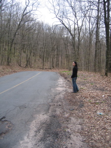
We hiked on the wrong side of the road on purpose at this point – it was safer.
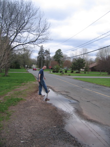
Here I am negotiating one of the difficulties along Section 1.
I know this section of “trail” is the way link the Metacomet to the Mattabesett, which starts just across the Berlin Turnpike and winds Southeast through Middlesex County. However, I was a little bit deterred by the lack of blazes along the way. I counted 3 going each way. Granted, all we had to do was follow the stupid road but still… If I didn’t know that from my research, I’d have been mad. And even when we reached the turnoff into the woods, there was nothing alerting us to do so other than the map.
We weren’t the only asses along the trail!
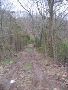
Although we were both excited to enter the woods to hike along a real trail, we had agreed to stop at this point and save that section for another day. Even if that section is less than 1.5 miles long and appears to merely be an overgrown flat path through some boring woods. If that’s not a cliffhanger inciting you to check back here often, I don’t know what is. (Actually, the trail does climb up and get to a couple really cool spots in short order, I promise.)
Official stop point of Section 1; Orchard Road Turnoff at Kensington Road intersection
…………………………………………………….
Section 1 Breakdown:
0.0 Miles: Berlin Turnpike and Orchard Road
0.05 Miles: Pass Giant old Victorian House
0.4 Miles: Cross Toll Gate Road (There is a blue-blaze here!)
0.7 Miles: Cross Bridge over train tracks
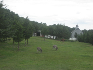
0.9 Miles: Pass small farm with horses and a donkey
1.0 Miles: Pass Metacomet Drive
1.2 Miles: Pass Elton Road
1.8 Miles: Pass Kensington Road and turn sharp left into the woods
End


Never did I think I would see someone blogging the Metacomet Trail! I pieced together the trail all the way to Mount Monadnock in the 1970s when I was a teenager in Tolland. What I remember best was the poor trail marking, often being lost, breaks in the route when a landowner decided to put up No Trespassing signs, and the sounds of lawnmowers and dogs barking in the back yards that you look down on from the 500 foot high trap rock ridge.
It was not for naught however–I through hiked the AT in 1980.
Nice blog!
Comment #1 on 07.14.08 at 4:17 pm