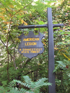
American Legion State Forest Trails
Don’t Pass The Buck, Jive Turkey!
Pleasant Valley, 2.3 and .88 miles (2 trails)
September 9, 2007
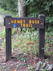
Henry Buck Trail, 2.3 miles
 I’m a purist, plain and simple. When I set off on my Appalachian Trail thru-hike in 1996, I was adamant about walking every mile of the thing. I’ve retained this sense of what “completion” means for my Connecticut 400 mission. Sort of.
To do so, one must walk the nearly 800 miles of “major” trails described by the CT Forest & Parks Association in their Walk Books (East and West). I’ve received some notes from others who have done this; one of which told me that he has (or plans to) hike every single inch of every single trail mapped or described in the books. That includes every single approach trail, side trail, spur, short-cut, and dead-end. I find this even more OCD than me – but I’m not too far off.
Anyway, on the official CT 400 List (The concept was borne when there were only 400 miles of trails. It has since doubled but Yankee stubbornness has retained the out-of-date name) “American Legion Trails” is on the list. The American Legion Forest is a smallish state forest west of the beautiful Barkhamsted Reservoir out near Pleasant Valley and Riverton. (Two aptly-named towns lifelong CT residents have probably never heard of; they are part of Barkhamsted.)
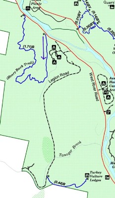
The West Branch of the Farmington River forms the eastern boundary and splits the American Legion Forest from People’s Forest, which is another state forest across the river. The American Legion gave most of this forest to the state. The first deed was received in 1927 and the most recent acquisition was in 2004. Within its 900 acres, American Legion State Forest has two trails for your hiking pleasure; Turkey Vulture Ledges Trail and the Henry Buck Trail. One is very short and the other is even shorter. So let’s get to them already, shall we?
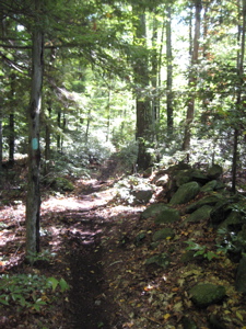
I had a couple hours free one Sunday morning and sped out along Route 44 West to get some hiking in. As I drove north along West River Road, I was struck with just how pretty this area is. The majestic hemlocks and well-maintained camping areas reminded me of a National Park out west somehow. In fact, in 1994, this stretch of the West Branch of the Farmington River was designated by Congress as a Wild and Scenic River.
This road is quite simply one of the best for a Sunday walk with the love-of-your life and your dog I can think of in Connecticut. (Save for the speeding jerks like me in cars.) After passing Legion Road, which I glanced at and cringed a bit knowing I’d be driving up it later, I easily found the Henry Buck trailhead thanks to the nice signage. I parked and hit the trail.
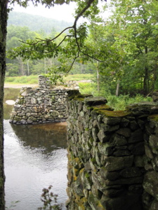
Actually, first I crossed the road to check out the stone ruins of a bridge that used to span the river, connecting the two forests. It was built by the Civilian Conservation Corps but was destroyed in the 1938 hurricane. In fact, there are a lot of things built by the CCC that remain here today. (Mostly campsites and stone stairways and waterbars and such.)
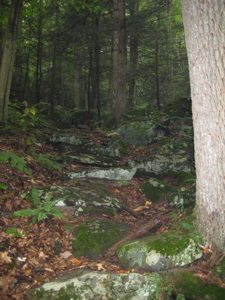
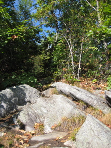
The beginning section of this trail is relatively easy traveling on soft trail through lush forest. Rumor has it that the wildflowers here in the Spring are some of the best around. After a short while, the trail turns sharply up hill following a streambed. Once the trail somewhat levels out again, I passed what the guidebook told me was the remnants of the old cheese box factory that operated in the early 1800′s. They made wooden boxes to store and ship locally-produced cheese. It looked like an old stone wall and cellar hole to me.
But the stonewall is actually part of the foundation and the factory extended out over the “cellar hole”. Water was directed into what looks like a stairway into the cellar hole via a sluiceway. The water turned a paddle in this “cellar hole” that was connected to a gearbox that, in turn, provided power up to the factory! The wooden sluiceway must have been in the area where the trail proceeds to an old, washed out earthen dam. The small reservoir that was created by this dam provided the water necessary to power the cheese box factory.
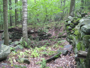
Pretty cheesy
Huh. Who knew? I must admit – it’s not really as cool as the name and description suggets. Shortly after crossing the old dam I climbed up under some large stone ledges. Looking up at the cliff/ledge, I noticed a bronze plaque, honoring Henry Buck, the trail’s namesake. Mr. Buck was vice president of the CFPA from 1928-30. He was a Yale-educated civil engineer who directed the construction of CT’s CCC camps and he also happened to have designed and built the trail I was halfway complete.
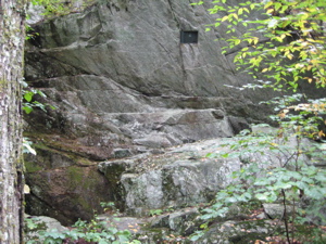
The ledge below tilts appreciably downward and the cliff above is at an acute angle. Wah-wah-waaaah…
To actually read the plaque requires a bit of balancing artistry. You can’t tell from the pictures, but trust me. It’s not that easy, especially when wet. This leads me to believe that Mr. Buck was not a good civil engineer. Of course it’s unfair to judge the man based on that, but that’s how I am.
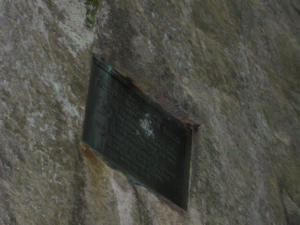
…But I made the effort. And this is what you get.
The trail continues down a short hill and to something called The Tremendous Cliffs. I hate to burst the cliffs’ bubble, but they were far from “tremendous.” In fact, they were really pretty weak and the view was minimal at best:
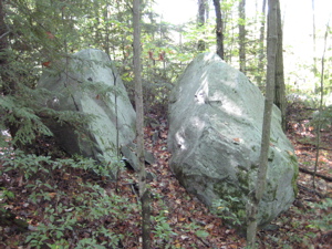
Then the trail climbs a steep switch back and levels out, and then passes a series of very large boulders. One of them was defaced by a very disturbed young man. He somehow looked at this rock and saw a nude woman, as seen here:
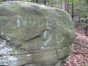
Um. Yeah.
The trail descended and crossed a small area, carved into the side slope, perhaps 30 feet across that is perfectly flat; ah, an old charcoal mound! Most of the hills of Northwest Connecticut were repeatedly clearcut to provide charcoal for the iron industry. Many of the cannons used during the Revolutionary War were manufactured in northwest Connecticut, using charcoal to fuel the furnaces. Later charcoal was used in the brass industry along the Naugatuck River valley. I will note all charcoal burning platforms from now on.
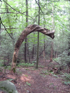
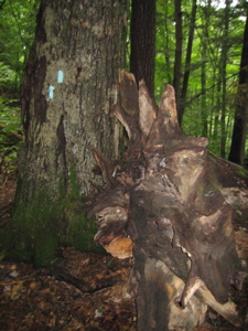
I don’t think I even want to know what sick and twisted thing happened to this poor tree towards the end of the hike.
After that, the trail continued down to the road along which my car was parked. I merely had to walk back down the river for about a third of a mile or so. I passed fly-fishermen casting and recasting to no avail. Near my car, I peered back across the river and saw something I’d been looking forward to seeing for years – a bald eagle! Sure, it was a mottled brown juvenile, but it was pretty cool to see him daintily eating a fish while the humans up and down the river weren’t catching a dang thing. I only regret that my camera’s zoom is more or less useless, but here you are:
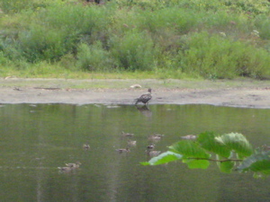
Trust me, that’s a bald eagle.
Was this a positive omen for my Philadelphia Eagle’s season opener a few hours hence versus Green Bay? Um… no. They lost – a recurring theme this year I’m afraid.
Finish!
– Much of my write-up (the intelligent sounding historical stuff) was taken from CT’s Letterboxing Website
…………………………………………………….
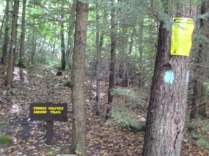
Turkey Vulture Ledges Trail, .88 miles
 I couldn’t skip out on the Turkey Vulture Ledges Trail a) because it’s a blue-blazed trail “required” for my mythical list and b) it’s called the Turkey Vulture Ledges Trail! Right? I had visions of evil raptors tearing the still-warm flesh from a dead faun; fur and feathers flying in a violent storm of angry hunger.
In the meantime, before I would have the pleasure of happening upon such a scene, I had to deal with the unimproved Legion Road. The road is maybe a mile and half and climbs the same hill the Henry Buck Trail climbs, just a bit further south. It’s not that bad, but in a low-clearance vehicle there are some tough rocks and ruts to deal with. At one point, while crossing Tanager Brook, the road was sort of washed out and I slid towards oblivion a little bit (“oblivion” being a one–foot deep trench) but I’m sure that gets patched up every so often.
The forest here is beautiful: Mature beeches and birches mixed in with pine and hemlock . The sun had burned off the morning clouds and the dappled white light through the quaking leaves was – while a bit blinding – a pretty cool experience. Once again there is a nice big sign noting the trailhead and a decent area to park. I was cutting things close with getting back home for the 1PM Eagles-Packers kickoff, so I more or less jogged the whole trail.
All .44 miles of it. It ascends gently through the somewhat unremarkable woods with the only memorable feature being a giant glacial boulder, split by eons of freezing and thawing. A couple minutes past the split boulder the trail spilled out on… the Turkey. Vulture. Ledges! (Dunh-dunh-duuunnnnnhh.) I looked left. I looked right. I listened intently. I sniffed the air for carrion.
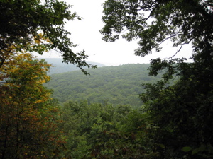
 Nothing. Nada. Zippo… However, with the sprawling view of the valley below I could hardly be disappointed (Okay, maybe a little bit). And the fact that a paralyzing fall was somewhat of a possibility here makes it a bit more intriguing. I did not see a sigle raptor of any variety in the 3 minutes I stood taking in the view. I turned tail and jogged back to my car and made the slighly more harrowing trek back down the hill to pavement.
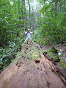
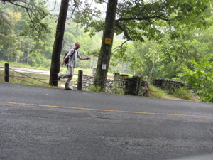
I did see a bald eagle at the end of my earlier hike and I was going home to catch the Eagles lose a football game, so in that sense, I saw the raptors I wanted to see. The American Legion State Forest is really very nice and I’m sure the camping grounds they provide right along the river are great. When I stopped to the take the picture at the beginning of this report I smelled the smoke of a campfire and heard the excited shouts of pre-teen kids without a care in the world.
And that was nice – So nice that I continued my day’s adventuring by swinging around up the other side of the river to check out the Barkhamsted Lighthouse; a most definite CTMQ Curiosity.
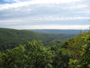
The view from the TVL
…………………………………………………….
Links of Interest
American Legion State Forest
The CCC
Buck Henry
The Cheesecake Factory
Turkey Vultures


I had to laugh at some of the comments in this one-I think you’ve been watching too much of Jurassic Park!!!!
Comment #1 on 11.11.07 at 5:50 amThanks for the review of this trail…I have hiked it many times and have always found something new and sometimes bizzare..like the time I was hiking the turkey ledge
Comment #2 on 11.27.11 at 9:08 pmTrail and heard what I thought were hawks..birds being murdered…I hurried down the trail to the ranger station at the nearby camp grounds breathlessly telling her of the mountainside “slaughter”when she tilted her head and piteously replied “Thats the mother feeding her chicks”
Oh. Heh heh…some outdoors woman am I eh?