Section 7: Hiking With The Apple Of My Eye
Metacomet Trail: Section 7
Andrews Street to Blue Oval sign on Rte 372, 5.9 miles
September 14, 2007
 After taking a couple months off from the Metacomet Trail (after all, who wants to exert themselves in July or August?), we picked up where we left off at the Southington/New Britain border for what turned out to be a far better hike than I’d expected. At this point, I really need to change my mindset because every section of this trail has been enjoyable for multiple – and varied – reasons.
For such a short section, a third of which would be along roads, I somehow took 26 usable pictures for this report. There are a couple really nice views, some very interesting geology, and some absolutely delicious donuts. D’oh? Donuts? Yup… Made daily right there along the Metacomet Trail! I just love having reasons to keep Hoang plugging along; carrots (in the form of donuts) at the end of sticks.
We began our jaunt along Long Bottom Road in the middle of an orchard. Somehow we’d left the high ridges of the previous section and descended into Apple World. But wait… First there’s Hoang’s traditional starting picture:
Work it, girl!
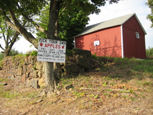
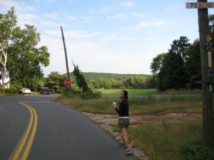
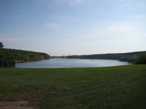
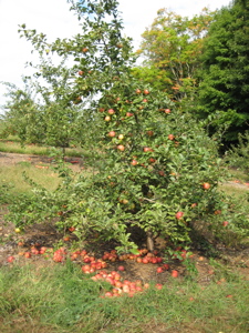
We wound our way along the road with the smell of apples thick in the air. Autumn was right around the corner and many central Connecticut towns had their Apple Festivals coming up in the next several weeks. There were literally thousands of apples at arms length, but we stuck to our morals and didn’t touch. Isn’t there a famous story somewhere about that? We were on the cliffs high above Shuttle Meadow Reservoir in the last section, but now we walked at the same (drought affected) water level:
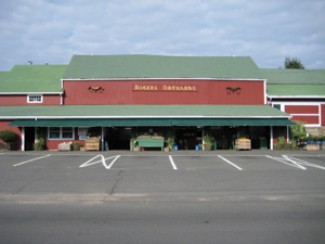
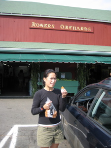
You can see it was a beautiful early morning to be out for a hike. We soon came upon Rogers Orchards which I’ve read about in others’ Metacomet reports. When open, it’s like an oasis; fresh apple cider, homemade pies, and apples out the ying-yang.
If this isn’t New England, I don’t know what is.
We passed a sign along the road announcing “Fresh Daily Donuts.” Hoang began drooling and suggested we just hang around for an hour or so until they open. “Ahhh, no. We have to come back here to pick up our car and we’ll get your donuts then, baby,” I replied. She reacted thusly:
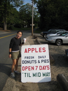
“Maaaaaaaaaaaaaaaaaaaaaaaaaaaaan!”
We continued on. Onward past more apple trees than the eye could see. Old, old apple trees but with plenty of viable fruit. After once again contemplating eating some forbidden fruit, We found a thorny tangle and…
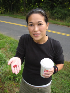
That’s one haggard looking apple tree… and two juicy, delicious, and okay-to-eat raspberries that we found in a brambly mess!
Yes, it’s true. We began our hike with Dunkin’ Donuts coffees in hand. Hey, when you’re road-walking, why not? It doesn’t make us any less hardcore. What if I told you they were black coffees? Let’s get into the woods already!
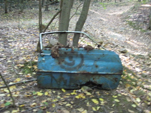
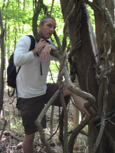
The trail crossed through a three-way intersection at the bottom of a hill and entered the woods via an old, rocky, overgrown road. We climbed steadily through an odd forest, full of skinny trees and lots of thick and twisty vines. It was obvious that this area was clear-cut not too many years ago as there were no mature trees at all. The fact that we crossed and re-crossed and followed several different old woods roads also tells me that this was once a cleared area. Some of them, apparently, still somewhat driveable – even if they were so bumpy your doors would fall off, literally:
The trail continued ascending slightly and the tangle of old roads and crazy giant vines and the jitteriness caused by the black coffee and the donut-addled minds resulted in:
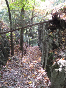
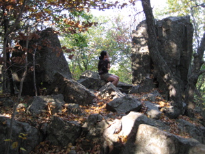
Phew, that was tough. With Hoang’s help, I extracted myself and continued the hike. Just in time for a very steep (and very short) climb up through a split boulder. Wow, that was cool… In fact, for the next several minutes, the trail wound it’s way through several other split basalt formations. The trail blazer certainly sought out as many as he or she could find to make this section as fun as it could be.
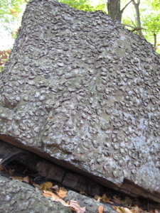
Hiking through giant boulders is typical for this section… but this odd lichen was not.
We reached the ridge-top and couldn’t help but notice a massive old fireplace. Also very noticeable were orange blazes as well as green blazes mixed in with our familiar blue blazes. The orange ones are a loop trail that heads down to Crescent Lake and the green ones, I think, are a park boundary. There were areas where it looked as if a three-way paintball game had taken place up there.
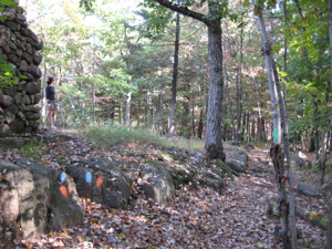
You can sort of make out then green blaze on the tree to the right and the fireplace to the left.
The fireplace sits atop a downright beautiful outlook. That would be this one:
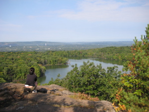
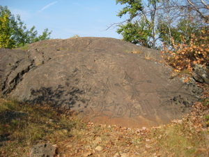
The trail continues along the ridgeline above Crescent Lake and takes in several more nice views. One of them is called Sunrise Rock and strangely, I only have a picture of the rock itself, rather than the view. Perhaps because at this point I figured we had enough “Views of Hoang or Steve’s back gazing out upon a body of water view.” So you get a rock with graffiti on it instead:
From there, the trail tracks northward, often on bare rock. At one point recently, a deadly super-poisonous snake sunned itself on one of these bare rocks and shed its skin:
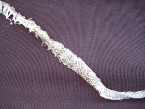
Uh-oh, did this mean that Hoang’s shirt was now deadly super-poinsonous too?!
No. And I’m just kidding about the poisonous part. You didn’t really believe that, did you? Even if the next section had us climbing up and over Rattlesnake Mountain, I’m fairly certain that’s a Common Garter or black rat snake skin. But don’t tell Hoang that… After a turn west and another short little climb, we summited Bradley Mountain (I like to mention the named climbs along the Metacomet, as there are so few) which was really a very nice area. Open forest, interesting boulder formations, well-marked trail – this had been a great little hike.
Then, almost suddenly, we were treated to another great view, this time towards the South and of several hills we’d been over along our Metacomet Adventure.
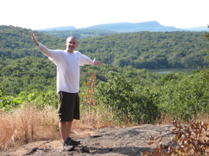
“Take in my conquest! I own this ridgeline!”
From there, it was all downhill through beech and hemlock. Down, down, down… It seems to me that South-to-North is definitely the way to hike the Metacomet. I know it sounds nonsensical, but it just seems like we’re always climbing less than we would if we were going the opposite direction. Not that there are any climbs of exceptional difficulty anywhere along the trail.
Once at the bottom, we hit Ledge Road and a sharp turn to the North. In a weird way, I sort of look forward to the road walks now. They are sometimes interesting in their own right, and have made me appreciate just how cool the Metacomet truly is. It is certainly unique in the way it “gets away” from development quickly and beautifully in a part of the state where it just seems impossible to do so.
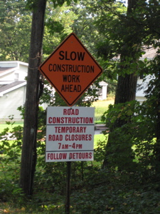
Halfway down Ledge road we hit some construction – and quizzical looks from the construction men to say the least. They were repaving the road so we were forced to walk across a bunch of lawns.
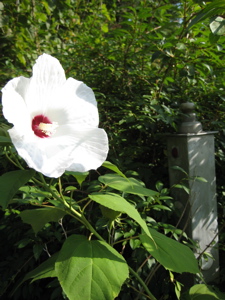
The forced detour off the road allowed us to get close to some private gardens, including one with this beautiful flower.
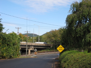
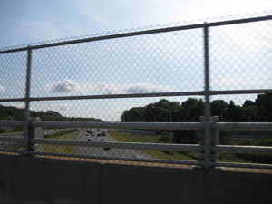
Towards the end of Ledge Road, we were afforded a view of the aforementioned “Rattlesnake Mountain” in the distance. Note the highway bridge…
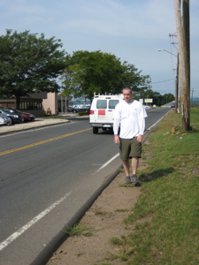
I believe I’m okay in saying that this is the worst part of the 63 mile trail. A right onto the busy Woodford Avenue and then a left onto Crooked Street to cross Interstate 84. There are no sidewalks and the shoulder is about a foot wide. There are no blazes at all either, but that didn’t really matter. What mattered was not dying. The following three pictures are literally, part of the trail:
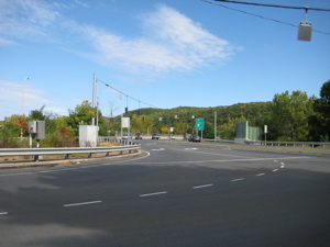
Now, the granddaddy of them all, the Appalachian Trail, crosses plenty of interstates and hikes along several dangerous roads. But somehow when you’re hiking there, you believe that all passersby know what you’re doing and respect you for it. Here, in Plainville, Connecticut, I’m just not so sure. We survived the 1.6 miles along the roads, but not with smiles on our faces:
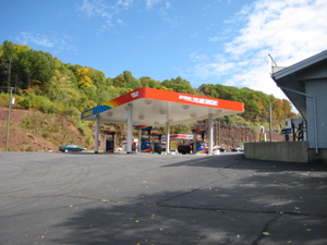
Oh, who am I kidding? I loved it! It’s stuff like this that makes the Metacomet so unique and fun! Hiking through a gas station lot? That’s awesome. We reached the turn off of Route 372 where the trail heads north and the next section.
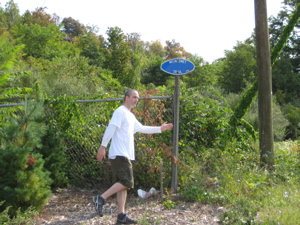
Official stop point of Section 7: The blue oval sign on Route 372
Postscript: We drove back to our other car and made the stop at Rogers, now open. What a wonderful place… It appears to not have changed much from the 1950′s. We bought a bag of Cortland apples (which Hoang made into a phenomenal apple crisp that night) and yes, a bag of “Fresh Daily donuts.” Apple donuts to be exact. And, I’m happy to report, Hoang was a happy girl:
…………………………………………………….
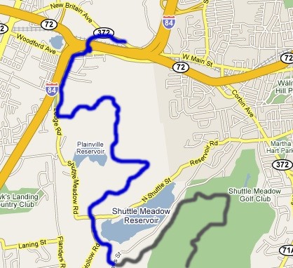
Section 7 Approximate Breakdown:
0.0 Miles: Andrews Street crossing
0.5 Miles: Rogers Orchards
0.8 Miles: Enter woods
1.8 Miles: Old fireplace
2.0 Miles: Views of Crescent Lake
2.8 Miles: Sunrise Rock
3.5 Miles: Bradley Mountain summit
3.6 Miles: View from Bradley Mountain
4.3 Miles: Ledge Road
5.0 Miles: Cross I-84
5.9 Miles: Blue oval sign on Route 372
End
Links of Interest
Rogers Orchards
Apple Harvest Festival
Apple Crisp recipe


Leave a Comment