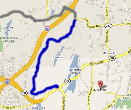
Section 2: Higby Hollow… Hollow Head
Mattabesett Trail: Section 2
Country Club Road Trailhead – Route 66 Crossing (Middlefield), 4.4 Miles
July 11, 2008
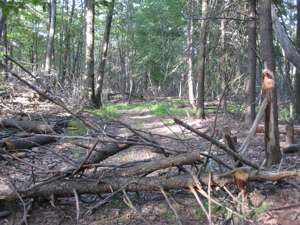
 I’d really like to not spend too much time on what I must spend some time on. Intrigued? You shouldn’t be. As your intrepid Connecticut 400(825) reporter, I simply must describe the situation with the Mattabesett over off of Country Club Road. When I reached the end of my Section 1 hike, I noted all the “No Parking” and “No Trespassing” signs as well as the blacked out blue-blazes at the trailhead at the trailhead. Not to mention all the bulldozed trees lying about.
In light of this, I decided it would be best to hike this section backwards, north from the Route 66 crossing instead of sticking to my more sensible continuous intinerary. This decision was not made lightly; it completely screwed with my internal sense of order that keeps me happy.
 It also caused me many minutes of trying to figure out if I should A) write this section backwards (south to north) as I hiked it, B) write this section opposite the way I hiked (north to south) with several paragraphs explaining my torturous decision-making process, or C) write this section opposite the way I hiked it but pretend otherwise.
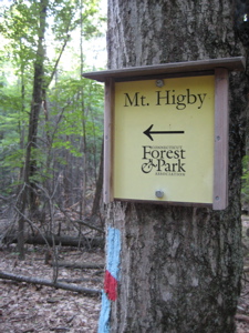
Of course, now you know the answer is B – I just want my pictures and entire multi-sectioned Mattabesett hike to “flow” continuously and not have a weird backwards section due to this access situation. Oh yeah, back to that… Some guy named Jeffrey Pierce and his wife wrangled a 140 acre piece of land on the north and eastern sides of Mt. Higby in Middletown. He has decided this piece of land (formerly – and still surrounded by – Wesleyan University land) is good for an ATV park of sorts. He calls this land Higby Hollow.
Never mind that it’s totally not good for ATV’s as it’s far too small and featureless. Never mind that he’s constantly battling with the CFPA over the 50+ year old Mattabesett Trail route while promoting a destructive activity. Or that even the ATV community seems to think his waivers are silly, his fees are way too high, and his land is just too boring.
It gets better. He’s also trying to sell his 147 acres for $13.1 million dollars, but that website appears to be gone. [12/6/08 UPDATE: Middletown closed down his ATV ranch until further notice. Good.]
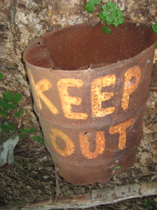
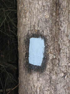
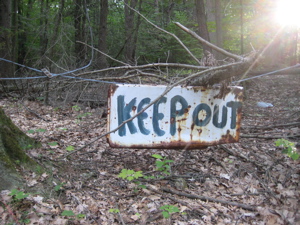
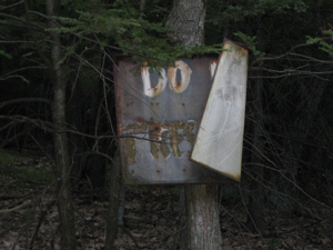
Yes, be sure to “KEEP OUT” away from tetanus! Note the re-blazed blacked out blaze. Your move, Jeffy.
While it’s cool that someone is trying to create legal ATV parks in Connecticut, the way he’s done it is just really lame. The plethora of angry “KEEP OUT” and “GO AWAY” signs, aimed directly at (perfectly legal) hikers makes me angry. There is no parking at the “Higby Hollow” entrance, so it seems he’s building one by bulldozing an acre lot. What I don’t understand is that while his waiver mentions being stewards to the environment and to not litter, etc, what is that piled high on his land, just off the trail and slightly out of sight?
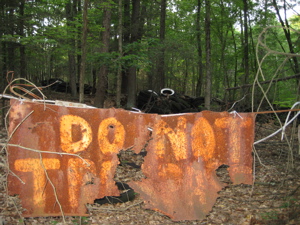
As if I need to be told to not trespass into a garbage dump. Idiot.
Enough about all that. Let’s get to the hike itself… So now enjoy pictures of the Sun climbing higher in the West as I describe my hike in reverse. I parked about a quarter mile from the trailhead at a large town park – I suggest everyone does the same, unless they are planning on walking over I-91 from the commuter lot.
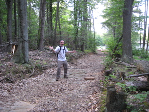
Start! (err, Finish!)
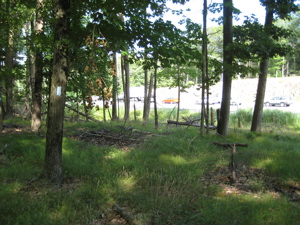
Entering the woods where it is clearly evident I was not welcome does leave an odd feeling in the pit of one’s stomach. I never felt in danger, just a bit out-of-place to say the least. (As my pictures convey, it’s not a friendly place.) The first 3/4 mile of trail here sort of follows the woods road/ATV trail just off to the side. For the record, I saw zero ATV’s and actually didn’t really see too much evidence of their being here recently at all.
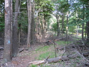
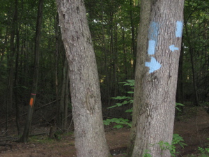 Although the trail’s been re-routed a tad, it still follows the general path of the CFPA maps, so that’s not a worry at all. Of note: If you are not a insane completist like me, you can now access the “good” sections of this hike via Tynan Memorial Park. A blue/red blazed trail will show you the way, which is nice.
Once the trail turns west, most of the ugliness is left behind, although there are some large swaths of dead hemlocks and interesting barriers to either keep out hikers or keep in ATV’s. I never figured which. I do want to make sure I drive this lesson home: The first mile and a half of this section is sketchy and ugly, yes… BUT it is totally worth it to get to the rest of the hike. No question.
Bleh.
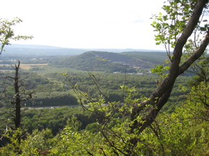
First of all, the hike “up” is very gradual and easy. The beauty of out traprock ridges is they all pretty much form a giant ramp, so to speak; gradual slope on one side, sheer cliffs on the other. They all seem to be east/west facing too. There is much on the web about this unique geography, and I’ll explore it more in later sections I think, as the Mattabesett actually leaves the traprock ridges in Madison and crosses over to some different land forms.
In other words, a very easy hike up a gradual slope and suddenly…
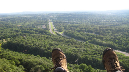
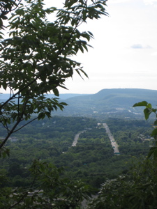
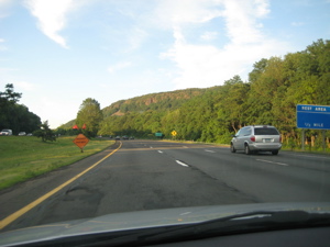
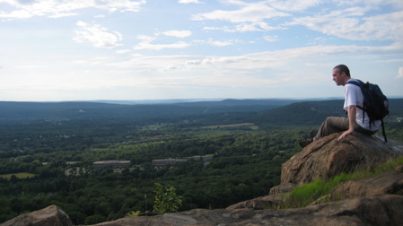
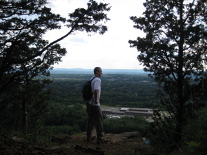
Yeah okay, the view is of an interstate highway, but it’s still cool. The haze of the day is evident, but the cliff is sheer and it’s rather exciting to be up there. Just for fellow Nutmeggers (and passers-through) to get your bearings, remember every single time you drive up 91 North and see this?
That’s where I am right now on this hike. Up there. Loving it. Remember that ugly quarry from the last section? I’m leaving that in the distance:
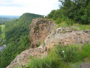
The walk along the cliffs of Higby Mountain are just great. (Which is another reason the ATV thing irks me – it’s denying people access to this from the north.) Higby is actually two distinct humps with a “notch” in between, called Preston Notch. I have no idea who Preston was, sorry. I know you look to CTMQ for such factoids. I can make one up if you’d like.
Walter Preston was a colonialist who was accused of conspiring with the Tories in 1779. He was hung from an oak tree in the swale between the two Higby peaks and left for dead. As the mob of angry revolutionaries began walking away, they noticed Frank Preston hiding behind a tree, watching the whole affair. He was grabbed and stripped to his skivvies, which happened to bear the Union Jack. He was also noted to have bad teeth and a pocketful full of loose leaf tea. Walter was cut down and freed, but still made to watch the hanging of his traitorous brother, Frank.
So there you have it. A true(r) story about Higby is that I see it every morning from the parking lot at work. Also, I get to stare at it all day long out my office (aka cubicle) window too. To think I’d never been up it before is just crazy to me.
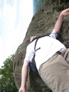
Once on the southern, slightly less-in-height Higby peak, I fiddled with my camera to set a 30 second timer, but forgot to change the depth of field setting. (As if I really know how anyway.) As a result, you get this picture:
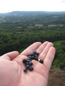
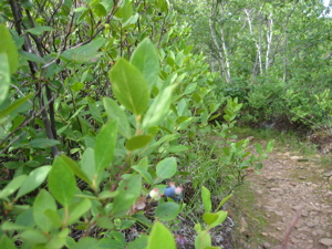
If you squint, you can see me in the distance. After I returned to the camera to see my handiwork, I decided against sprinting across the cliffs again for a second try. Now you know. Also know this: July 11th seems to be peak blueberry time on Higby Mountain. I stopped to enjoy handfuls upon handfuls of them:

Pondering the deliciousness with East Peak in the distance and… GULP!
I figured, “Hm, if the blueberries up here were so delicious, the bearberries must be equally so. So red… so shiny… mmmm…
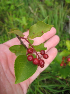
Pondering the deliciousness and… my throat swelled up and I died.
Actually, you can supposedly eat a couple and be okay. But the possibiities – while sorta cool – aren’t worth it: “Bearberry is relatively safe, though large doses may cause nausea, green urine, bluish-grey skin, vomiting, fever, chills, severe back pain, and ringing in the ears.” Green urine? Hmmm…
Continuing south down the ridge along the cliffs, the views don’t quit for almost 2 miles. In fact, heading south, they seem to get better as you go. There’s even one spot called “The Pinnacle” which is cute, but for those of us familiar with the plethora of other Pinnacles on the east coast (I know I’ve been to Pinnacles in VA, PA, and I think NH and WV) it’s not the best pinnacle in the land.
But that’s really only because of the highway and powerlines. But, as you can see from the pictures, it is still very nice and I seem to have enjoyed it quite a bit.
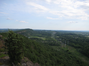
Looking south, at next section’s Beseck Mountain
Near the end of the cliff walk, there is a strange piece of graffiti – yes, there is graffiti on pretty much ever central Connecticut rocky outcropping area, but surprisingly little trash (so far) – anyway, this guy (or girl) really loves the Mattabesett:
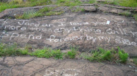
“Jordan, I love you Mattabesett Trail blaze more than anything will you spend forever by my side.”
Awww, I’ll think I’ll crop that and take it out of context to use it in another report:
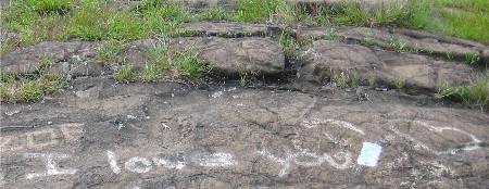
There, that’s all one needs to say.
Once the southern end of the cliffs are reached, the trail swings left and heads down to Route 66. I must mention that the trail crosses into and out of Cockaponset State Forest for about 100 yards just as the descent becomes gradual. I only mention this because a) I like saying “Cockaponset” and b) this State Forest seems to be EVERYWHERE in the southeastern quadrant of the state. Total patchwork – it’s sort of weird.
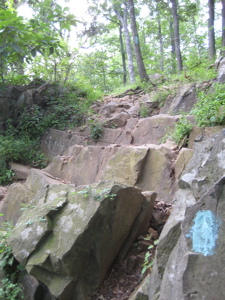
The descent to the end of this section is easy but is littered with those softball sized cube-shaped rocks I’ve become so familiar with on this trail. I mean, this isn’t too fun:
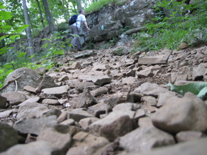
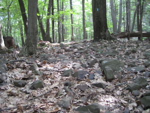
For one brief moment, I was reminded of the many-miles stretch of the Appalachian Trail in central Pennsylvania known as “Rocksylvania.” I quickly was thankful that my current stretch was a walk in the park compared to that. Especially since the the last half mile or so ambles softly through greenery and grasses, down to perhaps the best trailhead treat I’ve encountered thus far:
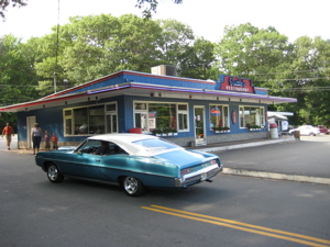
Yes, an authentic (sort of) old-school diner! The trail actually goes through the parking lot of Guida’s Restaurant and there happened to be a classic car event there the day I hiked through. Either that, or guys with classic cars like classic burgers and malteds a disproportionate amount – a distinct possibility.
The easy walk near Route 66 to Guida’s
(Alas, as this was actually where I began my day, I didn’t get to enjoy a real milkshake or anything at Guida’s. And since I’d be resuming my southbound trek next section, I’ll miss out again. Then again, this place is only ten minutes from work so I’ll stop whining now. It’s also home to a “Best of” Connecticut hot dog)
Section 2 Approximate Breakdown:
0.0 Miles: Sketchy Country Club Road Trailhead
1.3 Miles: Leave the ATV Park nonsense
2.0 Miles: Mount Higby north summit
2.5 Miles: Preston Notch
3.2 Miles: The Pinnacle
4.4 Miles: Guida’s/Route 66
End
Links of Interest
Higby Hollows ATV Park
ATV rider forum discussing the lameness of Higby Hollow
The diverse flora of Higby
Bearberry
Guida’s in Middlefield


what a shame that tool is creating such a mess with the north terminus of the mt higby section. Seems so trashy and gross with all the rusted signage and keep out’s. Lets hope his misserably failed business venture forces him to sell to a much more enviro/hiker friendly owner. nice job with walk through.
Comment #1 on 05.30.09 at 8:42 pmDid this hike yesterday…the first 1.5 miles aren’t nearly as bad as they used to be. We only saw one or two keep out / no tresspassing signs. We had a lengthy conversation with someone who was traveling in the other direction (or is it same direction? haha). Apparently, not too far from the natural bridge formation there is plane wreckage leftover from a crash which happened in the 60′s. Does anyone know anything about that? I found some vids on youtube but they were from five years ago and I was wondering if anyone knows if any of the wreckage is even still there. I want to go back and check it out (we didn’t have time to explore yesterday) and was curious if it is even worth it…
Comment #2 on 10.15.12 at 2:42 pm