Section 1: I Have But One Lament…
Mattabesett Trail: Section 1
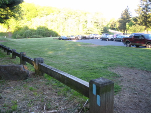
Berlin Turnpike – Country Club Road Trailhead, ~ 9 miles
May 23, 2008
…And that lament is this:
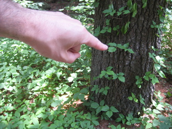
Doink!
Indeed. Lots and lots of it. On the ground, on trees, in shrub form, on my shins, behind my knees, fingers, arms nose, eyelid, ear, stomach, neck, some here, some there… Yes, my annual brush with systemic poison ivy was a result of my first section hike of the Mattabesett. It wasn’t too bad at all this year and my secret stash of old Prednisone does wonders. I shall be wearing pants on all hikes through September henceforth. Okay, so who cares about my wanton stupidity, let’s get hiking!
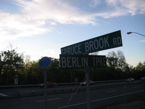
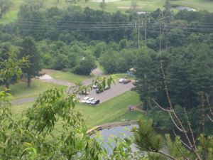
The western terminus, along the Berlin Turnpike – an old highway infamous for motels of ill-repute
My title is actually a play on the name of the first mountain on this leg of the Mattabesett – Lamentation Mountain. Besides the story behind its original name (it’s from an incident in 1653 when a member of a nearby colony became lost on the mountain for three days before he was found by a search party), it has a more recent lamentable story – as related to the trail I’m hiking.
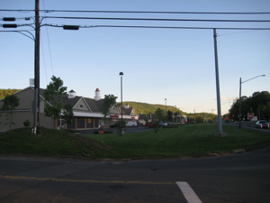
The same gas station plaza that began my Metacomet hike – with Lamentation Mountain in the distance
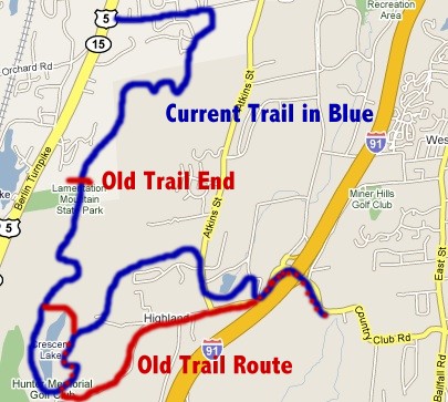
A private landowner essentially closed the entire northern portion of the mountain down to public access. As you can imagine, with this trail so near the incredibly over-developed Berlin Turnpike, this problem did not come as a surprise. Fortunately, through the hard work of many people I’m sure, the trail was re-routed east a bit, re-blazed, and re-opened a short while ago. And, as a result, I could hike the dang thing.
 (If you like land access issues and trail re-routes, the Mattabesett is for you! The western 25 miles is full of both.)
A co-worker helped me with my car spot and dropped me off at the trailhead on the Berlin Turnpike. Right across the four lane highway is where the Metacomet Trail begins – CTMQ Report here! I recommend you don’t start here, as it’s about a mile road walk with no shoulder and lots of traffic and nothing to see at all. So I guess this would be another lament.
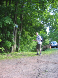 Once I finally reached the turn-off into the woods right up someone’s driveway, I was excited to start some real hiking. Unfortunately, with the re-route around the private property, the initial mile or so in the woods is really rather lame. Of course, I applaud the efforts to connect the trailhead to Lamentation Mountain, but I do lament the 3 rusted out old abandoned cars along the way (See them all at the “Carcasses” Photo List), the miles of rutted out ATV tracts, the Power line swath, the random housing development, the unfortunate dumping grounds of broken down household appliances, and the swamped trail.
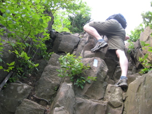
Alas, it’s absolutely worth it to get to where you’re going. Even though there is a section requiring a brutal uphill boulder scramble:
Just kidding:
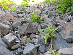
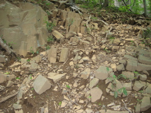
Camera perspective tricks!
But that cube-shaped scree is clear evidence that the trail here is (as many around here do) crossing another basalt traprock ridge. On the way up, the trail does become a little bit difficult to follow with the re-routing and random sharp turns to veer away from the ATV trails. At one point it pops up onto a very nice residential street and then dips back into the woods. I found the sign here pretty funny:
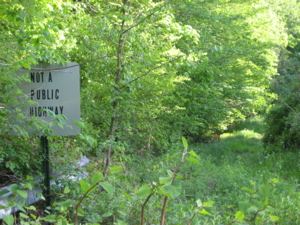
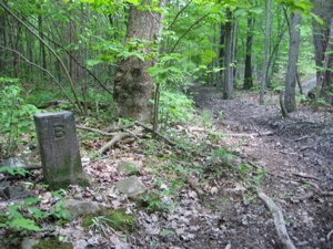
It says, “NOT A PUBLIC HIGHWAY.” Um, yeah… ya think? Maybe the trees in the middle of it make that point by themselves. I soon left Berlin and crossed over into Middletown, as this (probably) 100 year old or more stone marker told me:
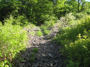
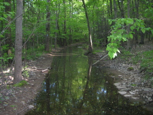
Still on the newly blazed trail, I did a little mud-boggin:
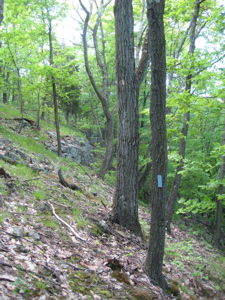
As I said, this first mile, mile-and-a-half really was “lamentable,” but necessary… I soon took a sharp right turn, and began to climb up:
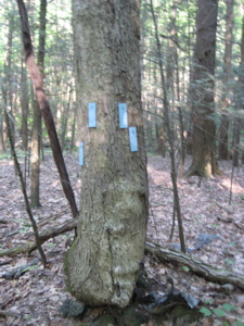
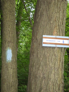
It’s difficult to see, but the blazes here are all wooden blazes nailed into the trees. I would guess that this is due to the temporary nature of the path through here and I hope the goal is to set a more permanent route. Time will tell…
I was about to be rewarded for the initial slog after maybe 4 minutes of climbing. The “new” trail joined the “old” trail to the best of my knowledge and I quickly gained the ridgeline. I took an artistic picture:
Nice, huh? I thought so when I took it – not so much anymore. I then settled in to a more typical, somewhat boring “Here is the first true view of the day, so I must take a picture” picture:
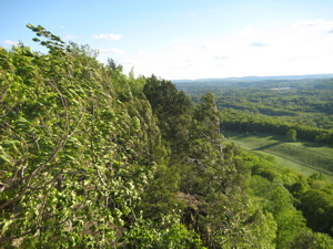
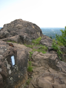
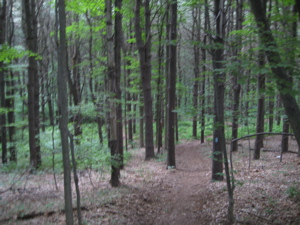
I’ve only just begun, trust me. For the next mile or so, the trail follows the ridgeline and takes in plentiful views west. It is an exceedingly enjoyable walk, through grasses and over rocks. The best part is, pretty much anyone can get up here and do this hike. It’s barely a climb and the views are really pretty. Time to stop for show my appreciation:
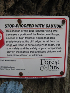
Uh-oh. Just as I was saying this was an easy little hike with great reward, I was stopped in my tracks!
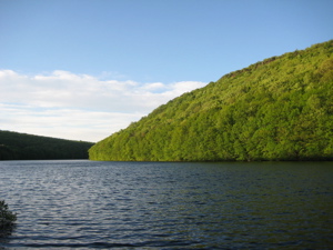
It is interesting to note that these easily accessible, simple little climbs here in central Connecticut actually all do present the very real possibility of death. I never really think about it, but it is worth mentioning. But only for a brief moment, as I had more views to enjoy. Like this one of Silver Lake:
I had crossed back over into Berlin now, and was just skirting the eastern edge of Lamentation Mountain State Park. For you geography nuts, yes, that meant I was about to hit town number three for the day, Meriden. Exciting stuff. So exciting, I had to find a natural bench and take a rest:
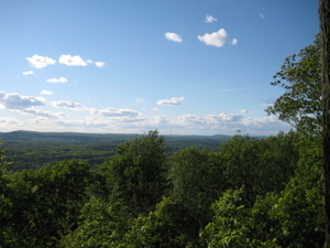
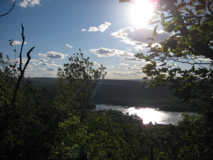
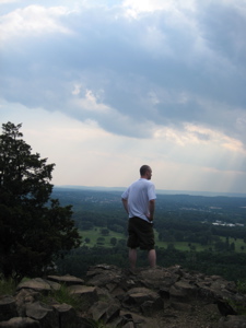
Phew. That was nice. Who wants to see a beautiful view of Hartford?
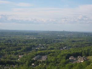
I think this marks the 5th ridgetop view of our capital city so far. I also think it’ll be the last, unless the Shenipsit Trail offers one as well. I think this is a cooler picture though – of Meriden’s Hanging Hills, with Castle Craig over to the west:
That was a fun hike up to Castle Craig, almost exactly a year prior – read all about it here. As I walked along the exposed ridgeline I was struck by two things. One, it was wicked windy, as evidenced by this shot of the blowing trees:
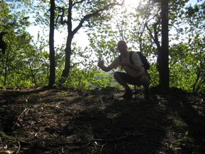
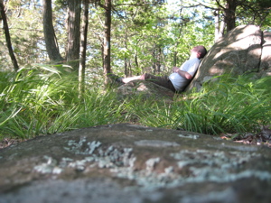
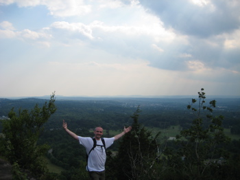
And two, I was alone. Okay, the approach route I took has been closed for two years and it’s sort of hard to find. But the Southern approach is from Giuffrida Park, a very popular place – and just as easy to hike from. People, get off your couches and get out here! Don’t you want to be as cool as me and chill out like this?
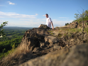
What’s funny about my pictures like this is that they belie the fact that I had just set the 10-second timer and gingerly ran over the the top of the deadly cliff to delicately take my “relaxed” position for posterity. Anyway, after soaking in those views, the trail turns sharply left (east) to descend the backside of Lamentation Mountain. The descent is fairly gradual in most spots, but is pretty steep for a small bit.
Soon, I hit an intersection with a blue/red blazed trail. My Walk Book map actually showed that this was the route I wanted to take, but I went with my gut and followed the normal blue blazes further down the mountain, west of Crescent Lake. Although I wasn’t sure, I had a feeling that this was a re-route and I thought I understood the logic of it.
The descent to the Giuffrida Park parking lot is not too exciting, and my suspicions were confirmed that this was a fairly recent re-route – because of the temporary blaze seen here, on the right:
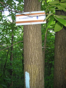
And yes, if you can read it, that is an absolutely horrible misspelling of Giuffrida Park on the left-hand sign. But I guess I got the point. Then suddenly, even though it was only a short distance away from the solitude up on top, I was thrust into a crowded parking lot full of people who are apparently afraid to climb up a few hundred feet.
Crescent Lake (formerly Bradley Hubbard Reservoir and no, I don’t know what Hubbard did to lose the distinction), sits between Lamentation Mountain and Chauncey Peak. There is a park map here that hasn’t been updated since the rather drastic Mattabesett re-routing, which confused me a little bit, but I pressed on…
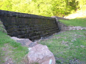
…Pressed on past the dam…
And then started figuring out the change in the trail’s location. I was about to go up the south side of Chauncey Peak, whereas the Mattabesett used to come down this way, after crossing over to it up above Crescent Lake. It then used to pop out onto Westfield Road for a looooooong road walk, across I-91 to the Mount Higby section. Now, that road walk has been halved (at the least) and as I was about to find out, continues much further along in the woods.
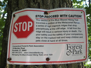
This is a very good thing. The clouds rolling in were not. Oh well, I trudged on, up, up, up Chauncey Peak. Yes, the “up-up-up’s” here really rarely last more than a couple hundred feet of elevation gain, but they are still worth mentioning. As I found my climbing rhythm, I was hit with another caution sign:
Yeah, yeah, yeah. Dangerous cliffs, death, blah blah blah. How about some real danger, like dynamite or giant boulder moving machinery to mow you down? Now THAT would be dangerous! Not these corny little traprock ridges. Not these square rocks that tear up your ankles:
No… Though perhaps a picture of my butt climbing up a steep little ledge is slightly dangerous:
A few minutes past that bit of difficulty and voila! Another view!
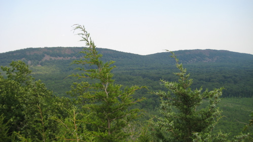
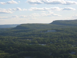
Higby Mountain with Preston’s Notch clearly visible
I’d be up there, looking at where I am right now, on my next Mattabesett section hike. Fascinating stuff… Let’s take a moment for two pictures I really like:
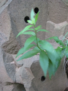
I like the first one (from the southern summit of Chauncey) because it really looks like I’m a few thousand feet up, rather then just 680 or so. And the second one… well, anyone have any idea what that is? Three perfect holes in solid rock? The world’s toughest snake burrow? Hmmm, let’s walk a little further and up a few feet more, over that little ridge and…
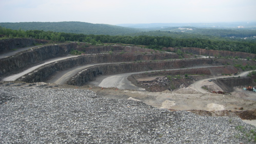
My word! Where did that come from?! Geeze, a guy could really get blown up with dynamite or run over by heavy machinery here! Wow. It’s true, on the eastern side of Chauncey Peak is a rather large quarrying operation. In fact, it appears they’ve taken half of the mountain away. I find it pretty cool in a weird way that the Mattabesett skirts the quarry property from above. Unique, to say the least.
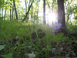
Also unique to this area, although I missed them, are some old engravings. Here’s one from the Cosmopolitan Club from 1875. And here are some pretty flowers:
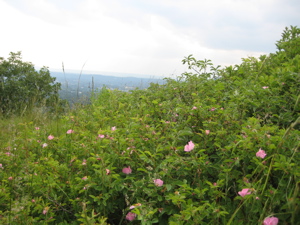
They looked like roses of some sort. A few minutes further along and hey! There’s the little parking lot I had just walked through a short while before!
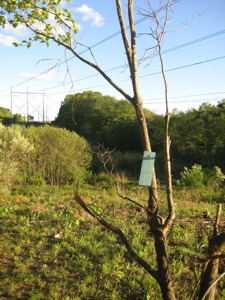
The trail follows the Chauncey ridgeline a little ways more before heading east, gradually downhill through some open forest, crossing over from Meriden to Middletown again. This is entirely new trail, having just been blazed (I think) in the last year or less. This new trail replaces the 4 mile dangerous road walk I mentioned above. It does cross a couple roads and does walk along a couple more (Atkins and Bell Streets) but they are much more pleasant then what I had prepared for.
A hearty THANK YOU to the CFPA volunteers responsible for the new trail! It’s great! Have I posted enough pictures yet? Nah…
The open woods to Atkins Street
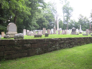
A cemetery just before turning back into the woods.
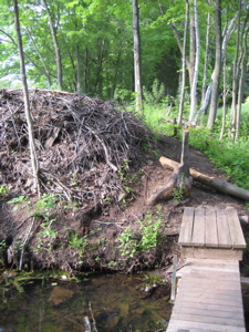
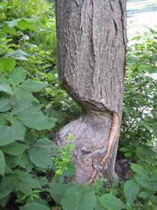
Beaver Dam and Beaver Tree (quitter)
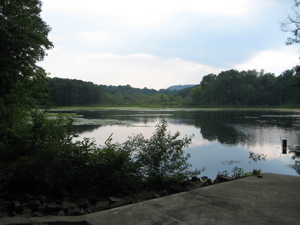
This final section before the still somewhat long road walk is really very pleasant. As the sun set behind Chauncey Peak, the little Highland Lake provided a final bit of “nature” for me. Sure there were a few mansions behind me, but it was still very pretty.
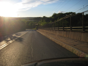
Once past the lake, the trail takes a hard right onto Bell Street, then a left onto Country Club Road, past the Department of Public Safety, across I-91, and continues up Country Club Road another 1/3 of a mile or so before the turnoff up into the woods toward Higby Mountain.
Looking back from whence I’d come
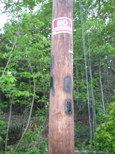
My car spot was still a ways up the road, however, as the trailhead here has been co-opted by a local landowner who has a problem with hikers. Numerous “no parking” signs were posted and he had blacked out the blue blazes showing the way. Of course, that just meant to follow the black blazes for the 20 feet he’d defaced, but it was still a little disconcerting. This left me questioning how I’d fare for the next section, but I put that thought aside and simply reveled in my day. I’ll do so some more here by posting a “good memory” picture next to a bad one:
Wow, what an introduction to the Mattabesett! A quarter of the trail was closed until this year, a third of it brand new as of this year, and a third of it simply stunning. Um, that leaves 11/12th’s by my math. And that 11/12th’s would be the disturbing and ominous end to my day.
…………………………………………………….
Section 1 Approximate Breakdown:
0.0 Miles: Berlin Turnpike/Spruce Brook Road Terminus
0.7 Miles: Enter woods
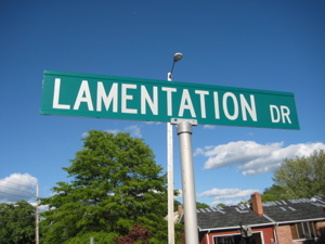
1.3 Miles: Lamentation Drive
3.6 Miles: Lamentation Mountain Summit
4.8 Miles: Giuffrida Park lot
5.4 Miles: Chauncey Peak Summit
5.6 Miles: Quarry
6.5 Miles: Atkins Road
7.5 Miles: Highland Pond
8.3 Miles: Department of Public Safety
9.0 Miles: Country Club Road Trailhead
End
Links of Interest
Giuffrida Park
Much better pictures from Chauncey Peak
The Book of Lamentations (KJV)


In regards to the hike at Giufridda park… does anyone have any idea how that old, rusted car that looked like it fell from the sky 60 years ago got there? Very curious. Thanks!
Comment #1 on 07.11.09 at 7:31 pm