Regicides Trail
How Did The Chicken Cross the Wilbur?
Bethany/Hamden/Woodbridge/New Haven, 7 miles (North-to-South), with Andy
January 13, 2008
 Four months (or so) prior to this hike, I reached out to my friend Andy who lives near this rather unsung trail. Since it is an end-to-ender, I would need a partner. I also had this (rather stupid, in retrospect) idea that – follow me here – the “Regicides” Trail, having something to do with killing kings, would be fun to hike on or near Three Kings Day.
I said it was stupid. Not to mention the fact that Three Kings Day isn’t exactly a big holiday anywhere in the world other than Hartford, Connecticut for some reason. Heck, you don’t even know what it is! Now you know. Regardless, the incredibly tenuous reason aside, the hike with Andy was planned and with no snow on the ground or in the forecast (Andy’s rule, not mine), it was a “go.”
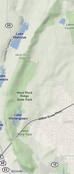
The Regicides travels North to South from just over the Hamden border where it begins off the much more storied Quinnipiac Trail down to it’s terminus atop West Rock, overlooking New Haven. A month or so ago I found a great article about the history of West Rock State Park – the former city park that fell into near-hopeless disrepair but was then turned into the state park it survives as today.
The beginning of the Sanford Feeder access trail
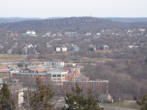
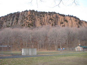
It’s important because the entire 7 miles of the trail give one a weird sense of a dirty, grungy past. I can’t quite pinpoint it (beyond the graffiti and abandoned and crumbled Baldwin Drive spanning same length of park) but the feeling is pervasive. And that’s a shame, because it really is a very pretty and historically interesting area. Not knowing the ins and outs of New Haven’s urban blight, I set up our meet point at the parking lot at the base of West Rock itself, at Amrhyn Field. This offered a rather stunning view of the massive traprock cliff that we’d be descending to end our day.
Very near this area, very near the city-cum-state park, the city decided at one time to build low income housing projects. Points for originality. Unfortunately, when reality set it, these projects were allowed to fester and decay as if on an island until themselves; rapidly becoming one of the most notorious drug and violence hubs in the Northeast. And, believe it or not, the thugs actually did venture into the very “nature” that was supposed to pacify the unemployed. Hence, West Rock Ridge and Regicides Trail weren’t the most welcoming escapes for a few decades.
Begin!
As fellow blogger “brendan” writes (on his well-written but decidedly non-family friendly blog):
 “…Those projects, which were situated out by West Rock Ridge state park. West Rock was a beautiful park, which stretched miles out of the city into the surrounding towns and countryside, linking Sleeping Giant and East Rock. All three parks were part of the same geologic formation. Then, as now, New Haven was in dire financial straits, and had to choose which of the their parks to maintain, and West Rock had lost out. As a result, twenty minutes up the paved drive, the ridge returned to a real semblance of wildness. The tarmac was overgrown in places with grass and saplings, just past some ancient graffitti which read “The women’s movement is a bowel movement” and “Frak Zappa”. My friend Dennis and I used to take mushrooms and go watch the trees melt: “Frak Zappa” always sent us into paroxism of laughter. Camping was illegal in the park, but ten minutes in, you saw cairns pointing to choice spots and beautiful overlooks. It was my understanding that years ago, someone had the idea that poor people were isolated in ugly urban ghettoes within New Haven’s limits and so housing had been placed out by the state park, where they could commune with nature. And so it was that the poor people were just as isolated if not more so, and a number of the trees around the entrance to the park were pocked with bullets.”
 The most notorious were the Brookside Projects – some pictures and comments here, which have been shut down and will be torn down soon. Over on a hiking bulletin board blog, “shortoak” wrote:
“I have to say that I think I built this up in my mind a little to much before going. Unfortunately I was very unhappy about this state park. I went and got this “map” of the park that was the quality of third grader with a crayon. I found the trails to be very poorly marked. But what irritated me the most is that from most places in the park you can hear the hum of Rte 15.(the Wilbercross Parkway goes directly under the park)Also I found the amount of graffiti to be a bit disappointing, it seemed to be everywhere. Also a considerable amount of garbage lay about the entire park. I found myself leaving with nothing but frustration and disappointment.”
For what it’s worth, shortoak, I knew how to spell “Wilbur Cross” when I was making crayon maps in third grade, but I was slightly advanced. Anyway, these days, the place is not that bad, I promise.
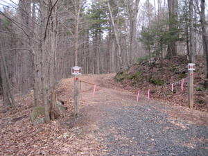
 Andy and I drove north paralleling the ridgeline we’d be hiking and parked on the sharp bend of Brooks Road. Some maps claim that a “Sanford Road” will allow you to drive up to the trailhead, but I assure you that is not the case. I also assure you that you’ll need the CFPA map and a good grasp of reading topography to figure out where to go. The Sanford Feeder trail is very poorly marked – if at all – and is rather confusing the further up it you hike.
Once near the ridgeline, we reached the abandoned old park road and were again a bit baffled by the conflicting blazes. Me being me, I needed to find the actual Regicides start point – its intersection with the Quinnipiac Trail on top of York Mountain. Andy, not being insane, didn’t feel compelled to hike backwards for a few minutes just to turn around and return to the same spot. But I compelled him – funny thing is that our conversation distracted me so much I never took an official starting picture at the official start. (I did almost go back up the hill, but realized I’d be there when I do the Quinnipiac, so we continued southward.)
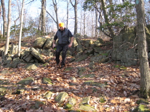 Regicides Lesson: The trail crosses the old road a LOT, despite what the books and guides say. There are long stretches where the trail picks its way over jagged rocks and cliffs mere feet from the graded road, which causes the obsessive hiker to say to himself, “Um, why am I slowly risking life and limb over here when I could be strolling down the road right over there? This is a fair question and credit must be given to Andy for suffering with me and my quirky completist needs.
We survived some initial confusion at the northern end of the trail because, quite frankly, the map is not super accurate and the blazes directly contradict it. In fact, as Andy and I caught up on the goings-on in our lives, I was uneasy the entire time. In my mind, maps need to be perfect; when they are not, I get tweaked.
The silliest blaze I’ve yet seen… and “Boy that guy in that mansion over there is rich enough to have an entire power line right to his house” – Andy joke.
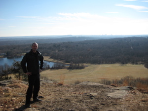
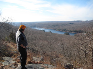
After about 10 minutes of following the squirrely blue-blazed trail, everything became ok again. We burst out onto an overlook rivaling most others in the state. I was assured that we were on track, as the uniquely shaped pond below us matched the figure on the map. But more importantly, we enjoyed the view of New Haven and Long Island Sound. Andy even got a cool, sun-dappled panoramic shot:
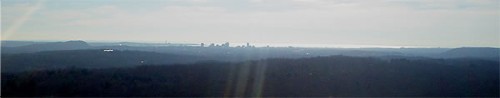
On the left is East Rock and to the right is West Rock – a truly unique vantage point. So unique, in fact, that Andy’s professional hobby really came out in conversation. As we ambled along the trail, we talked about his painting – and how he’s switched from watercolor portraiture to oils and landscapes. I, having no artistic talent whatsoever, was fascinated by his ability to do this. Anyway, I think he decided to come back here in warmer weather to paint the scene.
(Andy is no joke. I just bought this book he illustrated for Damian. Andy Yelenak is renowned for his sports illustrations including the annual posters for the Boston and the New York City marathons, as well as work for numerous magazines. His paintings have been exhibited in galleries throughout the United States, including the Society of Illustrators in New York and the U.S. Distance Running Hall of Fame. Want examples? Check this out – like I said, I was in rather impressive company for this hike.)
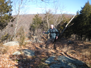
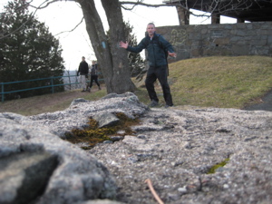
Andy’s artistic side was also present with every picture taken. It’s evident I just point and click and keep moving along. Andy, on the other hand, actually cared about sun angles and framing and apertures and things like that. For example:
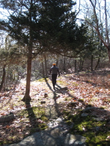
While I snapped both pictures, Andy had me re-do the first one a couple times because he felt I didn’t have good interplay with light and shadow. And the second one received a “I guess that’s 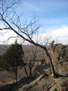 alright” approval, with regards to the framing of the trees at left. Whatever, Andy… I count professional photographer Paul Penders as a reader and he suffers through my pictures just fine.
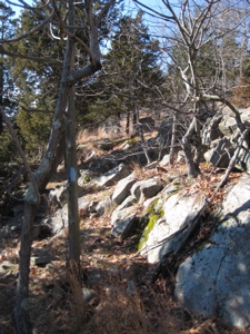
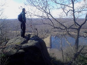
So, now that I’ve spent a few thousand words on ancillary stuff, what about the actual hike? I liked it. It traverses yet another traprock ridge which means it has several overlooks along the way out over Lakes Waltrous and Dawson in Bethany and Woodbridge. The road crossings and constant talus scrambles to become rather annoying after a while – since the ridgeline proper was graded for the road and that presents a much easier hike obviously – without the views.
At one point, towards the third pond of the day, Andy and I sat down and enjoyed three red-tailed hawks just gliding along the updraft created by the cliffs. They were right above and parallel to us, which offered a rather serene respite along the way. As discussed, my picture does not do this justice:
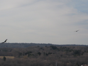
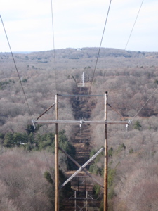
But the picture does tell another story – the clouds had rolled in and our low 40′s day had suddenly turned into a mid-30′s day, with a whipping wind out of the west. We trudged onward towards what was, for Andy, the highlight of the day: hiking over the West Rock Tunnel and the Wilbur Cross Parkway (which becomes the Merritt a bit further south). I’ll admit, it was sort of cool and of course all subsequent drives through the tunnel will annoy my wife and child: “Papa has been up there. Above us now. Right over this tunnel. Yeah, that’s right.”
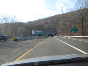
Driving under the tunnel…
The view from southern side over the tunnel…
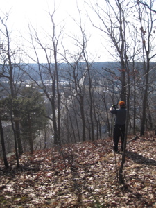
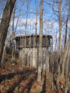
Andy framing one of his “perfect shots” from the northern part of the woods over the tunnel… and there’s that mystery tower…
This rather odd stone tower in the middle of the woods is – to the best of my knowledge, a ventilation tower for the tunnel a couple hundred feet below. A CT letterboxing website (RIP) descibed this thusly: “Walk up the stairs to a stone octagonal building, built into the hillside. We believe this building is an air shaft for the Wilbur Cross Tunnel below. This looks like some 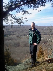 medieval tower with its iron gated windows and steel door.” Not mentioned is the weirdly distant sound of the trucks passing below.
The tower is set on the steepest part of the whole trail, which caused Andy some discomfort on his two reconstructed ankles. Yes, that’s right, reconstructed ankles. I didn’t even know about them until about halfway through our day. Artists can be tough guys too, apparently.
After the tunnel came the next big event – Judges cave. And fellow humans! While there is a road up to the “cave,” it’s only open on a few select days through the year, and this wasn’t one of them. However, a few intrepid souls had hiked up from various side trails and seemed puzzled about us coming from the north. Read all about our visit to Judges Cave here. (That report also explains the odd name of this trail.)
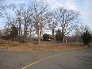
Judges Cave from afar
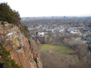
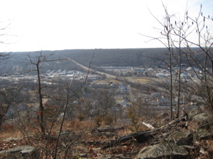
The final three quarters of a mile is rather dramatic; it continues along the cliff tops of what was now West Rock proper. There are some iron gates up there, but really – they are kind of silly. Death was certainly an option Overlooking western New Haven, the trail curled around to the terminus high above what was now all of New Haven. Definitely, definitely a cool spot and worth the effort. The vista takes in about 270 degrees and even gives one a decent view of Sleeping Giant:
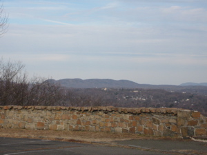
I’ve always felt that whomever decided that looked like a giant man in repose was on drugs, but from this vantage point, I can sort of see “him.” I could also see Southern CT State University with East Rock in the background:
All that remained was to warm up my now-freezing hands and the “Finish” picture. This was funny to me because Andy had begun the return trip back to the Westville Feeder trail down to his car so I set up the timered shot on my own. I don’t know, the random couple who appeared behind me must have been thinking I had a screw loose:
Finish!
All in all, the Regicides is not a bad trail at all, despite the bad rap. Sure there was graffiti in spots but no litter problem (this may be very different in, say, July). And yes, while going down the access trail down to the car I did pass through young men in quite baggy jeans and large parkas just sort of “enjoying nature,” but don’t be afraid. Andy and I weren’t and I now have one more trail on my resume.
[Note: As promised, I didn't mention that Andy left his lights on and killed his car battery, which was fun. Thanks to the random guy who jumped us!]
…………………………………………………….
Link of Interest
The housing projects at the base of West Rock
West Rock view from Andy’s dead car


two thumbs up for Andy.
hb
Comment #1 on 02.24.08 at 3:02 pmWest Rock is Hamden’s OTHER state park, and attracts far fewer visitors than Sleeping Giant, mostly dog walkers, fishermen, and mountain bikers. You will frequently find you have the trails to yourself, once you leave the Lake Wintergreen area.
Comment #2 on 10.03.09 at 3:36 pmI have put in a few hundred hours of work at the park over the last two years, under the direction of Park Supervisor Lori Lindquist, blazing trails, pruning back overgrowth, cutting invasive species, and remedying wet trails.
The Regicides Trail is not one of my trails and can be confusing to follow. Footing can be tricky in spots, due to the trap rock. Footing on any other trail is generally excellent, making West Rock a good place to hike in slippery conditions. The exception is the Red Trail up to the South Overlook, is steep and can be slippery when wet.
This is an update to my posting of 2008. I assumed responsibility for maintenance along the Regicides Trail in summer 2011. As a result of that, I have done a general update along the trail with fresh blazes and pruning back overgrowth, so the trail is easy to follow. There is extensive information about the trail and the park, including many pictures, on my blog.
Comment #3 on 10.16.11 at 8:19 amI recommend printing a copy of the park map, which was updated in 2010, from the state website at http://www.ct.gov/dep/cwp/view.asp?A=2716&Q=325276.
The easiest way to access the Regicides Trail is to park at Lake Wintergreen at 29 Main St., Hamden. From the parking lot, walk straight up the hill on the Gold Trail, which intersects the Regicides Trail at about the midpoint. From there, turning left heads south and turn right heads north.
“I’ll admit, it was sort of cool and of course all subsequent drives through the tunnel will annoy my wife and child: “Papa has been up there. Above us now. Right over this tunnel. Yeah, that’s right.”
Too funny…I did that to my wife the other day!
Thanks for your (really amazing) efforts that you put into this website. After about a 20 year hiatus from hiking and camping in any form, I am venturing back out these days to do some day hiking and really loving it. Your site has been a great reference for some the trails I have been hiking.
And thanks to you Tom, for helping to take care of the park. :)
Keith
Comment #4 on 01.11.12 at 2:08 pmI think the actual cave is barely visible from this park,is sort of behind a tree growing from the face of the Rock. Someone has written 420 near there. A slightly ironic twist on the earlier use of the cave which I don’t doubt was known to the local Native Americans, one of whom’s descendants pointed it out to me! I have not been up there but do want to go someday. Rock climbing is problematic around here. If you try to check it out closely, don’t be foolish, be safe!
Comment #5 on 02.12.12 at 1:56 amAlways avoid the King’s Representatives, and only tell responsible trustworthy people, do tell someone of you plans. Be well and be free:] -GCD