Tunxis Burlington Region (South)
Black (Dot) Power!
Nature Center Connector, 2.7 miles, solo
November 16, 2008
 Why is this short little “Nature Center Connector” trail so important to me that I had to write it up NOW when I have, quite literally, about 20 other things to write about that I’ve done in the last few months? Two reasons: One, it’ll be short and easy and two, because it marks my completion of the Tunxis jumble of trails in Burlington.
You see, there are 8 trails here totaling somewhere over 30 miles I’d guess. I don’t feel like adding it up right now. After knocking out the 5 miles still needed on the Tunxis mainline trail in town, Rob Y spotted my car so I could finish up with this short trail. I never felt like doing the out-and-back myself and since the Barnes Nature Center at the Eastern end of the trail is closed for a while for remodeling, I couldn’t make it a family thing either.
 This was my chance, and I took it. I had low expectations of this trail going in – and I was stupid for that. This trail is really very nice and definitely fun – and a lot more challenging that I’d thought. I figured I’d almost job the trail, call it a day, and hit the road.
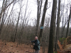
After Rob dropped me off along East Chippens Hill Road (another of Burlington’s inexplicably unpaved-the-whole-length roads), I entered the woods on the Mainline Trail, followed it for about 25 feet, and hit the Nature Center Connector trailhead. There are three signs here showing directions and mileages for all the different Tunxis Trails in the area. This signage is very impressive, especially over there in a lightly hiked area.
The purpose, if you will, of this little trail is to connect the Tunxis Trail network to the Barnes Nature Center which is just over the Burlington line in Bristol. Lest you think this would therefore be a simple little jaunt through the woods – as I did – I’m here to tell you it’s not. Put it this way: I had envisioned doing this with wife and child to go to the nature center, and I’m quite glad I didn’t.
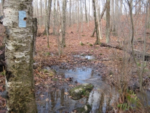
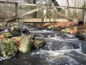
Soggy Trail
The first bit of the trail was soggy if not filled with standing or running water. Water and leaves and hills don’t mix well, but it was no biggie. There is, according to the book, a view:
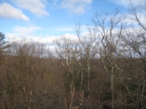
View?
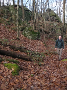
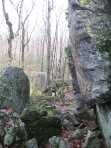
As you can see, it’s not the best one around town. After about three-quarters of a mile, the trail traverses the “Great Wall.” The Walk Book merely describes this as a big ol’ rock formation for the most part. I was completely surprised how much scrambling I was forced to do here. I judge these things by how often I had to use my hands – and the Great Wall had my hands on rocks and trees about six times. Yeah, my toddler would not have fared too well.
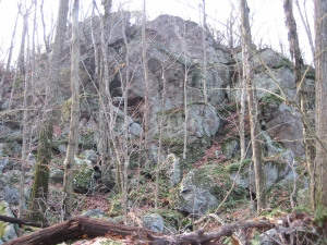
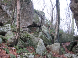
Of course, in my world, this makes for a better hike. This Great Wall thing is most certainly one of the least visited landmarks in the whole Burlington Tunxis system, but it’s worth the trek. It’s really cool; only a few shades less cool than the far more popular “Mile of Ledges” a couple miles west.
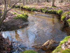
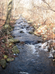
 Once past that excitement, the trail took me down to a large brook called Negro Hill Brook. I dipped into Sessions Woods land for about 8 seconds before following the brook along its eastward path. And I got to thinking… Barack Obama just won the presidency and here I was hiking along Negro Hill Brook beside Negro Hill (in a town where 0.59% of the population is black) on a trail marked by conspicuously black dots.
It all seemed to come together for me somehow. I was moved.
Moved to cross Route 69 via a barbed wired stile and hook back up with Negro Hill Brook as it wound its way behind houses and over rocks. The trail was really quite slippery here, but I was never in danger. Oddly, when the trail crosses South Main Street (an oddly named road here in town, as it’s only about an eighth of a mile long with a few buildings along it), it goes right through the parking lot of some machine repair shop of some sort.
Black Dot Power!
Let’s take a moment to delve into the history of the “Negro” names. I’ve consulted the excellent Burlington pdf history document again and learn that it actually used to be called, you guessed it, N-word Hill and N-word Hill Brook. So now it’s Negro. Ahh, progress. (Actually, some folks have taken to calling it Falls Mountain Brook these days. PC wimps.
A River Runs Through It
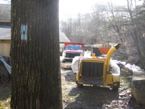
And a Trail Runs Through this Parking Lot
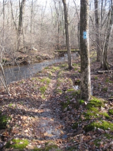
After that, the trail cozies up with the book which is pretty cool; the brook here winds back and forth wildly and supposedly contains wild brook trout. Despite recent rains and the general wetness of the woods, the trail was actually pretty dry through here, and someone has nicely built us hikers plenty of bridges over the second half of the trail.
The last bit is sandwiched between the backyards of some houses to the west and the Barnes Nature Preserve to the East. It would have been nice to check out the nature center at the end of my day, but that will have to wait.
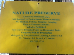
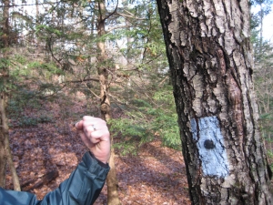
This sign is hung on about 72 trees once the trail crosses into Bristol. Get used to it.
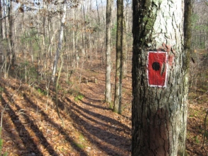
One of the Nature Preserve’s side trails. That blaze takes some serious commitment.
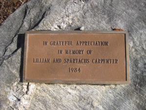
I don’t know who they are, but I’m inspired to name my next child.
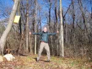
Finish! (Extra excitement for finishing all of Burlington!)
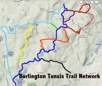
The Tunxis Trail in Burlington (Nature Center Connector in black).
Remember – this is considered ONE trail and is all called “The Tunxis Trail.” So when you’re driving down Route 69 in Burlington and pass 4 separate signs where the Tunxis crosses the road… Now it makes some sort of sense.
…………………………………………………….


Wow, thanks for the info. I grew up right near Bristol/Burlington line and have been hiking in Sessions Woods, Mile of Ledges and Barnes Nature Ctr, but never knew they actually all connected. Thanks for taking the time to do this (I’m sure you enjoy it) and letting everyone know about these awesome trails!
Comment #1 on 03.11.10 at 10:55 amHelp, I clicked onto the Burlington history PDF, but to no avail. I would like to learn more about Negro Hill and incorporate it into the map and compass field learning experience I do with 5th grades from Bristol and Plymouth. Please point me in the right direction.
Comment #2 on 05.12.10 at 4:21 pm