Tunxis Burlington Region (North/East)
A Devil of a Time; a Helluva Hike
Burlington, 6 trails, ~10 miles, solo
June 29, 2008
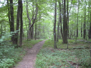
 The maze of the Tunxis Trail in Burlington is a full thirty miles in total. Aside from the Tunxis mainline, there are eight other trails. I hiked one and two thirds of the trails back in April (The Yellow Dot and most of the White Dot report here). On this muggy June morning I set out to complete the rest, save one – the Nature Center Connector.
Once again I’m challenged with how to present the various trails, as I hiked them as efficiently as possible meaning that I chunked them up with some double-backing and bushwhacking. If you plan on using my hikes as a guide, well then I think you are an intelligent reader – as my planning is second-to-none. Ha.
…………………………………………………….
Tunxis Burlington Region Punch Brook Trail, 1.7 Miles
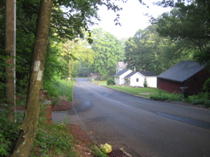
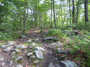
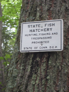
 I parked on the steep little driveway along Route 4 where the Tunxis Mainline reaches it’s Burlington Region northern terminus. I hiked in half a mile as dawn dawned, through much poison ivy and along the perimeter of the Burlington state trout hatchery property. (CTMQ Visit here!)
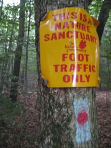
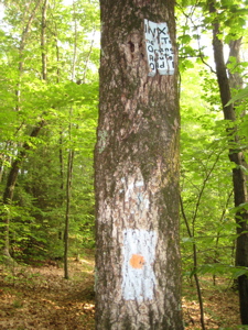
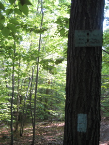
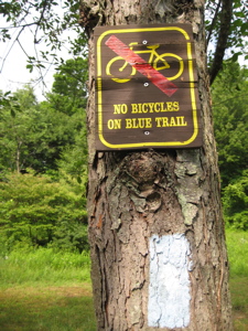
The area around the Punch Brook interection is rather sketchy – and the reason is two-fold. Many of the hemlocks (this area is called “Hemlock Hill”) were harvested in 2000 due to the wooly adelgid blight and then, in 2002, “a tornado or downdraft wind killed or damaged most of the trees left in this 8 to 10 acre plot.” (According to a sign along the trail.) It appears the same storm knocked down the trail head sign (above) as well.
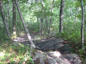
As a result, there is much brush and scrub underfoot to pick through while searching for the purple-dotted blue blazes of the Punch Brook Trail. Alas, I found it and headed southeast through the Nassahegan State Forest. Immediately, I was thrust into a wide open pine tract that strangely was once a baseball diamond(?) – this is what the Walk Book tells me anyway. It was all very pleasant, if only for the two minutes it took to walk through it.
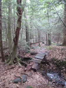
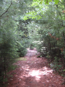
 Down towards the actual Punch Brook and it’s many little ponded areas, up a short steep little incline, then back down again to the Red Dot intersection. I continued (southwest now) on the Punch Brook, following along Punch Brook, through some cool fern covered swampy areas.
Before long, I crossed Punch Brook Road on the Punch Brook Trail right alongside Punch Brook. I punched myself in the head at this point, just because. Feeling punchy, I drank some Hawaiian Punch and reached the end of the Punch Brook Trail where it hit the Tunxis Mainline, just off a residential street. I punched my ticket and had one more Tunxis Burlington Region trail completed.
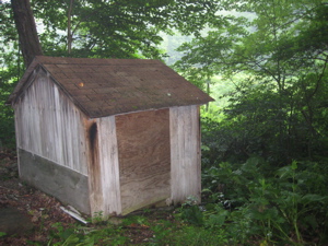
A little fishing shack or something near one of the little Punch Brook ponds
I backtracked the three-quarters of a mile to the Red Dot Trail and got on with that one.
Finish!
…………………………………………………….
Tunxis Burlington Region Red Dot North Trail, ~ 1.5 Miles (half bushwhack)
 Bear with me here… as this trail has changed significantly very recently. I’ll detail my hike as well as the hike that normal people will do – as I did both, because I’m insane. At the time of my hike, the CFPA trail update site wasn’t updated. (It’s still not, actually.) It’s not as if the Red Dot is a popular trail anyway, as it officially is a dead-end with no views. And I’m not sure my report will sway anyone to undertake the hike…
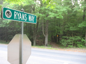
From the Punch Brook Trail intersection, I hiked through some fir trees and then up to a rather nice residential street – Ryan’s Way. Once down that road a pace, the trail crosses, yes, Punch Brook Road again and then descends to little brook, now in the Taine Mountain Preserve. Ironically, Taine Mountain wasn’t preserved too well on its eastern flank, as that is now a McMansion subdivision – which is what split the Red Dot into North and South sections.
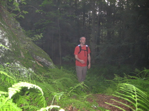
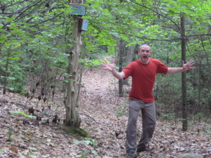
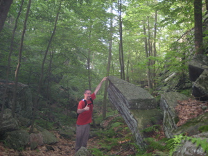
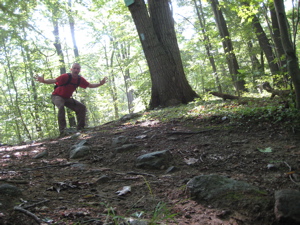
Just as I began ascending Taine Mountain, I took what I thought was an awesome picture. And it totally would have been if my camera was worth more than a hundred bucks and I knew how to use it:
Sigh. That could have been a frame-worthy shot. Once up to a plateau area on the mountain, I enjoyed Perry’s Lookout. Except that it was so dank and foggy, the “view” was of nothing. It was such nothing, I didn’t even take a picture! Me! Not taking a picture! (That became a theme on this trail, as you’ll see.)
 After Perry’s Lookout (really only interesting because no one seems to know which Perry it was named for – The Perry family with a house at the corner of Punch Brook Road or Perry Deming who helped clear and cut the trail I was on) the trail does a funny thing: It doesn’t follow the map.
It veers left down to Taine Mountain Road, follows that a bit, and then circles back to the bottom of Taine Mountain reconnecting with the trail I described two paragraphs above. Hm. I wasn’t expecting that. So I trudged back up Taine Mountain, past the New Britain Water pipeline right-of-way, and followed what was the old Red Dot trail up the ride to the true summit of Taine.
Don’t do this. It’s not worth it and there are no views. I did it just to do it… The summit area is a wide, flat expanse and it’s only slightly over 900 feet. Once I could see I was near the construction of new houses on the eastern flank of Taine Mountain Road, I veered right (south) down the ride. The woods are open so it was no bother, but it’s highly unnecessary.
I descended down, down, down heading straight towards the intermittent traffic sounds from the George Washington Turnpike. I popped out onto the road very near its intersection with Jerome Avenue, crossed, headed west a bit, peering into the woods for the Red Dot South Trail. It took some serious peering, but I finally spotted it and headed back into the woods to the confusion of some neighbors doing yardwork. Oh well.
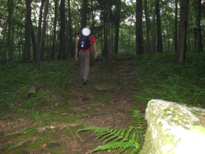
Tunxis Red Dot North White Dot on Back of Head Trail
…………………………………………………….
Tunxis Burlington Region Red Dot South Trail, ~ 1.1 Miles
The Red Dot North and South Trails used to be all one trail, of course, until development split it in half. An easier way to connect to two (if you don’t want to do a road walk (Punch Brook to Case to the George Washington Turnpike) is to follow the New Britain Water pipeline down Taine Mountain.
Once I found the trail right next to a private yard with a quizzical woman gardening, I dipped down to a Wildcat Brook and then ascended fairly steeply up Wildcat Mountain, elevation 850 feet. This area supports a rich population of American chestnut trees and has been the focus of a chestnut tree research project.
The below is from this site:
One hundred years ago, magnificent American chestnut trees dominated the forested hills and mountains over much of the eastern U. S. They made their best growth on the slopes of the Appalachian mountains where some towered up to 100 feet and had diameters greater than 10 feet. In some places, chestnut trees formed nearly pure stands. It has been estimated that one out of four trees in the Appalachian forests was an American chestnut (Castanea dentata) prior to the arrival of the lethal chestnut blight, a fungal disease which destroys the bark tissues of the chestnut.
The chestnut blight was first noticed in New York at the Bronx Zoo in 1904, but according to chestnut researcher, Sandra Anagnostakis, the blight was probably first brought into the northeastern U. S. sometime in the late 1800s on Japanese chestnut trees. The blight spread like wildfire from the northeast southward killing almost every American chestnut tree throughout the eastern U. S.
Our chestnut trees had little or no resistance to this exotic fungus (Cryphonectria parasitica), because the American chestnut had evolved in North America isolated from the Asiatic chestnut trees which had evolved with this parasitic fungus and had developed some resistance to it. By 1950, billions of American chestnut trees in the eastern U. S. had been killed by this exotic fungus.
Now, only rare sprouts remain, clinging to life in the forests–puny relicts of the giant trees they once were. Very rarely, a sprout lives long enough to flower and produce nuts but they are usually infertile from lack of cross pollination; even this is cause for celebration among American chestnut enthusiasts, but the euphoria is short-lived because these fruiting trees usually die just a few years later.
On that note, I finished the rather unexciting (as a non-chestnut enthusiast) Red Dot South Trail.
Finish! (With Stone Road in the background)
…………………………………………………….
Tunxis Burlington Region Orange Dot Trail, 3.1 Miles
 Okay, let’s get to the good stuff. The Orange Dot passes through something I’d been looking forward to for quite some time: Devil’s Kitchen! What an oddly named “box canyon” – how exciting!
After leaving the Red Dot South Trail and crossing Stone Road (which is not paved here, by the way, but quite drivable) I hiked on the Tunxis Mainline for a few minutes looking for the trailhead. And kept hiking… And kept looking. I somehow missed the turnoff south – was the ol’ Devil messing with me?
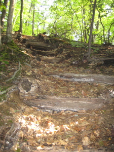
Apparently… I backtracked and finally found it – and of course began hiking it. The trail descends a bit, then climbs up and then steeply down a staircase in the woods. At this point, the bugs had finally found me as the sun was higher up the sky and they were warmed up. Just getting warmed up, as it turned out…
This is a pleasant hike and for the first time all day, I found myself ambling through, up, and over some large boulders. The persistent buzz of mosquitoes and deer flies kept me moving along pretty briskly, to say the least. I’d forgotten my bug spray at home – more work of the devil, no doubt.
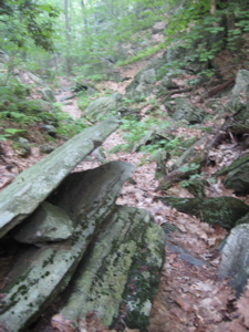
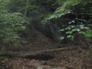
I reached a plateau of sorts and found myself staring down into pure hell (not really)… Devil’s Kitchen! Dunh-dunh-dunnnnnnnh! I had read that this was “a very long box ravine with a series of small cloven canyons.” “Cloven” canyons? Really Walk Book? Such imagery.
Devilish!
As I picked my way through Devil’s Kitchen I was struck by just how… How this really wasn’t all that great. It pales next to Tory Den a mile or so west of here (CTMQ Visit Here) as well as the Mile of Ledges off to the west as well. But it’s still definitely cool.
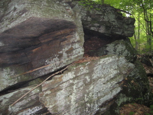
Brimstone?
There is some controversy about how this place got its unique name and no one really knows anymore. You can read my in depth report about it here. I have developed my own theory… There are many little pools of standing water in the rocks here and I imagine in late spring there are even more. Prime mosquito breeding grounds.
Mosquito Factory of Evil!
And boy, were they bred well. I was attacked by them constantly (and mosquitoes very rarely touch me). Deer flies appeared from nowhere and bit my arms and neck as if sent directly from Satan himself to do so. It was crazy! But it hardly ruined my hike. I trudged onward, having survived the perils of my devilish trek.
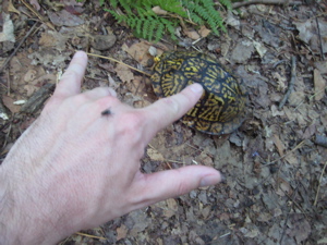
Satanic Deer fly warding me off from a box turtle minion!
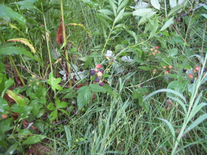
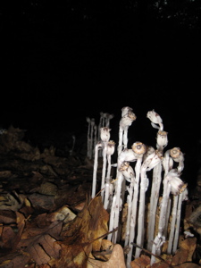
Deathberries to cook with in the Kitchen!
I soon hit a woods road (Stony Hill Road) and resisted the temptation to take a picture of a stoney hill. Shortly I crossed the Tunxis Mainline Trail at Clarks Corners and kept going west along the flat dirt road. I picked up the pace, getting in some jogging as this would be a backtrack section and if I’m going to see something twice, I can see it twice as fast. That’s logic for ya!
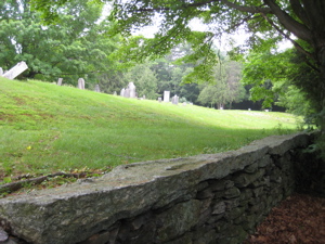
There are Dead People here!
I soon hit Lamson Corner and the cemetery right next to it. I crossed Route 69 and a bunch of cyclists preparing for a ride, entering the woods again next to the large parking lot. Burlington sure does recreational folks a service, that’s for sure. A slight ascent, a walk across the (dirt) East Chippens Hill Road, and another few minutes jog to the end and the third juncture of the Mainline Trail.
I turned tail, this time noticing more of the household appliance dumping ground along the way and passed the same cyclists now 20-some minutes later. This time, they stared at me like I was totally lost and needing some help. I smiled and waved and walked back into the woods next to the cemetery.
 A note on the Lamson Corner Cemetery – as with all old cemeteries, some ding-dongs believe it’s haunted. Here’s a blurb from the goofy website, Shadowlands: “Burlington – Lampson (sic) Corner Cemetery – A very old Cemetery, with some occasional orbs and lights. Incorrect info passed on about the Smallpox, it is haunted though. Hikers from nearby trails have seen apparitions and orbs of light. One hiker reported seeing a man in uniform standing near a gravestone, yelled to him for the time and the man disappeared. the hiker walked over and it was the grave of a WWII Veteran.”
“Orbs of light?” Like the one on my head in the picture at the end of the Red Dot North Trail up above? Dopes.
Burlington does a spooky Halloween hike around here utilizing the cemetery and Devil’s Kitchen, which I think is pretty fun. As for me in June… it was time to head back north up towards my car.
Another broken sign at the end… More Devil’s handiwork?
…………………………………………………….
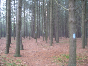
Tunxis Burlington Region Green Dot Trail, 0.6 Mile
The Green Dot Trail connects the Mainline Trail and the White Dot Trail. It serves no other purpose. So after a half miles or more on the Mainline again from the Orange Dot, I hiked it. No need to editorialize on this one:
Begin!
Glacial Erratic!
Up!
Down!
Finish!
…………………………………………………….
Tunxis Burlington Region White Dot Trail (Eastern portion), 3.6 Miles
 Ah, my old friend the White Dot! I had previously hiked the western two-thirds of this trail in April, out to Route 69. Now, I had to hike west back out to Route 69 again, backtrack that 3/4 mile or so and then head towards home.
It’s during sections like this when I really question my sanity as I tiredly descended to the road through featureless terrain. Every step I walked down, I knew I’d be hiking back up in short order. I hate that. But as a Connecticut 400 (825) completist, I understand what must be done. AND… I’m getting used to it.
I felt like I was doing a long “suicide sprint” – down the hill, “tag” Route 69, and then back up the hill from whence I came. This final portion of the White Dot was a very nice way to conclude my hike. Lots of hemlock and pine, a few nice bridges to cross Belden Brook (which feeds the state fish hatchery) and plenty of wide, soft trail.
There is an icky section through forested land (unavoidable wherever hemlocks grow) but the trail remained well-marked and pleasant. At one point, I passed a 50-something woman running on the trail. Needless to say, I was very impressed. (She seemed me scared to happen upon me, as once again she was the lone person I saw all day hiking.)
This trail actually crosses into the hatchery land for a minute or two and then ends in the blowdown/timber harvest area mentioned earlier.
Although my day involved a few backtrack sections, an aggravating loop I wasn’t expecting, some road walking, an annoying bushwhack, very few views if any, and bugs out the wazoo, it was a great day in the woods. Very varied and historic. At this point, I still have the Tunxis Mainline section from Sessions Woods Nature Center to Route 4 to complete (although I did hike a good deal of it by default on this hike) as well as the two mile Nature Center Connector to complete the Burlington Region.
I can’t wait!
Final Finish!
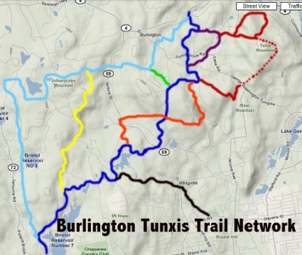
The Tunxis Trail in Burlington (Colors correspond with the trail blazes, red dots = my bushwhack).
…………………………………………………….
Links of Interest
Burlington Land Trust
More on the “haunted” Lamson Corner cemetery (Warning: Sound!)
Burlington Trout hatchery
Mountain Lion on the Tunxis Orange Dot! Scroll to end


Leave a Comment