Section 1: What’s all this Shenipsit?
Shenipsit Trail: Section 1
Gadpouch Road Terminus – Route 2 Crossing, 8.2 Miles
May 5, 2009
 It was high time I got going on the Shenipsit. While not one of the “big three” CFPA trails (Quinnipiac, Metacomet, Mattabesett), I’ve always felt it should be included in any discussion on Connecticut’s long distance trails. The Shenipsit has one distinct disadvantage however: There is a fairly large break in its continuity at Ellington before continuing on up towards the Massachusetts border at its northern terminus in Somers. (Update upon completion: The “break” has been “filled in” – but it’s not the prettiest section.)
But we’ll deal with that later. For now, we’re in the southernmost section in East Hampton – with short forays into Portland, Marlborough and Glastonbury.
 The Shenipsit begins ingloriously enough along a hard-pack dirt road in extreme western East Hampton. Now, we know East Hampton isn’t exactly a one of our state’s hot spots (though it used to be, about 100 years ago) and the web of dirt backroads through the Meshomasic State Forest is really known only to off-road vehicle enthusiasts.
But the trailhead is fairly easy to find if one knows where to look along Gadpouch Road. Something else to look for along Gadpouch Road? A veritable forest of fiddlehead ferns – I foraged a bunch here and ate them.
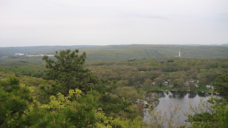
If you’re only looking for the highlights along this stretch, look no further. Park your car here past the houses at the trailhead and begin the steep half-mile trek up, up, up to the Great Hill ridgeline. This healthy effort will reward you with a rather nice view of Great Hill Pond, the Connecticut River and Portland beyond. If its views you are looking for – and nothing more – turn tail and head back to your car, because that’s it for the next several miles.
Of course, that’s not my style. After the short overlook side trail I continued up the Shenipsit along the ridgeline. For the next couple miles the trail straddles the East Hampton/Portland border. It’s not exactly the most exciting stretch of trail in the state, but at one point I was startled from my inward thoughts by two very large herons flying just above the tree tops over me. I wasn’t quick enough with the camera but trust me, it was really cool.
 There is an old abandoned quarry a couple miles in that deserved some exploring. This part of the state is noted for its brownstone – known as Portland Brownstone. The brownstone mined from these quarries was an important source for construction in the latter half of the 1800s. The stone from these quarries was used in a number of landmark buildings in Chicago, Boston, New York City, Philadelphia, New Haven, Connecticut, and Hartford, Connecticut. The site was listed as a National Historic Landmark, which also placed it on the National Register of Historic Places, on May 16, 2000.
It’s kind of interesting to imagine that stone from these woods is now part of the famous New York City skyline. A short ways after that, I crossed a stream that is only interesting in that the green mosses give the small waterfall the appearance of being green.
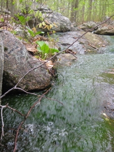
Not exactly tempting to drink, that’s for sure. Just past the green stream the trail climbs up Bald Hill – which at 893 feet is 123 feet taller than Great Hill. Not so great after all, are you Great Hill? There may be views up there in the wintertime, but not so much with leaves on the trees.
I was about a third of the way through my hike and so far it had been quite nice. I’d read a few trail reviews that wondered why the Shenipsit bothers continuing south past Route 2. I was about to discover why. Perhaps the dead shrew along the trail was a talisman of sorts:
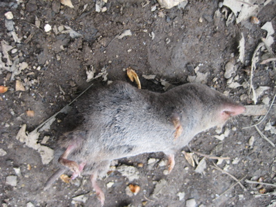
That shrew seemed pretty well “tamed.” There is a very nice bridge over a marshy area and then the trail changes to follow an old woods road for the next few miles. These are the miles that naysayers say not to bother with. Well, some of us “must” bother with every mile of every CFPA trail and quite honestly, we’re glad when we do.
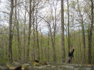
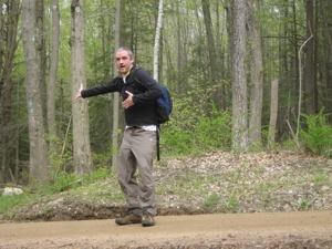
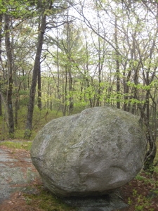
On Bald Hill
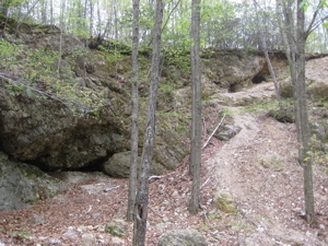
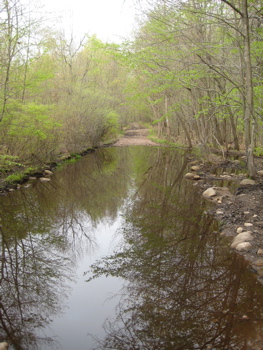
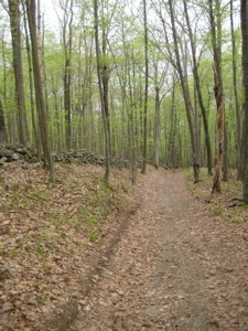
The trail is relatively flat here and there are no views at all. However, that doesn’t mean it’s not challenging. With all the rain we’ve received this year in Connecticut, the southern end of the Shenipsit has become an excellent example of water erosion, ATV damage and mud.
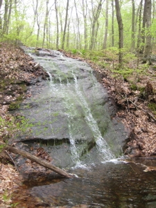
Here, in pictures, are the various ways water makes an easy hike difficult:
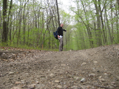
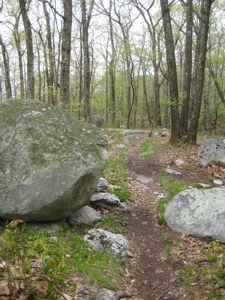
Ahhh, nice dry trail…
Hm. I’m sure this is a ball of fun in a Jeep. Not so much on your feet though.
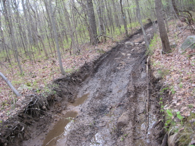
Some nice mud
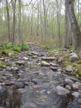
And the ol’ trail-waterfall effect
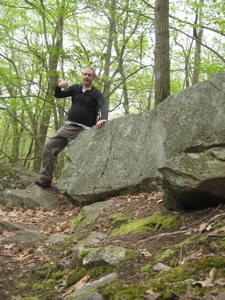
Those were four pictures in a row on my camera. I don’t mean to suggest that this is how the trail is year-round or that there aren’t pleasant sections during these miles. There are… But apparently they weren’t exciting enough for me to photograph. But that belies the fact that I was hiking through the Meshomasic State Forest – and that, my friends, IS exciting.
 Meshomasic State Forest began as 70 acres, acquired for $105.00 in 1903. It was the first State Forest in Connecticut and in New England, and the second in the country (Pennsylvania had the first). Meshomasic State Forest now exceeds 9,000 acres in the towns of Portland, East Hampton, Glastonbury, Marlborough, and Hebron.
The forest was originally purchased was to provide private landowners with examples of good forest management practices. During the Great Depression (1930′s) two Civilian Conservation Corps (CCC) camps were located in the forest. It was the CCC who built most of the gravel roads in the forest.
 Today, about 75 acres per year are harvested. This is a sustainable rate of harvest that also increases biodiversity in the forest and makes the forest more resistant to such disasters as uncontrolled wildfire and destructive insect outbreaks.
Once off of Portland Reservoir Road – which I don’t think you can drive on – the trail gets noticeably better as it becomes trail-width again and makes its way toward Route 2. There are a couple connector trails here as well – one to Mott Hill Road, which looked like it slogs right through a swamp and another one that connects with Dickinson Road. Both roads are in Glastonbury and just judging by what I saw from the Shenipsit, opt for the Dickinson connector if you must.
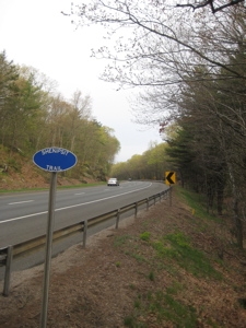
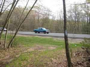 But as long as you aren’t hiking with little kids, I suggest sticking to the Shenipsit proper and hiking through the laurel and rhododendron down the hill to Route 2. The trail is clearly blazed along this last pre-highway section and heck, there’s a blaze right at the highway! The dangerous crossing is made easier by the swath of “forest” between the East and West highway lanes, so you get a nice break in between Frogger runs.
There are no blazes in the median, but there is a clear pathway and once on the other side, you’ll see the familiar blue oval sign marking the trail. Note: you will get funny looks by the people whizzing by at 80 mph, but no matter. To actually hike around via the connector trails and roads would add 5 boring miles of road walking and as long as you have your wits about you, it’s not too insane to cross the highway.
Disclaimer: If you get hit by a car, it’s not my fault. Or the CFPA’s – the Walk Book states you should make the long walk ’round. Just don’t be stupid.
Once across the highway, I hiked the mile or so along the white-blazed connector to my car at the end of Toll Gate Road, just off of Exit 11. This little jaunt is actually fairly interesting as I passed the remains of what I can only assume was an old toll plaza.
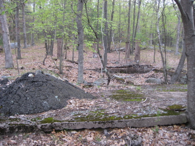
I also passed the Glastonbury shooting range which for me was a bit less interesting.
I know the remaining miles of the Shenipsit are nicer than these first eight. I know this section gets a bad rap but it’s still interesting and definitely has its highlights. Don’t tell me you’ve hiked the Shenipsit unless you’ve REALLY hiked ALL of it. And that includes these southernmost miles.
Thanks to CTMQ Friend Becky for hooking me up with a ride back to my car.
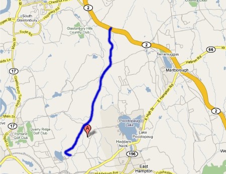
Section 1 Approximate Breakdown:
0.0 Miles: Gadpouch Road Trailhead
0.4 Miles: Great Hill Ridge/side trail to view
1.5 Miles: Old Quarry
2.9 Miles: Summit Bald Hill
5.7 Miles: Mott Hill Road connector trail
8.2 Miles: Route 2 crossing
End


At the RT2 crossing, you can actually go under. There’s a stream that runs through a 5′ pipe. You can walk all the way through.
Comment #1 on 04.28.12 at 11:14 pmWould you say this section is safe for dogs? I’m hoping to do this one next weekend and I want to bring our dog. The walk book says there are some steep ascents and descents..and that has me a bit concerned. Are any of them steeper than the ascent to box mountain on the Risley Pond/reservoir trail? We did that one today and he was fine.
Comment #2 on 11.04.12 at 6:23 pmJust run across the road. That’s what everyone else does.
Comment #3 on 12.20.12 at 10:18 pm