Paugussett Trail
Aww, Paw! Jus’ Gussett!
Monroe/Shelton, 9.1 Miles, solo
October 27, 2008
 I wasn’t about to let a perfect Fall day go to waste. My parents were up for the weekend so I used the opportunity far a car spot in a place I’d have trouble getting one otherwise. I pretty much chose the Paugussett based solely upon this criteria; that is, get as far away from my house as possible, an end-to-end trail, and don’t screw up my parents’ drive too badly.
Mission accomplished. Of course, my dad now drives slower than he used to and he questioned my navigation skills to get us through the rural backcountry roads, but it all worked out fine.
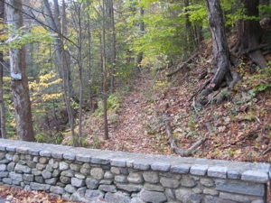
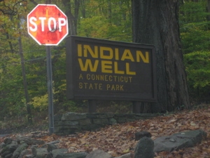
Well, except for finding the trailhead off of Indian Well Road. The trail starts “immediately after crossing stone wall bridge.” This is absolutely true and seems pretty straightforward, but a) the first blaze is a bit hidden, b) there is no signage, and c) there are a few stone wall bridges.
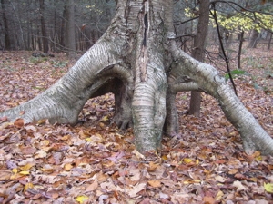
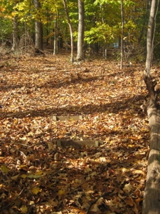
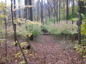
This is where the Paugussett really starts
As a result, I started a little bit further up the road where a) the first blaze is seen from the road and b) there is a huge sign. What’s cool about the real starting point is that it will save you a few bucks during the summer when they charge to enter the Indian Well State Park. My parents dropped me off, my mom a bit aghast at the idea of banging out nine miles of hiking for some reason, and I was off.
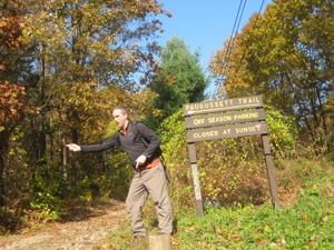
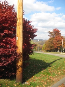
Fake trailhead
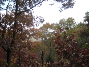
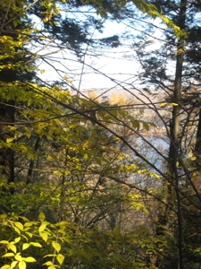
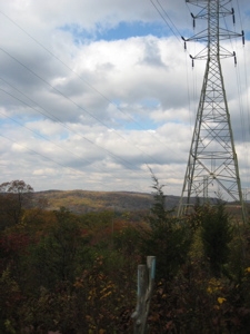
Up the white-blazed access trail, climbing away from the Housatonic River. It wasn’t too steep and I quickly reached the “real” Paugussett. I turned south to quickly collect the last half-mile I missed with the initial drop-off confusion. This wasn’t all for naught, however, as I was afforded my first and truthfully only view-from-above view of the day:
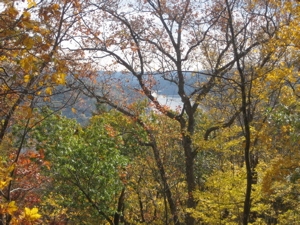
The Housatonic
The Paugussetts were American Indians who occupied mainly what is now Derby, Connecticut (our smallest town, by the way). The word “Paugussett” literally translated means “where the river widens out.” Reservations were set up for the Indians soon after the colonists arrived. In 1659, the General Court in Fairfield ruled that 80 acres of land should be held for the Paugussett Indians at Golden Hill – named after the corn grown on the hill – located in Bridgeport.
 Over time, however, the tribe was forced to sell off its land to succeeding generations of New Englanders who inhabited the area. Today, only one log cabin on one-quarter of an acre of land remains there.
I doubled back and passed the side trails for the Shelton Open Space land, then passed the access trail I took earlier, and then entered a stunning and surprising grove of massive tulip trees. By far the biggest I can remember ever seeing; and there are a lot of them.
Tiptoe through the massive tulips
For a short spell here, though the tulips and beeches, I was struck by just how pretty a New England Autumn day in the woods can be… It was all right there in front of me – the yellow leaves, the centuries-old stone walls, the quiet rustle of nothing more than the wind and a distant squirrel. Yeah, this is why I do this.
I really think this is a good picture, save for the washed out sky
The next mile saw a gradual change under my feet. While I was looking up at the canopy trying to identify different trees – which reminds me, what are these leaves on the left from? (The green leaf is from the tulip tree.)
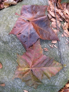
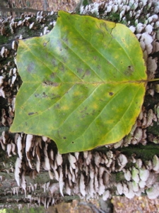
What tree are the dark leaves from?
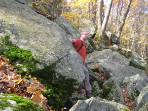
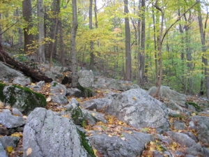
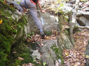
I would say black maple but I can’t bring myself to be confident about that. Almost looks like a black maple – tulip hybrid to me. As I was saying, the trail entered some much rockier terrain as the hillside become steeper. While the trail does contour the hillside pretty well, I was surprised by the technicality needed to safely traverse this section. Anyone can do it, but I was really motoring along and was caught off guard by the rocks.
I have some photographic proof of what I’m talking about. Of course, this section is only maybe a third of a mile long and it’s more fun than anything else – just be prepared for it, especially if you’ll be hiking on the dreaded wet leaves.
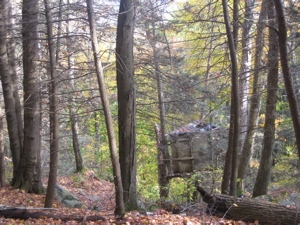
Towards the end of the rocky section, I came upon another of those signs that drive me crazy:
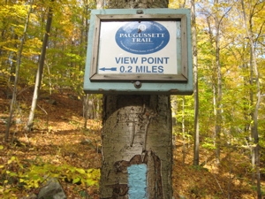
Why? Because I can never deny their allure and yet they always disappoint me. They lie, they steal, they often offer nothing but empty promises and often require far more effort than they deserve. Okay, this one is only .2 miles up the steep hill… Once I was closer, my hopes were perked up a bit more by another promise of a “Look out”…
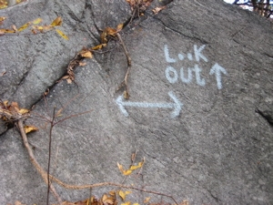
As ever, my anticipation reached a crescendo and then…
I took a swig of water, turned around, and descended rapidly back down to the Paugussett. Sigh. CFPA side trails to viewpoints are like really hot women who flirt with you saying all the right things… and then just when everything is perfect, you realize she’s totally not into you.
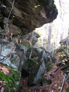
One last section of ankle-twisting rocks
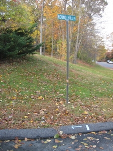
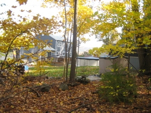
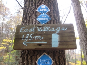
Back on the main trail, I passed a sign stating .75 miles to Okenuck Way which put a spring in my step. For some odd reason, the idea of hiking through backyards excites me. Crossed a few more streams, traversed a tiny swath of woods behind some suburban yards, and then I popped out not onto Okenuck Way, but rather something called Round Hill Road. See, look:
This also meant I was leaving the confines of Indian Well State Park. According to legend, a waterfall at the park was the secret meeting place for two lovers from enemy Indian tribes. When their tryst was discovered, the father of the Princess, a Paugussett chief, ordered a raid upon the Pootatuck village where the brave lived. The Princess believed her lover was dead, and in despair dove off the waterfall. Her brave, who had survived and was sleeping nearby, awoke to the sound of her suicide. Then he too jumped off the waterfall to join her in eternity. The pool was once much deeper than it is today and was believed to be bottomless.
 This legend seems rather pervasive with various tribes in Connecticut. Just upriver there is a similar tale along the Lillinonah Trail, we have a Lover’s Leap State Park too, and don’t forget Yantic Falls down near Norwich with a similar legend.
Anyway, before we leave Indian Well, I wanted to draw attention to the state park itself and more specifically, the beach along the river. Shelton Trails has a good description of it but there is a disappointing addendum to this. Teresa, who writes that fine site, has several legitimate gripes with the DEP and the lifeguards at the park. I’ve had my own run-ins with similar folks all around the state and am happy to read that one person called them on it.
(Example, which they’ve sort of fixed – I’d like to think as a result of my letter – they used to charge something like 9 dollars for shipping and handling of the little state park pass sticker. The one that costs 42 cents to mail. I just checked the DEP online store and see there is no longer a S&H charge, but the price is now $50.00 for the pass. So they still win.)
I wonder if they care about hunting stands only 100 yards from houses?
That’s funny, my little map doesn’t even mention that road. Funnier still, I don’t remember seeing that blaze and arrow on the curb when I was there. Regardless, I knew I had to go left anyway so I was okay. The road walk here is short and safe; a quick turn right onto Boulder Path (blazes are not in abundance here) and then straight across Princess Wenonah Way and…
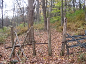
Straight uphill. You can’t tell from these pictures, but the first 200 yards or so after the road is one of the steepest 200 yards of Connecticut blue-blazed trail. You can see the handy little steps built into the hillside in the picture at left here;
Rant: This third of a mile bit through these woods is completely unnecessary and quite frankly, stupid. I realize we want to stick to the woods as much as possible and I appreciate that. But in this case, it really makes no sense. The trail climbs straight up in between two houses, then takes a sharp right-hand turn to squeeze through what I assume is a 10 foot corridor of non-private land.
 You can easily peer into the windows of the houses below as the occupants of the houses above peer at you doing so. The grade is very steep and before popping out onto another road again, the trail pretty much skirts some fencing through a few backyards. Meanwhile, the road the trail takes here is the same road we just crossed before that steep climb. This may be the only time I ever say this but, the trail would be better served to just stay on the road for this small stretch.
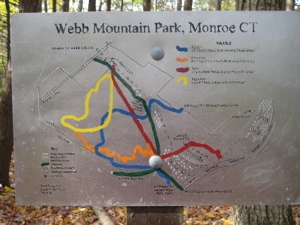
After the few minutes on the road (Thoreau Drive extends further than the Walkbook shows), the trail again ambles right next to a driveway and then steeply down this time, down some steps towards Round Hill Brook. After crossing the brook and now entering the town of Monroe, the trail enters Webb Mountain park. The Town of Monroe purchased Webb Mountain Park in 1972 from Mr. And Mrs. Alfred E. Wagner.
The park has many unique features from when the Wagner family owned the land. The Wagners built and ran a sawmill on the land for three years. They also owned a Christmas tree farm and planted several varieties of evergreens, such as Balsam, Frasier and Douglas firs, White and Blue Spruce, and Scotch and White Pine. These evergreen plots have overgrown and are now the campsites of Webb Mountain Park.
And don’t forget about the Webb Mountain Discovery Zone here as well – a place I’m excited to bring Damian to once he’s a bit older.
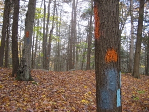
This town park suffers from over-blazing, as do many parks in the state. The woods here resemble a paintball competition venue. This is what I’m talking about:
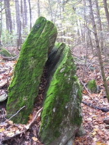
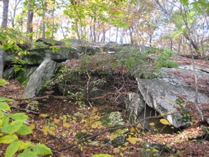
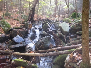
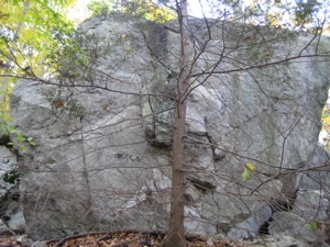
But that didn’t take away from my enjoyment. It’s a pretty area with some interesting rock features and supposed views of Lake Zoar – which is a wide area of the Housatonic River. I climbed up something called the 100-foot ledge which was cool and then descended the backside down to a power line cut, then an old gravel road along another brook.
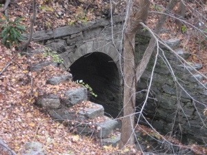
The trail then pops out onto some railroad tracks, passes a very old stone archway bridge along Cottage Street. I meant to remember the name of the company on the arch, but I’ve forgotten. It was Kelley Brothers or something from 1888 or thereabouts. Sorry for the oversight on my part.
From this point on, the trail takes on a very different feel. It turns southwest and follows Boys Halfway Brook almost straight as an arrow, slightly uphill, the final three miles to the Monroe end. The whole way is very pretty which a bunch of old stone walls, old (and still used) pasture gates, several mill races, and a weird little section of bushes rather than trees. I actually think this is a grove of witch hazel which is fairly rare but certainly not unheard of.
Witch hazel?
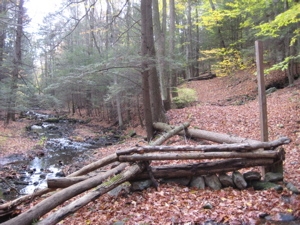
Pasture gate 1
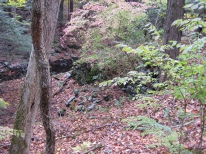
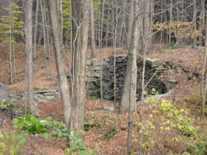
Old silver mine (really), and mill race
Pasture gate 2
Old hoop-skirt mill (that’s what the Walkbook says)
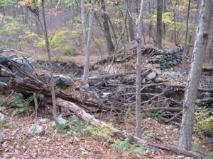
old dam and mill race
Apparently along this stretch I missed a Satan in Connecticut opportunity. From the 1968 version of “Short Walks in Connecticut, “Cottage St. Trail follows cart path through hemlock grove then parallels the west bank of Boys Halfway River. After crossing river continue on trail southwest to Devil’s Den.Trail leads to Barn Hill Rd.” The hemlock is pretty much dead, the trail has a different name (and is half the distance), and the trail doesn’t cross the brook until very near the road… and it no longer passes this Devil’s Den. Which really stinks.
I did, however, find an addition to my CARcasses list at least… though I did waffle on whether or not this latest edition was a car or not.
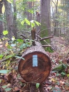
One road crossing and then a short stint back through some white pine and 9+ miles later, the Paugussett was complete! I hear tell there is talk of lengthening the trail at some point in the nearish future, so I’ll have to keep updated on that.
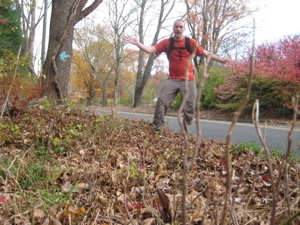
Finish!
…………………………………………………….


Nice blog! I’ve been finding and planting letterboxes along the blue trails, and was looking for more info on the Monroe section of the trail, which I haven’t been on in a long, long time. Looks like some good places to hide boxes, there, I just need to find out which areas are public land. The unknown leaves look like Sycamore to me. I can’t see the questioned shrubs too well, but I think they might be winged euonymous, an invasive species.
Comment #1 on 02.20.09 at 4:08 pmI have a question about the Paugussett Trail.
I have been trying to walk it slowly but confused as to where it is.
It is an ancient trail with only ‘remnants’ left but ———–
Comment #2 on 07.23.11 at 12:38 am