Gay City Trails
“We Built This Gay City… We Built This Gay City on Rocks and Roll(ing Hills)!”
Bolton, Glastonbury &Hebron, about 11 miles total
June 17 and 24, 2009
 It is always challenging for me to logically and concisely present these trail network posts. I put a lot of effort into planning for and hiking every inch of every trail on the CFPA maps (I’m a purist). As you can imagine, my hikes aren’t exactly one trail at a time. But I must report them as such.
It’s always around this point in my writing that I realize no one cares, so I’ll just get to it and present the various trails of Gay City as logically as possible. I’ll start west from the main Shenipsit Trail and head generally east, discussing the bigger trails first. I guess.
…………………………………………………….
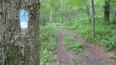
Shenipsit/Gay City Connector Trail (Blue/White blazes)
The Shenipsit Trail extends from southern East Hampton up to Somers, just past Soapstone Mountain. There are some breaks in the trail, but that doesn’t really take away from its unique beauty and history. One can access Gay City from the west via one of the two connector trails, both of which connect to the blue-blazed Gay City Trail leading into the state park.
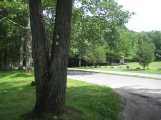
 Case Mountain (and its trail network – CTMQ hikes here – lies northwest of Gay City State Park and is connected by the Shenipsit (and a bunch of roads, of course). From the south, there is parking along Birch Mountain Road by the radio tower array near Hebron Avenue, but it doesn’t really make sense to start there if your goal is to explore Gay City. (You can park a little ways north on Birch Mountain Road where the Gay City Trail crosses – I did.)
Note: The Shenipsit was rerouted between Hebron Avenue and the southern Gay City connector. It now follows Birch Mountain Road and uses what the CFPA map labels as the John Tom Hill Connector to get back to the original Shenipsit just north of the power line cut.
Man, this is pretty boring so far, huh? (Read more about the Shenipsit proper here.)
Which is a shame, because the two legs of the connector trails are both way cooler than you’d think, for such a utilitarian and short set of trails.
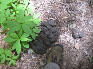
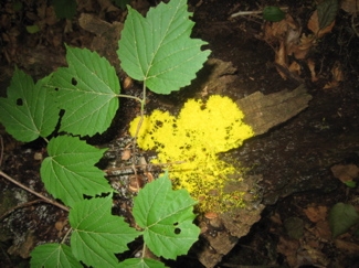
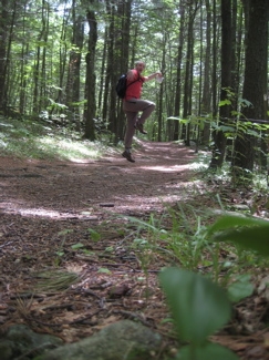
I parked on Birch Mountain Road and did the loop with the Shenipsit. It was a muggy June day but this being Connecticut, I encountered some snow:
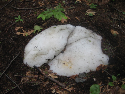
Don’t believe me? Here’s some more:
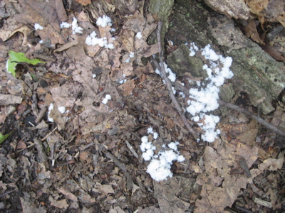
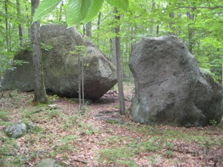
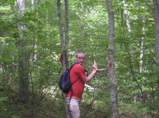
Okay, one was a rock and the other some sort of fungus, but you had to do a double take. Both legs have some stuff worth checking out – large glacial erratic, tons of blueberry bushes, an unexplained monument to America, and even a couple decent views.
And if you hate Bolton and Hebron for some reason, this loop is entirely within Glastonbury. You weirdo.

…………………………………………………….
Gay City Trail, 1.7 Miles (Blue Blazed)
 The Gay City Trail is your gateway to the state park from the west. (From the east, you can simply drive in and park in a lot.) I can assure you, this is not the popular way to enter the park – though it IS free during the fee-for-entry summer months, and “only” about a mile and a half hike to the swimming lake. Think about it.
The trail starts where the two connectors meet, west of Birch Mountain Road and then heads due east across the road and into the park.
It’s a flat, wide trail and very most likely used to be a road back when Gay City was a bustling mill “town.” Almost every other trail in the park touches this main artery, that cuts the park in two and ends at the real park entrance a couple miles east along Route 85 in Hebron.
This trail passes the remains of the main old mill – the woolen mill – which you’ll learn about as we go along. Actually, it looks like a good time to start learning right now. From the DEP’s Gay City State Park site:
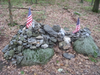
 Located on the Hebron-Bolton town line, Gay City’s 1,569 acres of parkland offer swimming, picnicking and an almost endless opportunity for exploration. The name “Gay City” derives from a now-extinct mill town that once occupied the site. Today only some tumbling stone foundations, several grass-filled cellar holes and a few silent tombstones suggest its former existence.
Gay City was first settled in 1796 by a religious sect led by Elijah Andrus and later by Rev. Henry P. Sumner. The Gays soon comprised the majority of the 25 or more families who then lived in the community. The residents kept strictly to themselves, existing as distinctly separate from the neighboring communities. They built a sawmill along the Black Ledge River and erected homes from the lumber.
 Gay City’s fate changed with the successes and failures of several commercial enterprises. A woolen mill on the site 1/4 mile below the present pond was a successful business until extreme pressures caused by the various blockades during the War of 1812 brought its closing. Once revived, the mill burned to the ground in 1830, beginning the town’s decline with the exodus of many people to urban factory jobs. Rev. Sumner’s son built a paper mill which again revived the town somewhat until the Civil War, when many of the town’s younger men were killed in battle. Soon after, the mill burned down, triggering the final demise of Gay City and nature’s reclaiming of the land.
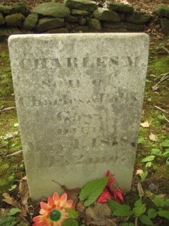
The cemetery mentioned above is a pretty cool little square plot just off the entrance road shortly inside the park. After passing by it, the Gay City Trail comes to an end and your only option keep hiking forward is to head north on the… (Continue below)
…………………………………………………….
Outer Loop Trail, 5 Miles Red blazed
 As its name implies, this trail more-or-less rings the park. If one were to hike the whole red trail, and nothing else, it’s about 5 miles. Starting at the eastern terminus of the Gay City Trail, along the entrance road right near route 85, the trail heads north and eases out very near the busy road.
The northern half of this loop trail is pretty woodsy and the very northernest northern tip takes in a nice beaver pond. You’re also in Bolton up there too, but you’ll be okay.
The trail abruptly heads due south along the old dirt French Road before ultimately hitting the Gay City Trail again.
The southern half of the loop (south of the Gay City Trail) is the most remote area within the park and hits some nice stands of pine and hemlock as well as a few pond overlooks and stream crossings. The southern half of the Outer Loop Trail is bisected by the…
…………………………………………………….
Connector Trail, .8 Miles Yellow blazed
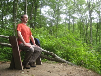
At just under a mile, I haven’t much to say about this one, other than it was annoying to complete it for the purposes of my CT 400(825) goal. So sit down with me on the most perfect posture bench and learn some more about this place..
From: Legendary Connecticut. (I’ve edited out all references to the supernatural, as I always do.)
 WHILE IT MANAGED to survive, after a fashion, for some eighty years, Gay City was never, as its name seemed to suggest, either a center of metropolitan merriment or a tiny version of San Francisco. In fact, the twenty or thirty devout, hard-working families who first settled the “city” on the Hebron-Bolton town line probably would not have recognized the name. That’s because the settlement planted in 1796 by Elijah Andrus and a band of devout followers from Hartford was long known as “Factory Hollow,” until feuds, wars, liquor, and fires finally transformed the small community on the Blackledge River, below Still Pond, into a permanent ghost town in the 1880s.
Not until 1953, when the area where Factory Hollow once stood was turned over to the State of Connecticut for use as a state park, did the Gay City name become firmly attached to the place. There was an irony in this, too, since it was descendants of the powerful Sumner family, which for years battled the Gay family for village domination, who decreed that the state use the Gay name for the new public recreation area. So, though “Factory Hollow” or “Sumnertown” it should have been, Gay City — with all the possibilities inherent in the word “Gay” — it is, today.
 If the traditional stories about the settlement are credible, there was trouble, right there in Gay City, almost from the beginning. Within four years of the founding, Elijah Andrus had abandoned his followers to the not-so-tender mercies of the rocky soil, steep terrain and utter isolation of the dark gorge of the Blackledge, just as the first frame houses and muddy streets began to appear. No one knows why Andrus departed, but tales persisted for years of feuding and fighting among the group of Methodist zealots which he had led into the wilderness. In 1800 John Gay was officially appointed “president” of the colony, while the Rev. Henry P. Sumner took Andrus’ place as spiritual leader. John Gay and his brother Ichabod apparently shared with Sumner the responsibility of administering the community’s affairs, though the relationship between them was never cordial.
Good stuff. And so far, the hiking here was good too. Most people (99% I’d say) come to Gay City for the little beach and swimming pond. The trails are pretty empty – but they do allow horses on most of them here, so you have to be careful where you step.
Mountain bikers seem to enjoy this place too, which is okay I guess because a lot of the trail network here follows old woods roads to a large degree.
…………………………………………………….
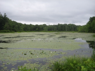
Pond Loop Trail, 2.5 Miles white blazed
 This little trail is probably the most popular in the park. It can be accessed from the main parking lot and it passes by the two most interesting places: The old woolen mill and it’s race as well as the pond everyone hangs out at.
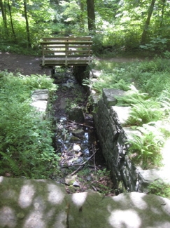
There are actually several old cellar holes along the path, but the main ruins here to worry about are those of the woolen mill. It’s remarkably well-preserved. But to me, the raceway from what was the Blackledge River (before its damming for the pond) to the mill is the coolest relic.
The trail makes a very meandering loop around the pond (only coming within sight of it for a second) and ends along the Gay City Trail near the cemetery towards the park entrance.
 Here’s some more history:
According to legend, alcohol was the principal factor contributing to Gay City’s next upheaval. Some say that it was part of the group’s religious practice and others claim that it was an inducement to attend the compulsory twice-a-week services, but whatever the reason, all male members of the community were served hard liquor when they attended the frequent meetings for worship. Rum may have improved attendance figures, and it may even have encouraged spirited participation in the religious services, but legend has it that the booze did very little for the peace and tranquility of the religious gatherings. As the drunken brawls and blasphemous language of the male parishioners contributed more and more to the general civic unrest, a number of the first families of the colony packed up and left Gay City, resettling in the Hockanum River region of East Hartford and Glastonbury, and along the banks of the Connecticut River to the south. By 1804, the colony had reached a turning point.
 John Gay and the remaining families decided that the survival of the struggling community depended on some sort of economic stimulus, something to bring jobs and income to residents whose interest in the colony was flagging, and maybe even inspire new population growth. Their answer: a mill for the manufacture of woolen cloth. So, after choosing a site about a quarter of a mile down river from Still Pond, the Gay City folks, aided in the back-breaking enterprise by outside laborers recruited from neighboring towns, began construction of a woolen mill.
Huge foundation stones, some weighing over a ton, were moved to the site on ox-drawn sledges, while a dam and canal were constructed to divert water from the river to run the huge, overshot wheel which operated the mill. The work was finally completed after many months, despite the defection of at least one of the laborers. According to a traditional story, this workman refused to have anything to do with building a canal in which the water “ran uphill” (as, indeed, it seemed to do). Proclaiming that it was “doing the Devil’s work” to contribute to an “un-natural” stream of free-flowing water, he laid down his shovel, walked off the job and never came back.
 The mill began operation under the name William Strong and Company around 1810 and, for a brief time, provided a welcome boost to the Gay City economy. Much of the wool used in the manufacturing process came from locally-raised sheep, while Hartford and other nearby towns provided a ready market for the cloth. Then came the War of 1812, the British blockade of shipping and a recession — inspiring decline in commerce. The Strong mill failed. Although Henry P. Sumner purchased full control of the factory and continued the business as the Lafayette Manufacturing Company, a disastrous fire in 1830 finished for all time the production of woolen cloth in Gay City. At least the venture may have preserved the village for several decades beyond its time.
Several years after the cloth factory burned, Dr. Charles F. Sumner, son of Henry P. Sumner, erected a new mill — this one for the manufacture of rag paper — near the site of the old woolen mill. Run by several generations of the Sumner family, the paper mill inspired a modest revival in Gay City, as well as a folk misconception about the operation which has persisted to this day. Because so many buttons have been found over the years at the site of the old paperworks, people believe that the place was a button factory. Actually, the buttons came from the scrap rags used in the paper-making process.

Even with the success of the Sumner paper mill, however, Gay City’s days were numbered. The last members of the Gay family had left after the woolen mill fire. Other founding fathers and mothers were dying off, and young people were moving out of ” The Hollow” to seek economic opportunities elsewhere. Then the Civil War carried off many of the village’s young men, most of them never to return. Old homes stood vacant or deserted because death had removed the last resident. Finally, the paper mill met the same fate as the old woolen factory, burning to the ground in 1879. Gay City as much as died with it.
…………………………………………………….
Orange Trail, .75 Mile
 Half of this trail is joined by the Outer Loop Trail. It serves as a connector between the Pond Loop Trail and the Outer Loop Trail at two different locations, if that makes sense.
I liked it. I don’t know why… Maybe I just like orange.
(Here, I’d love to continue the history of the area, but my source spends the last 8 paragraphs on ghosts and hauntings in the area. Since CTMQ readers are intelligent, I won’t insult you with that crap.
…………………………………………………….
Split Rock Trail, .4 mile (red/yellow blazed)
This little connector was an Eagle Scout project at some point and it’s great. The split rock of the name is a really cool split glacial erratic.
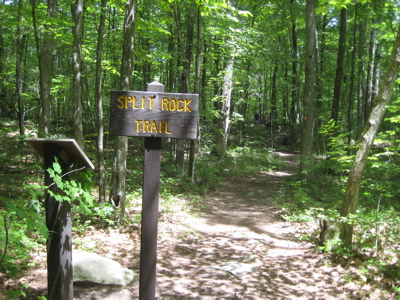
This trial connects the pond parking access road to the Pond Loop, east of the pond itself. Check it out next time you’re in the park, it’s really worth the little walk.

…………………………………………………….
Conclusion
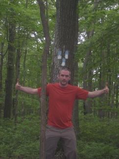
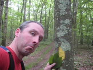
There. I just put this together without a single gay joke. Oh sure, I had planned to have some – and those pictures of me in somewhat odd poses at the colored blazes are my nod to interior decorators weighing on on paint chips… But that’s all I’ve got.
I’m getting old.
CemetEry


I care!! and read your hiking posts on a regular basis, especially before I do a hike. Keep writing.
Comment #1 on 03.08.10 at 6:12 pmThanks, Ann.
(What I meant was that no one cares how I spend way too much time figuring out the most efficient way of hiking every bit of every trail and then re-thinking later about how to best present the hikes.)
Comment #2 on 03.09.10 at 10:50 amI love your posts! keep them up. (I follow you on google reader just so you know)
Comment #3 on 04.06.10 at 8:01 amI just stumbled upon the Gay City article. I’m the granddaughter of Leon Stearns Gay, son of Joseph Stearns Gay. Brothers Leon and Olin Gay owned Gay Brothers woolen mill in Cavendish, Vt. Leon and his wife, Una Hadley Gay lived at “Glimmerstone” in Cavendish for 40 years. Una’s brother, Art Hadley, invented the expansion bracelet in 1913 in Providence, R.I. and I have that bracelet. This was the forerunner to today’s expansion watchband. I’ve co-written a book, “The Inventor’s Fortune Up For Grabs” by Suzanne G. Beyer and John S. Pfarr. In it are several old photos of us seated around the table at Glimmerstone with the grandparents, old photos of inventor, Art Hadley. The story is what happened following Art’s death and the deaths of his two children — simply put, all hell broke loose! Book is available at Amazon.com or through me.
Comment #4 on 05.30.11 at 11:34 pmYour article put me back in time and to my family connection.
Best,
Suzanne