Alain and May White Nature Trails
Rub a Dub Dub, Five Trails and a Tub
Torrington, 4.1 Miles or so, solo
September 13, 2008
 Having been sufficiently warmed up by my 2.1 mile hike hike down the John Muir Trail, I was ready to tackle the tangle of the Alain and May White Nature Trails, all within Sunnybrook State Park. There are five trails here, plus a short crossover trail, on the CT 400(825) list.
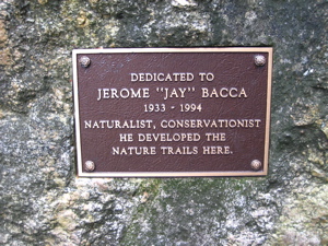
Once I entered the park through the woods off of Newfield Road, a short jaunt into the parking lot brought me to a bronze plaque affixed to a rock. This plaque dedicates the trails to naturalist Jerome “Jay” Bacca of Torrington. Jay and his wife Lorrie developed the trails in the early 1980′s in memory of Alain C. White and his sister May White.
 Together the Whites established the 4,200 acre White Memorial Foundation in nearby Litchfield and Morris, and donated substantial lands to early state forests and parks in western Connecticut. Alain White was president of the CFPA from 1923 to 1928. (Of course, the CFPA today maintains and oversees the network of the CT 400(825) trails and publishes the indispensable CT Walk Book that has become my bible.)
I decided to thwart that bible, though, and hike the trails more-or-less counter-clockwise for no particular reason. It’s a rather flat network, so climbing and descending is not at issue. But presenting the trails coherently is, as always, for me – because at places like this I do bits and pieces of some of the trails as I complete the connectors and loops, then backtrack to my leaving point. You get the point – as if I haven’t stated that point ten times already. Sorry to bore you.
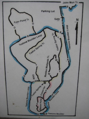
Think of the White Trails thusly: The Testone Boulder Trail forms a 2 mile loop – call it the eyeball. The Fadoir Spring Trail is a one mile loop within that bigger loop – the pupil. The Madden Wetlands and Beaver Pond trails are like bloodshot veins between the pupil and outer eyeball. And the Fyler Pond Trail is like a weird growth sticking out of the eyeball – see your optometrist immediately. In that “vein,” I’ll discuss the five trails in order of completion. That’ll work. Maybe.
Let me pause for a moment to see how the lawyers have legislated nature
…………………………………………………….
Fyler Pond Trail, 0.5 mile, Orange-Blazed
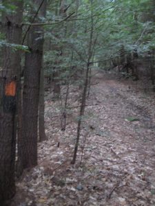
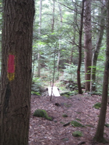
After hiking into the park on the Testone Boulder Trail, I took a right-hand turn onto the half mile long, orange-blazed Fyler Pond Trail. I took five pictures along this stretch, one for each tenth of a mile. How in the world to write enough verbiage to fill the space between the pictures seems rather impossible.
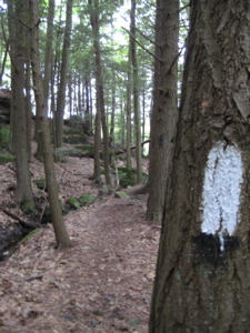
The trail starts out on a wide old woods road.
I like orange blazes. Orange is a good color. I’ll bet this trail looks great a few weeks down the road when the maples are ablaze in orange. There aren’t enough orange animals, don’t you agree? Oh sure, you have your orangatuans and tigers and clown fish. But what else?
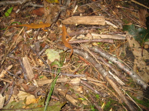
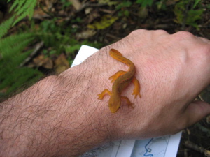
Perhaps two lovely little red efts, which are actually strikingly orange?
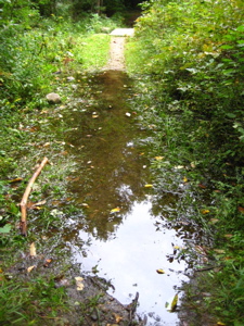
Love those little guys. Shortly after enjoying their company, I took in the scene of Fyler Pond. Formerly a peat bog, this pond was dug out with a steam shovel in the 1900′s. Thanks Walk Book!
It still looks more like a bog than a pond today, 100 years later
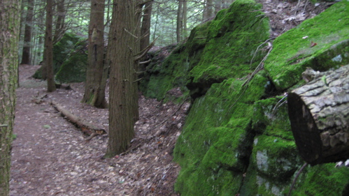
After leaving the little pond, the trail continues northwest, then turns south and follows along a decidedly green moss covered rock ledge. This was yet another one of those times when I wish I a) had a good camera and b) had any skills with which to utilize said camera. As it is, i have neither, so my “widescreen” artsy shot is as weak as ever:
Goodbye Fyler Pond, old friend.
Three minutes later I hooked back up with the Testone Boulder Trail, jogged back to where I left it for two minutes (if that), and continued my hike south.
…………………………………………………….
Madden Wetlands Trail, 0.2 Mile, White-Blazed
 Here’s where it gets really tricky. Before completing this little loop, I’d almost completed the Fadoir Spring Trail to get to it. Sigh… I know I’m the only one who cares about this stuff, so I’ll stop.
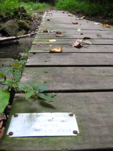
I completed this trail in about 300 seconds, including the time it took to take four pictures. Sure, my pictures stink, but you’re used to that. This trail follows an old millrace to its source at Madden Pond, which the trail views from about 25 feet up a hill. The trail (and pond) was named in honor of William Madden (1914-1986), a naturalist, writer, and educator.
The millrace I followed for about a minute housed the water wheel used in the 1800′s to power the Leech Saw Mill, whatever that was. And the trail passes by two large boulders:
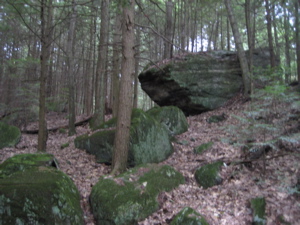
One is sharp edged like a tank…
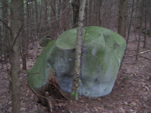
And one is rounded and smooth from glacial action.
And then I was done.
The view of Madden Pond from the Madden Wetlands Trail
…………………………………………………….
Fadoir Spring Trail, 0.9 mile, Yellow-Blazed
 I wonder if Fadoir is pronounced “Fah-dwah” or “Faydoor?” I prefer “Fah-dwah” because after all, I was on trail named after a guy named “Alain.” Let’s keep it french. Unfortunately the Walk Book tells me nothing of the name origin or any history of this trail at all. I suppose I could make something up, but that wouldn’t be cool.
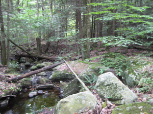
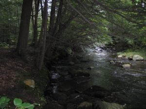
I began the trail from the overgrown “crossover” trail on the western side of the big Testone loops. This trail is the most woodsy of all the trails here I guess, and also hikes along 2 streams for a good portion. The eastern side is very pretty, with a walk along the Naugatuck River. Here, the Naugatuck is barely a “river” but more of a stream.
 Check this out – the Naugatuck River is the largest river in the state that begins and ends within the states boundary lines. The river encompasses 39 miles of river from its beginnings in Norfolk down to its confluence with the Housatonic River in Derby, CT.
The Naugatuck River has a long history of industry that used its waters for many processes from washing to power generation during the last century. Before the industrial revolution the river was an important part of local American Indian culture for it fed the masses. Because of the industrial revolution much of its banks were bought up by early industrialists and the river was dammed in many places.
 From the river valley many infamous products were born; the process of vulcanized rubber was developed in Naugatuck by Goodyear, Naugahide the furnishing upholstery came out of Naugatuck, metal clock parts were first developed in Thomaston and the booming brass factory made Waterbury. Without the river and the railroad, that allowed for shipment and receiving of products and raw materials, the river valley may have looked like any other pristine untouched area.
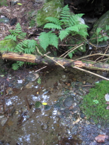
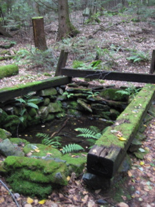
THE Fadoir Spring (left) and something historic (right)
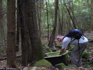
After passing the actual Fadoir Spring, which was pretty weak but very clear, I came upon and old something-or-other (picture above) that was clearly built to do something important to harness the power of the water. Fine. But then, just below it, there happens to be an old porcelain bathtub. It was (of course) filled with nasty fetid water, so I opted to not go for the funny “Steve in a tub” picture.
Shortly thereafter, I reconnected with the connector trail and continued along the Testone Boulder Trail.
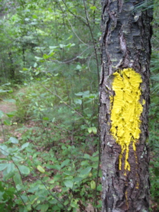
Hey – Alain and May White Nature Trails trailblazers: Eeeeeasy on the glopping, thanks. (This problem pervades the park.)
…………………………………………………….
Beaver Pond Loop, 0.6 Mile, Red-Blazed
 Hardly a loop, but certainly a trail, the Beaver Pond loop is surely the trail here that the others make fun of. First, there’s the name – I mean, anything with “beaver” in the title is fair game right off the bat. Then there’s the nature of this trail – it sort of starts and stops and lurches to and fro from the other, more important BTOC (Big Trails on Campus).
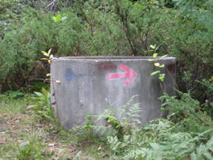
Plus, it has a giant ugly storm drain with a red arrow (blaze) painted on it. And it shares a couple tenths of a mile with the Testone Boulder Trail. This trail is bleh.
Note the red-blazing overtop the yellow. The Fadoir Spring (yellow) trail was like, “Hey Beaver Pond, you’re lame so you take credit for this section.”
…………………………………………………….
Testone Boulder Loop, 1.9 Miles, Blue-Blazed
 Ah, the granddaddy of them all. At an impressive (not really) 1.9 Miles, this “loop” really is a loop. It carries the weight of being a true blue-blazed trail – the most important color for such things in Connecticut. AND, it has the coolest name.
The Testone Boulder is a large glacial erratic named in memory or Connecticut mineralogist Dino Testone (1914-1991). Either Dino was unable to travel out of Torrington, was blind, or just wanted to be sure to have a rock named in his honor – because he called his namesake bouldter, “the largest split boulder I’ve ever seen.”
 Hellooooo?! Bible Rock in Haddam? Can I get an amen? Actually, I’ve seen bigger ones scattered all over the place, but I don’t have a cool name like Dino Testone (a mineralogist with “stone” in his name? C’mon!)
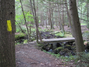
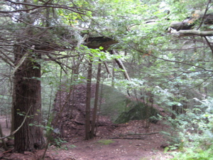
This was the trail I used as a jumping off point for all the others. It begins back in the parking lot and travels along a closed paved road. I took the right-hand turn off the road, immediately had to navigate a ponded part of the trail and then passed the junctions with the Fyler Pond and Fadoir Spring Trails. After that, the trail becomes very pretty and turns into a windy rocky trail through moss covered boulders.
I enjoyed the southern tip of this trail the most in the park I think – but not for the Testone Boulder. Here are three views of it:
From the trail above it…
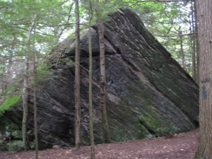
From the trail below it…
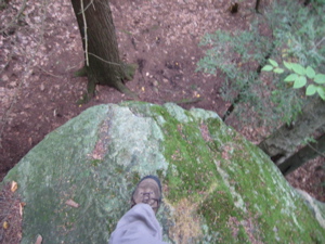
Standing on top of it looking down – it takes real testonicular fortitude to do this
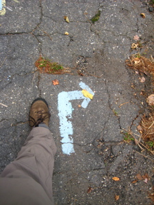
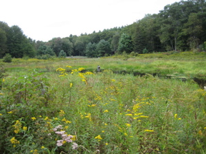
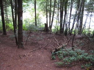
After the excitement of the boulder, the trail crosses a stream, and then bursts forth out into a large grassy field with a model airplane airport and a little pond. Weird. I hadn’t read my trail description and didn’t expect that at all. The blazes disappear for a while here (but it’s not really possible to get lost either) as I made my way up the old asphalt road.
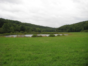
I was initially confused by this field and pond…
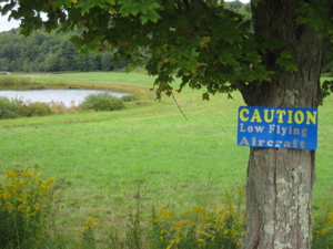
I was more confused when I saw this sign to watch out for “low flying aircraft…”
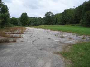
But then I just kept walking along this rotten old road and was fine.
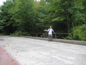
The trail (road) crosses the Naugatuck River one last time and I made my way out to the parking lot area again to hook up with the John Muir Trail again, this time heading north. If you want, you can read my John Muir Trail write up backwards now as I head north up to the last of the Torrington Trails – the strangely named The Wolcott Trail.
Finish!
…………………………………………………….
For the Curious


This was good to be back home..I remember all these trails on the map..I in Georgia just got email from nephew, Tom Fadoir in Texas about this webpage. Your “Steve in tub” was placed there for thirsty roaming cows by Tom’s father..my brother, Edwin. Around 1965 he built a small pavilion with fence around it so leaves and cows could not fall in the pool..on the railroad ties..your picture showed with foundation around the spring water. My father, Michael and his brother, Joseph built the foundation and dug and buried a pipe line from there to our house by the road near the other concrete bridge ..across the color pink on the map around 1920. That bridge was built in 1939. There were not many trees from the pool to the road because my father cut and burn bushes and branches before every Springtime so there would be more grass for the grazing milking cows..few Jerseys..mostly Guernsey. The farm was much bigger then and now couple of pasture are gone because of all those trees.
Comment #1 on 04.07.09 at 12:20 pmThe above comment is why I love writing this blog. Many thanks to Ms. Guerrini! It’s great to have my questions answered by such an authority.
Comment #2 on 04.07.09 at 2:42 pmMaybe Mrs. Guerrini can answer this. Right before the pond/mini airport,where the “low flying aircraft” sign is–why is there what appears to be an old parking lot? Was the pond some sort of recreation area? I go to Sunny Brook frequently and have often wondered about the history of the area. I see where the old driveways used to be–it’s all very interesting.
I’m glad I have an answer to the bathtub!!
Comment #3 on 04.28.09 at 6:44 pmI’m not sure about the road, but in an email Ms. Guerrini wrote (excerpted):
Fadoir is..either Fay door or Fae door…
Comment #4 on 04.28.09 at 7:29 pmThe pond behind the model airplane flying sign on the tree..is not the beaver pond…it is a man made
pond after the dam was built for swimming around 1965. It was a pasture before the pond.
Not that it is important but Jay’s wife name is Loraine not Lorrie.
Comment #5 on 01.05.10 at 4:46 pmI thoroughly enjoyed the writing and photos! Steve, you’ve really enlightened me on some things. In response to Kim, perhaps I can shed a little light on things. As a kid, between 25 and 35 years ago, my dad used to take us up to Sunnybrook State Park. Indeed, it was a popular recreation area. There was no yellow gate up and you could drive right through the main entrance, past what used to be a picnic area on the right past the bridge, and take a right, I’m guessing about 1/3 mile down the road, and drive into the parking lot. Everything is overgrown with trees and brush now, but the driveway into the parking lot was lined by large stones on both sides. A recent walk through there (the first in probably 20 years) revealed the large stones are still there, almost completely hidden by brush.
As you enter the parking lot, in the far right corner was a bath house. It was a stone and wooden beam building housing men’s and women’s restrooms and as well as a storage room. My uncle was a park ranger there for a few summers way back then and would sometimes give us a ball or frisbee that people would leave behind and never return for. Some years ago, the building was set on fire by vandals. The skeletal remains stood there last time I was up there, but now they’re gone also.
There was a nice sandy beach along the eastern side of the pond. My understanding is that the pond was deemed unsuitable for swimming by the DEP because of geese contamination. My recent walk revealed a bit of the sand still there, and suprisingly, clear water.
I have lots of memories of this place and am thankful to have come across this blog to learn and share. I look forward to hiking some of the trails in and near the park for the very first time.
Comment #6 on 08.08.10 at 5:27 pmI now live in VT, but spent a lot of time at Sunnybrook Park when I lived in Torrington (where I grew up). I’m not sure if you’ll actually get the message, as this entry is rather old. I first found out about the park when I was in 7th grade, where one of the teachers at what was then Vogel Whetmore middles school organized a interdisciplinary project. at the end of the project we all went to the park and swept the road, and did a number of other things. We all had to research several animals that reside in the area, and and write up pamphlets about them. We learned about the history of the park, which was once farmland owned by the Faidor family. The army corp of engineers built the damn, and deemed the park “flood plain”, for a number of years it was regularly used. My mother and her siblings used to get taken there to swim, before the small pond was overrun by geese. If you look carefully when you walk around you can see hints of it once being a maintained park, including several types of plants that have gone wild, and are not readily recognizable because they bare little resemblance to their maintained counterparts.
A few random notes:
-That “storm drain” isn’t a storm drain. It’s a bomb shelter, if you look about 10′ away you should be able to find the air exchange pipes. And if you look in the top of the “drain pipe” you’ll see ladder rungs. I’m not sure if the entire structure is filled in, or just the entryway.
-the smaller pond, if you keep bearing right going up the hillside, is actually mandmade, there is the little “beach” and if you look directly across, not that you can tell from that angle, but if you walk around the perimeter, the far side is a concrete embankment. to the left is a sort of floating bog, that could be dangerous if you fell through, so I wouldn’t suggest it.
-there is a slightly raised area in the large field that is roughly 10′ wide and maybe 75-100′ long, it has the skeletons of I believe 50 cows in it, that died when a barn was struck by lightening and burned. (I only found this out, because my mother worked with one of the guys who grew up on the farm).
-shortly before I left the area somebody noticed some odd looking material along the river bank, closer to the dam. it was found to be a large amount of old asbestos based gaskets. the state covered it with a membrane and top filled it with clean soil, as asbestos is only really dangerous if airborne.
Hopefully you see this, feel free to email me if you have any questions.
Comment #7 on 12.19.10 at 8:09 pmDerek