Section 5: Getting Into the Hartland
Tunxis Mainline Trail: Section 6
Barkhamsted/Hartland, 13.1 miles, with my dad
October 20, 2013
 My pops is no spring chicken, but he’s a rather fit septuagenarian. So he was pretty pumped for this 13 mile (or so) jaunt through the wilds of north central Connecticut. Granted, my dad lives in Delaware and has no idea what the wilds of north central Connecticut hold, but he was game.
What made this neat for me – and assume him as well – was that he’d joined me for the last section of the Tunxis mainline as well, from Satan’s Kingdom in New Hartford to the route 219 crossing in Barkhamsted. So with this last hike, he’d have helped me finish the last 22 miles or so of the Tunxis Trail.
And while I happen to love the weirdness of all those more southern 60 miles or so of Tunxis Trail, let’s be honest: My dad got to hike through the best parts.
It may surprise you, but I don’t think these northernmost miles are the hilliest on the Tunxis. Most of the climbs are a few quick down and ups to creeks and at the route 20 road crossing. But the steepest and longest? Bless you, Tunxis, for it comes at the very end.
I love hiking.
……………..
My poor mom joined my dad to spot my car at the end of a dead-end disaster of a road in Hartland called Pell Road. My Outback handled it fine, but their minivan? (for the grandkids!) It was a bit dicey to say the least.
You don’t have to drive all the way to the trail head, as parking where Pell and East Pell roads split in the middle of the woods only adds maybe half a mile to your hike.
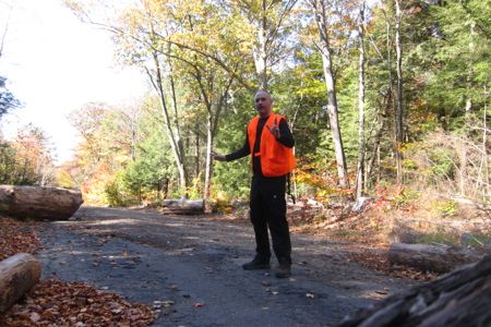
Back down to 219 and my mom saw us off as though we were heading out to do the 100-mile Wilderness in Maine or something. Pictures and everything. Geeze.
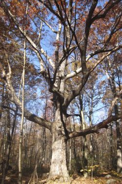
The first mile or so isn’t too eventful, Aside from the massive Wolf Tree, but it offers some good terrain to get your legs going. You go up a little hill, then you go down the little hill. You cross the first of what will be several woods roads of varying suitability. Though I’d be a fool not to mention that you do go through some nice laurel groves and some particularly lush mosses.
The next mile takes you through some pretty flat and standard Connecticut forest – hemlock, pine, beech – all in preparation for what some consider the highlight of this whole hike…
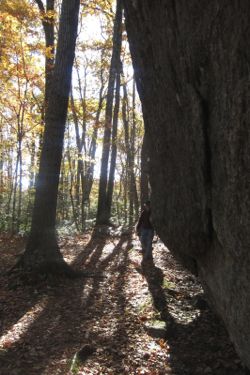
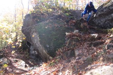
Indian Council Caves. I’ve been prodded to write it as “caves,” and I totally get that, but I also got over Connecticut’s propensity to call everything with a rock overhang a cave.
Indian Council Caves
And besides, Indian Council Caves are cool. The trail sort of skirts the top of them with a decent little view before descending right down into them. And when I write “them,” I mean “jumble of massive boulders, which appear to be a couple massive boulders that have been split by the forces of moisture and temperature swings and time.
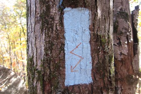
One of my favorite things during this hike was that the maintainer, or perhaps just an overzealous well-meaning hiker, took pains to be a bit more descriptive than usual on the trail blazes. Take, for instance, this one just before the steep descent around the eastern flank of the Indian Council Caves:
I, of course, have no good pictures of the boulders – okay, yeah, I do have a hard time calling these things caves now that I think about it. My dad was impressed. And I poked around the hollows and chasms and boulders for a good 5 or 7 minutes. I was fairly impressed with how clean they were, as there is a flat and straight dirt road/trail in from a legal parking area on Legeyt Road. This means that anyone can cart in a case of beer and have a grand old time.
There was evidence of an old campfire and some scraps of litter here and there, but nothing more than that. Well done, teenagers of Barkhamsted and Hartland… if you even exist.
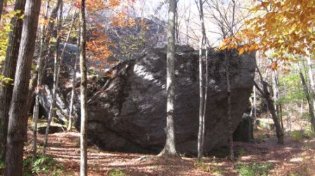
These caves, or “caves,” are fun to poke around I guess. You can’t really get “into” any of the openings to explore like, y’know, like a cave, but it’s still a fun place. There’s something else here that’s not entirely real either – the whole “Indian Council” thing. Turns out, Native American Indian artifacts were found at the location, but it’s not known whether it was actually used as a council site, so says my CFPA Walk Book.
If you want to see more bad pictures, but not much more information, you can check out my page on the Indian Council Caves here.
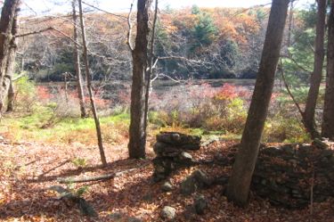 There is a very real, very abandoned foundation of a house right in front of the caves. Some guy lived out here, with pond frontage and giant boulder/caves in his backyard. Not bad, mystery dead guy, not bad at all.
This area is a great spot for a family picnic. The miles up from 219 that we did does not involve any difficult hiking, and the way in from Legeyt Road is even easier.
But we had 10+ miles yet to cover, so we continued north. We passed the Roaring Brook Loop and campsite. That’s right, these northern miles of the Tunxis have honest-to-goodness campsites! Aside from the Appalachian Trail, that’s quite a rarity in our state.
A short walk on a woods road leads to a sharp right turnoff. We missed the turn a couple times and decided that it wasn’t our fault. Once found, we climbed our way to the first of only two summits on the hike – Pine Mountain.
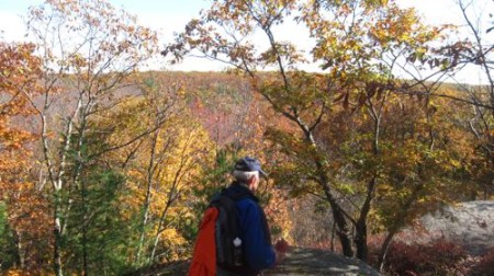
For some reason the Walk Book map doesn’t tell you that there are views up there. Well, there are! Quite excellent views too. Pine Mountain’s summit is the Tunxis’s big moment in Barkhamsted, as the Hartland border is maybe 100 meters north of the viewpoint. I’m fairly certain that Pine’s summit is the highpoint of the Tunxis Trail, at 1,391 feet. (This is only 30 feet less than Hartford County’s highpoint – South Johnson Hill, on the western side of the reservoir in Hartland.
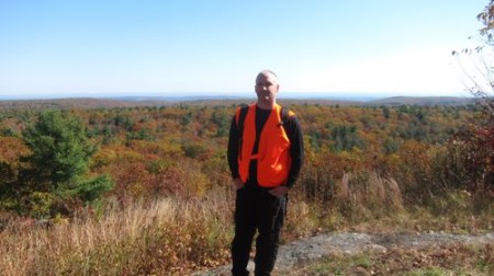
Pine Mountain
But the view takes in the center of Hartland, which is essentially just a church and a municipal building. You can see Springfield and Bradley airport up there as well. Furthermore, if you are lazy, you can park out on 179 and walk in the dirt Pine Mountain Road if you want.
WE continued onward and… downward. Down ultimately to Roberts Brook where we stopped to have lunch. True story: my dad does things the way he does things and those ways don’t change. Take, for instance, ham and cheese sandwiches.
Ham and cheese sandwiches need tomatoes. That is just a fact. So my dad, perhaps sensing that my tomato season was all done in late October in Connecticut, brought a few tomatoes from his garden in Delaware. Then, after a couple days at my house, he sliced one up and packed it up for our hike. Then he hiked 5 miles or so and sat down to lunch and pulled out that sliced Delaware tomato and put it on his sandwich.
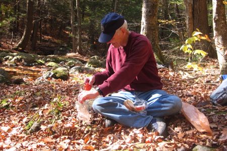
Because ham and cheese sandwiches need tomatoes. No matter where you are.
Now we know.
We crossed Roberts Brook and then walked along the edge of the steep drop down to the Barkhamsted Reservoir. This is a nice enough little section to walk through, and before we knew it, we – hey! –
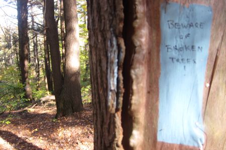
- Phew. That was close. Otherwise, I’d have walked right into random broken trees.
Those broken trees may have been busted up hemlocks, as they were devasted by the wooly adelgid here. A planned cut of the infected trees in “Emmons Grove” in Hartland happened in 2014. I have no idea where the name Emmons Grove comes from, but it exists.
 It exists right around where the Tunxis crosses “old route 20.” Old route 20 used to head in a straight east-west direction until the Barkhamsted Reservoir was created. As with many of these early 20th century reservoir projects, a town was flooded: Barkhamsted Hollow. The massive reservoir was conceived of and built between 1927 and completed in 1940. To this day, it is the main water supply for Hartford, which surprises a lot of people.
Anyway, old route 20 is now a nearly impassable road (and inaccessible, due to a gate up off of a road off of 179. So imagine my surprise and my dad and I heard a very loud clatter from down the hill towards the reservoir. It was actually kind of creepy, as it was literally the first non-bird or wind sound we’d heard all day.
So we stood there and waited… waited for a very slow SUV to pick its way up the cratered road. So we stood there. Watching this truck pick its way at 3 mph on a horrible road in nowheresville Hartland. The lady driving stopped and said hello to us – equally perplexed I guess. Then my dad noticed what caused all the rattling – a bear cage in a trailer!
Old Route 20!
And here’s what I learned: All those bears the state tranquilizes and takes away? This is where they take them! A delivery of two bears had just been made down by the reservoir! I found this to be rather information exciting to know. It surely is remote and not many people would know about what goes on here. Now you do.
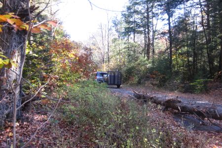
See the truck and bear carrier driving away
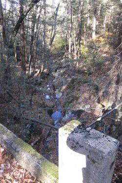
Moving on… Cross a little cascading brook with no name. I only mention this because Connecticut Waterfalls lists this as the “Cascades Near Balance Rock Road” and as a result, I must therefore write a page about them.
So if you enjoyed the Indian Council Caves page that added nothing, you’ll enjoy this page even more!
 The trail soon crosses the present day route 20 via an annoying steep up and down on either side of the road. I entertained the idea of walking through the drainage/creek tunnel that goes under the road, but my dad made fun of me for the idea. Up and across and down we went.
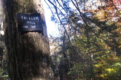
Once across route 20, those hiking with the CFPA maps realize that they are on the final last half page map of the entire Tunxis Trail and system. The end, on the map anyway, is in sight. When I started thinking about this, as we ascended the 1,281 foot Trillium Hill, I started to get a bit wistful.
There are no views at all on Trillium, but at least it’s a nice gradual climb, both from north and the south. We crossed over the tiny (but paved!) Hurricane Brook Road. I’ve read that it’s not open to vehicular traffic though, which kind of stinks. Just walking on it for a couple minutes told me that this was a road I’d love to drive. Oh well.
The trail here is straight up rugged. The path over the abandoned road and down alongside Hurricane Brook is quite fun. If it weren’t for the crossing of Route 20 a short while back, this would have been a long, uninterrupted section of trail seemingly quite remote. (It never really is, as it parallels routes 179 and 20, but it sure feels remote.)
By the way, Hurricane Brook Road goes west a short way to route 20. Near that intersection, at the top of Barkhamsted Reservoir, is the state of Connecticut’s Wilderness School. I don’t know much about this program, but I hope it is utilized to its fullest potential. It’s part of the DCF and is basically a program for at risk kids and such. I would love to be in that van the first time they drive around route 20 at the reservoir! Remember when McNulty takes Bodie to that cemetery in “The Wire” and Bodie was like, “We still in Baltimore?!”
That show is amazing.
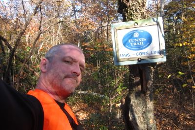
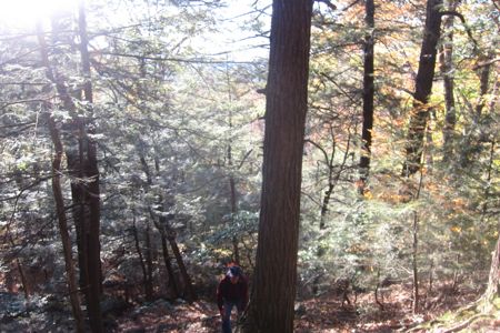
 The Tunxis’s last hurrah is a turn east for a very steep climb up to the terminus. It also crosses over into Massachusetts a bit, which is just a shame. This is OUR trail! But it parallels a mountain stream and mountain streams don’t care so much about state borders.
This last climb is a good kick in the butt after 13 miles or so of hiking. You are rewarded with a nice border marker stone and… well, the knowledge that once you crest the hill, you only have a third of a mile or so of relatively flat hiking until the end! – as long as you were able to park your car at the trailhead like I did.
I went ahead of my dad for this last bit. I wanted to finish alone I guess. Of course the Tunxis is not the Appalachian Trail, but there is something about finishing any long(ish) distance hike that gives reason for reflection. So I got down to the hiker’s lot and just sort of looked around the quiet autumnal woods. This trail starts down in a rather ugly, muddy lot in Southington near the Wolcott border. It takes the hiker through those towns, plus Bristol, Burlington, New Hartford, Canton, and finally, Barkhansted and Hartland.
Traveling north, you certainly get more and more remote as you go, ultimately ending at the Massachusetts border in the middle of the woods at a nearly inaccessible hiker lot. Perhaps that’s why I loved the Tunxis? And why I wished it to continue?
Tunxis Trail, Finis!
Finish up with the Tunxis Postscript
Mainline Section 5 Approximate Breakdown:
0.0 Miles: Route 219
2.2 Miles: Indian Council Caves
4.2 Miles: Pine Mountain
8.0 MIles: Old Route 20
9.8 Miles: Route 20
10.4 Miles: Trillium Hill
11.4 Miles: Lean-to
12.5 Miles: State line marker
13 Miles: Pell Road hiker lot
End
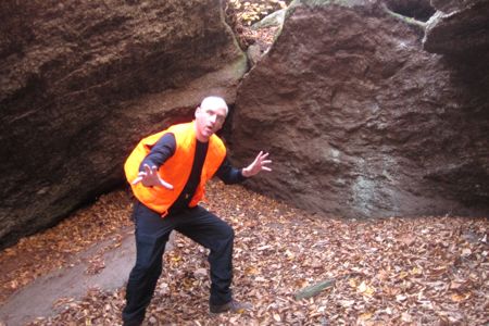
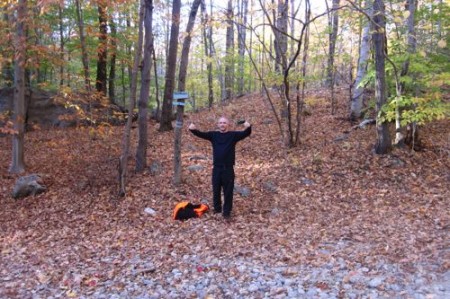
Showing my displeasure at being in Massachusetts
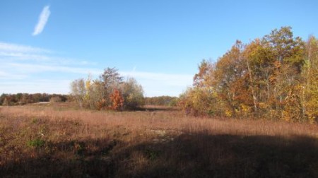
This field is in Massachusetts
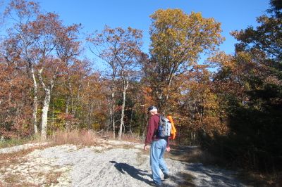
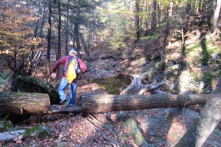
My dad, barely seen below, ascending the final difficult climb
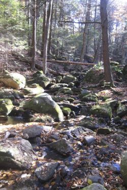
At Hurricane Brook
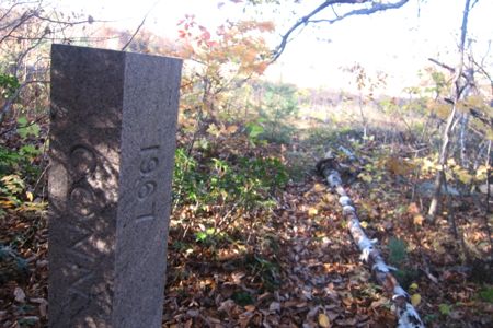
Border stone!
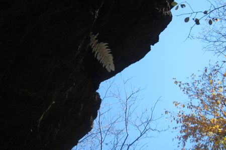
Dead fern leaf underneath Indian Council overhang


Leave a Comment